One of the great things about ArcGIS Online is having the multiple ways of delivering your data, it ensures that you can tailor it different ways and deliver the best experience for your many different audiences. In a sea of choices though, picking the right path can feel a bit daunting. So, in this blog we’re going to look at some common WebGIS workflows and pit different layers against each other to see who wins. Before you settle in ring side with some popcorn and a cold drink to enjoy the show here is some background on today’s contenders:
Feature layers
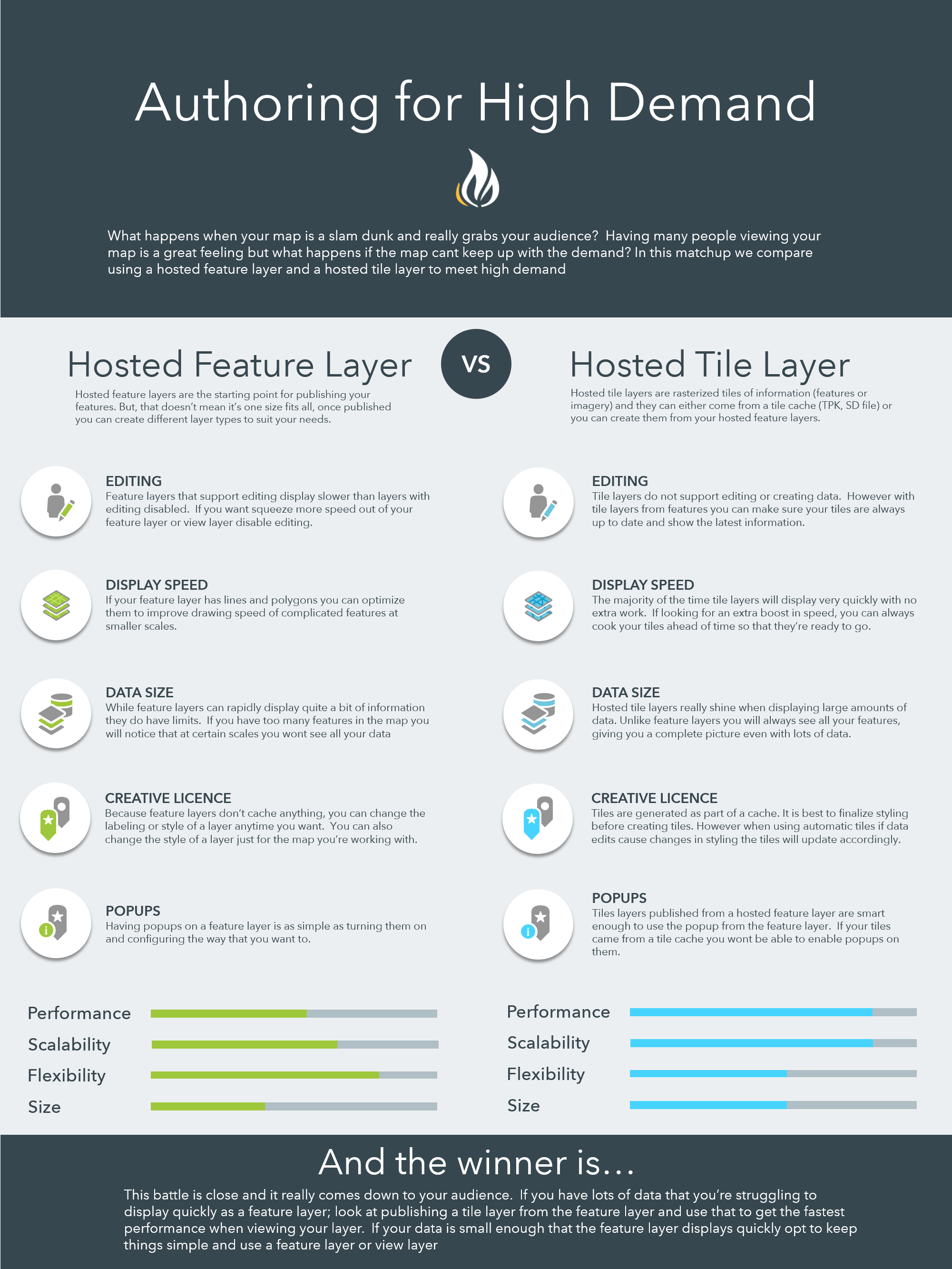
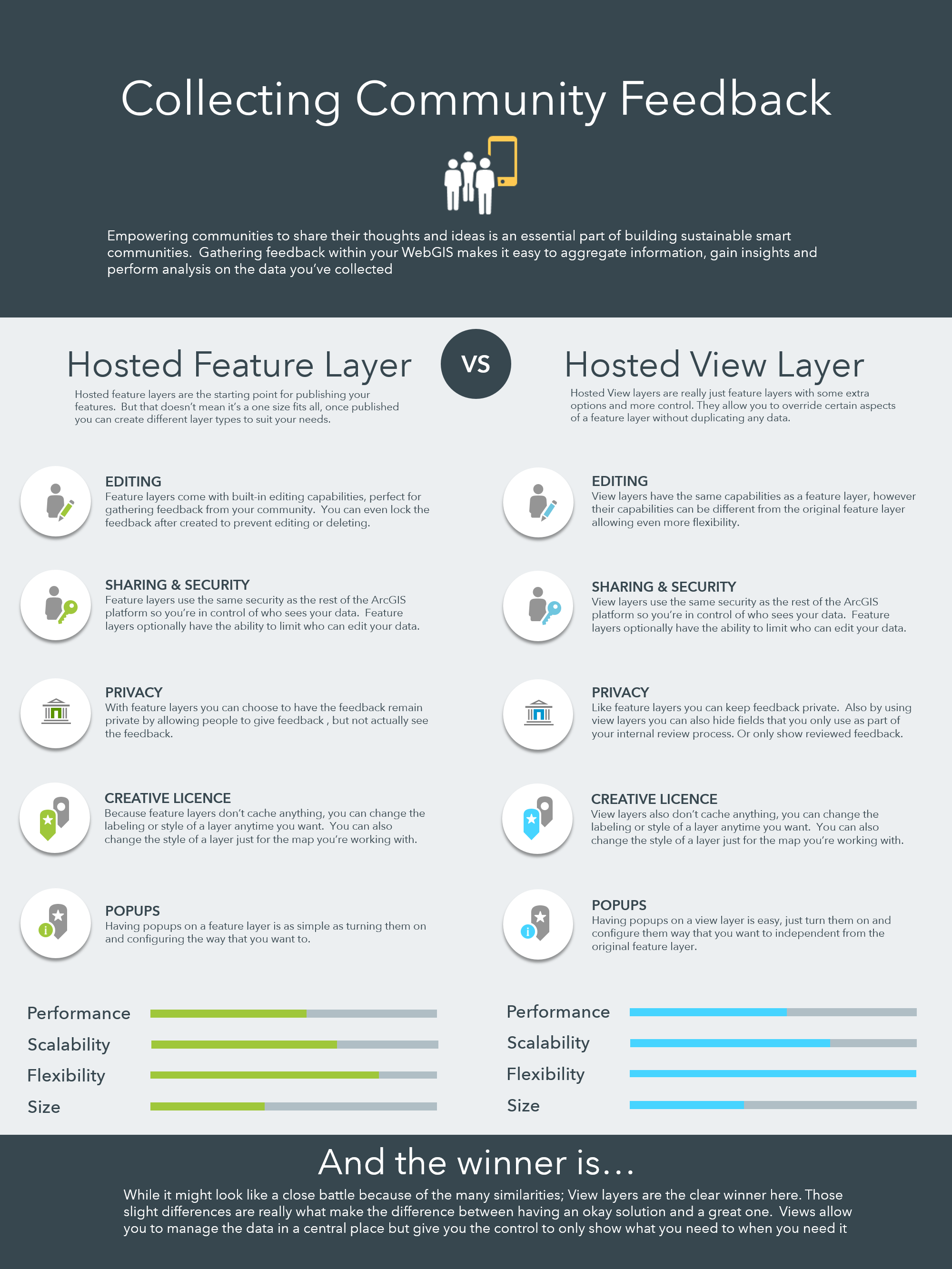
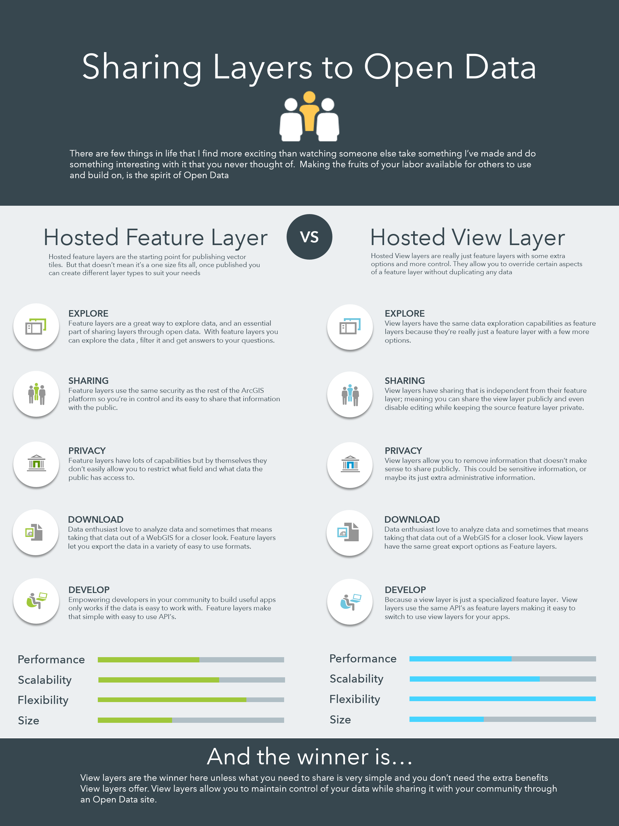
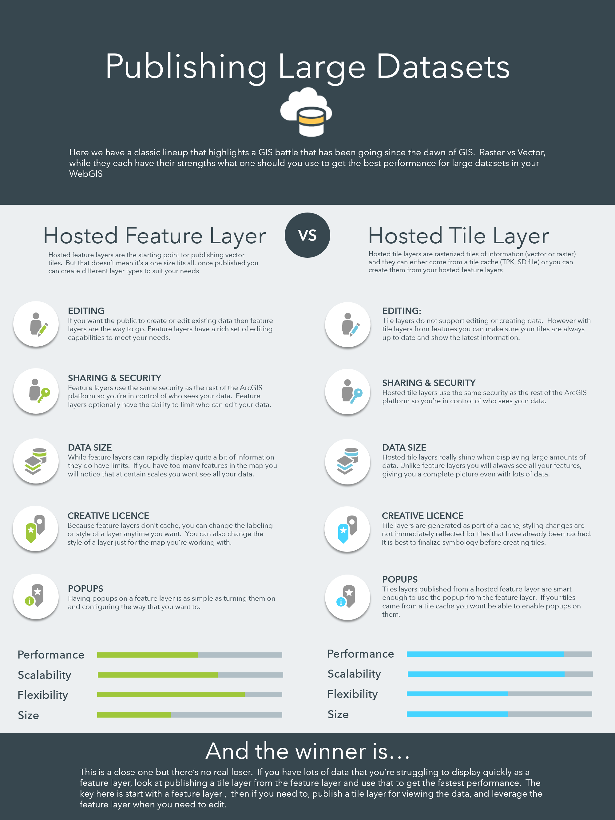
Feature layers are the bread and butter of every WebGIS. They allow dynamic styling, controlled editing, offline use and can be used to perform analysis. They’re flexible, fast and the starting point for almost any publishing workflow. Not sure what layer type is the best to use? Start with a feature layer, then expand into other layer types when needed.
Hosted feature layer views
Hosted feature layer views or view layers for short are created from feature layers. Think of them as a special kind of feature layer but with more options. View layers allow you to create a new layer that shares the same data as the feature layer it was created from. In addition to sharing data a view layer can filter that data, and have different sharing permissions or editing capabilities giving additional flexibility and control without duplicating data. Most of the time View layers and feature layers can be used interchangeably, but if need the added control that a view layer gives you it is the clear winner.
Tile layers
Tile layers are rasterized tiles of data. Tile layers can be created from a tile cache (like a tpk) and in that case, are static and never change (great for imagery). Tile layers can also be created from a feature layer or view layer, when they are they have the option of automatically staying up to date with the feature layer as the data changes.
With introductions, out of the way, sit back and enjoy the show…
Round 1 – Authoring for High Demand
Round 2 – Collecting Community Feedback
Round 3 – Sharing layers to Open Data
Round 4 – Publishing Large Datasets
Closing Tips and Advice
After the dust, has settled, you’ll have noticed a few repeating patterns. While there are some clear winners for some of the use-cases you’ll notice that it’s not a one size fits all. Depending on your audience, and data you may find the “best” approach is the simplest one if it is suitable for your needs.
- Start with a feature layer unless you’re 100% sure you don’t need one, it makes ramping up easier down the road.
- Introduce new layer types as you need more control, flexibility, or performance
- Views layers are just feature layers with more control, don’t forget to leverage that to make your life easier

Commenting is not enabled for this article.