Version 200.3 of the ArcGIS Maps SDKs for Native Apps provides several valuable enhancements including a full API for defining clustering on feature layers, visual feedback during geometry edits with the new geometry editor, and service-based validation of utility network edits.
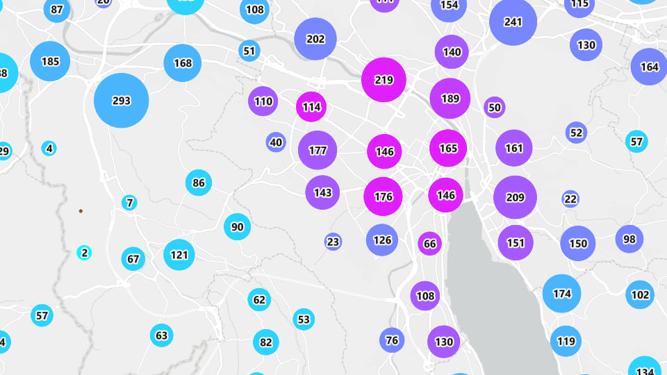
Clustering API
The previous release introduced support for clustering on point feature layers only when authored as part of a web map or layer item. In this release we’ve included a new clustering API to update existing or define new feature reduction options on point feature layers to simplify maps that display large quantities of data, even if the web map or layers you’re using aren’t pre-configured for feature reduction. This new, comprehensive API also enables you to define renderers, labels, and popups on clusters, set a cluster radius, add aggregate or summary fields, set scale thresholds, and define cluster symbol size ranges.
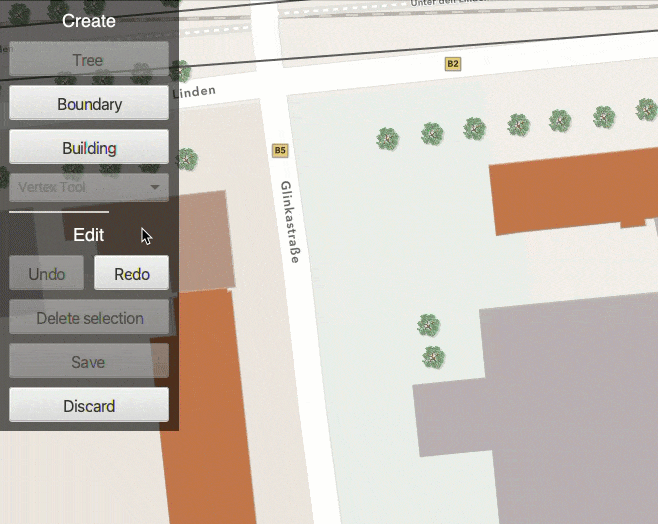
Geometry Editor visual feedback
The new Geometry Editor, now available with all Native Maps SDKs, has been further enhanced in this release with the addition of improved visual feedback when adding vertices. For platforms that support a hover action (e.g. with a mouse), the vertex tool will show a real-time preview of the new vertex and its connected edges enabling more deliberate placement. These enhancements lay the foundation for further interactive editing capabilities in future releases of the Native Maps SDKs.
Utility network edit topology validation
This release includes the ability to validate network topology on a utility network when working with a feature service. This means that you can now make edits to a utility network service, trigger re-validation of network topology including those edits, and perform trace analyses using the updated network topology.
These new APIs lay the foundation for future support of network topology validation in offline scenarios, enabling mobile workers to make changes to the utility network stored on their device and perform trace analyses including those changes without synchronizing with the source feature service. Support for offline utility network topology validation is on the roadmap for a future release.
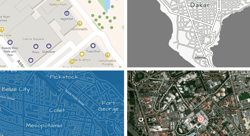
Basemaps styles and local language
This release includes support for the following cartographic styles available through the new basemap styles service API:
- ArcGIS Human Geography (light and dark)
- Open Street Map Blueprint
- Open Street Map Hybrid
- Open Street Map Navigation (light and dark)
In addition, basemap styles service v2 includes the ability to localize place name labels, and the Native Maps SDKs now let you override the default label language for a basemap style. You can choose to set a specific language, and if a supported language code is supplied, basemap labels will be displayed in the identified language. If you specify an unsupported language code, the label language falls back to the closest available language. For example, American English (en-US) or Canadian French (fr-CA) are not currently supported and these are interpreted as English and French respectively. If no suitable fallback language code is found, labels use the default language for the style. The default for ArcGIS basemap styles is global language (English) while the default for OpenStreetMap basemap styles is to show local place names for basemap labels. Alternatively you can choose to set the language to follow the application locale. If the application locale is an unsupported language it will follow the same language fallback behavior described above. You can learn more about the v2 Basemap Styles Service here.
Other improvements
This release also includes several improvements in functionality common to all Native Maps SDKs as well as SDK-specific enhancements and updates.
- Improvements to dynamic entity behavior with callouts and popups.
- Projection engine updates with new coordinate systems, vertical transformations, and geographic transformations.
- Support for Arcade 1.24 and 1.25.
- Improvements to indoor positioning with Bluetooth (BLE) beacons.
- Improvements to labeling.
- .NET 8 support with the .NET Maps SDK.
- AR Toolkit component for the Swift Maps SDK.
- Bug fixes and updated 3rd party libraries.
Download and get started
To get the latest version, go to the ArcGIS Developers website and download your choice of Native Maps SDK. You can also reference the SDKs via NuGet, Gradle for Java or Kotlin, or the Swift Package Manager. If you are new to developing with the ArcGIS Maps SDKs for Native Apps, the SDKs for .NET, Java, Kotlin, Qt, and Swift have extensive guide documentation, API reference, tutorials, and samples. Simply sign up for a free ArcGIS Developer account and get access to everything you need to develop your app.


Article Discussion: