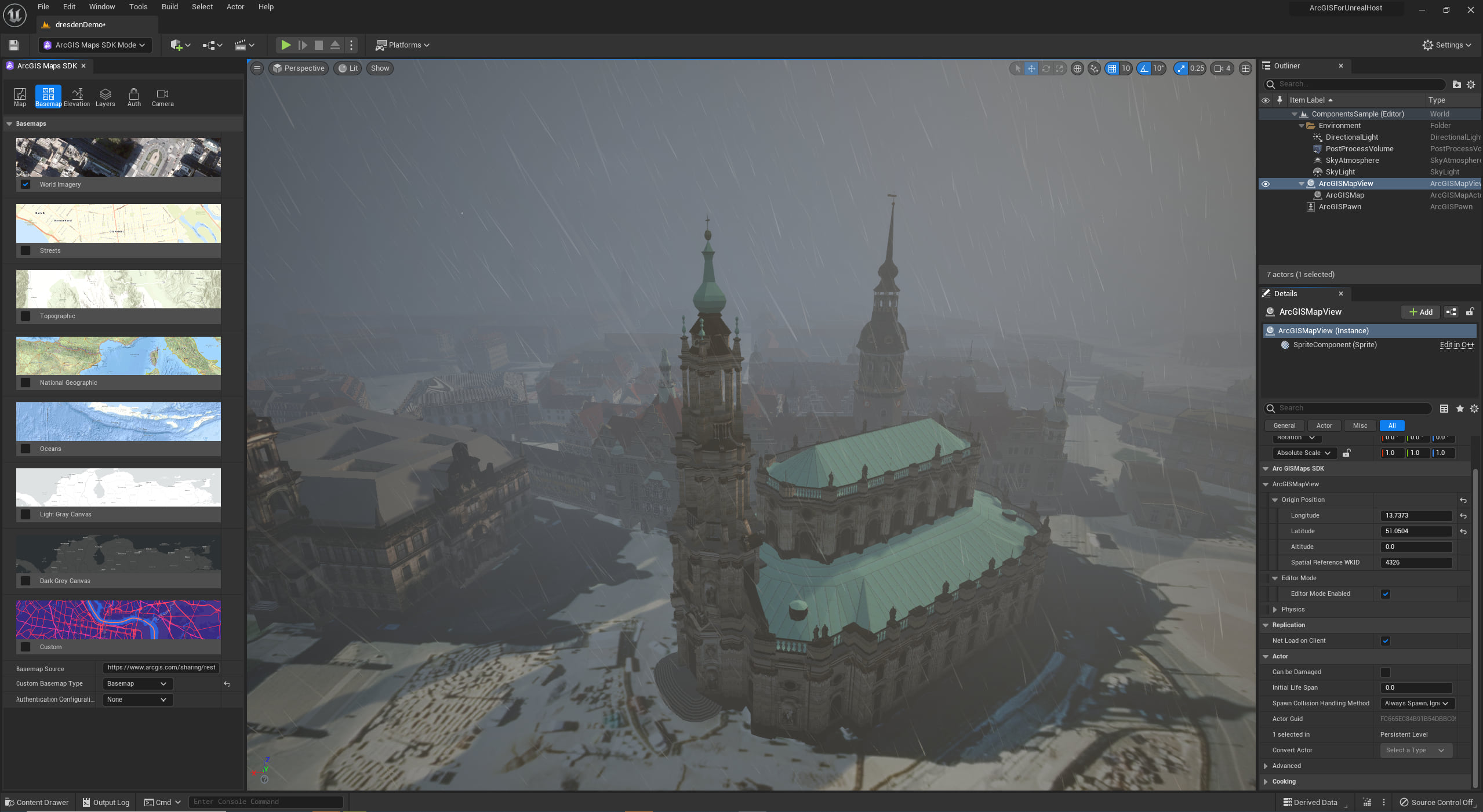
We’re delighted to announce a pre-release of the ArcGIS Maps SDK for Unreal Engine 5!
Just over 6 months ago we delivered a pre-release of the ArcGIS Maps SDK that supported Unreal Engine 4. Since then we’ve been working closely with our partner, Epic Games, and listening to feedback from the user community to refine the ArcGIS Maps SDK for use with Unreal Engine 5. We were excited to see the first production release of Unreal Engine 5 go out last week, which brings with it groundbreaking advancements in visualization, rendering, real-time interaction, use of high precision data, and a modern developer experience. Building on those advancements, our pre-release of ArcGIS Maps SDK for Unreal Engine 5 includes a few key enhancements:
-
- Edit ArcGIS Map properties and layers, place objects, and view those changes in editor mode. This streamlines the development experience as playing a level to view and interact with an ArcGIS Map is no longer required.
-
- Extensive support for coordinate systems is now available. You can set the spatial reference on an ArcGIS Map to just about any complimentary coordinate system. In global mode, set the spatial reference to any geographic coordinate system or Web Mercator. If Web Mercator, data will be displayed in WGS84. In local mode, set the spatial reference to any projected coordinate system, or WGS84, or CGCS2000. If WGS84 or CGCS2000, data will be displayed in Plate Carrée. If necessary, scene layers will be re-projected to the spatial reference used to display data in the ArcGIS Map. Tiled and elevation layers must match the spatial reference of the ArcGIS Map.
-
- A new geometry API can be used to create geometries of type point, multipoint, polyline, polygon, and envelope. Geometries have a spatial reference, are Z and M aware, can be re-projected, and serialized to and from JSON. The geometry API provides a foundation to define, display, persist and share geospatial content that can represent operational data, analytical results, and interactive experiences in an ArcGIS Map.
-
- Layers in an ArcGIS Map can now operate as a collision mesh. This enables more intuitive interaction, hit testing, and use of physics. This is the first iteration of support for mesh colliders so there are some limitations. For example, we do not have an API to return metadata of a structure or object within a scene layer, but support for that workflow is coming soon.
-
- The ArcGIS Maps SDK plugin UI has a fresh new look with a streamlined toolbar, refined property pages, and even a new logo.
-
- With the ArcGIS Maps SDK pre-release for Unreal Engine 4, geospatial placement was dependent on Unreal Engine’s Georeferencing plugin, which used a third-party coordinate transformation system. Unreal Engine 5 introduced support for double precision data, which enables use of large, real-world coordinate systems, and the ArcGIS Maps SDK includes Esri’s world class projection engine, so the pre-release of ArcGIS Maps SDK for Unreal Engine 5 no longer requires the Georeferencing plugin. That said, with Unreal Engine 5, the ArcGIS Maps SDK and Georeferencing plugins are compatible and can work together.

We invite you to join or login to the ArcGIS Maps SDK for game engines beta program and download the latest pre-release for ArcGIS Maps SDK for Unreal Engine, built for Unreal Engine 5. Feel free to peruse the product documentation, including release notes, for more information on enhancements as well as resolved and known issues.
Road Ahead
We plan to deliver the first production release of the ArcGIS Maps SDK for Unreal Engine in June 2022. Please use the beta program to provide feedback on issues encountered with the latest pre-release so we have an opportunity to review and assess for upcoming production releases.
The first production release of the ArcGIS Maps SDK for Unreal Engine will require Unreal Engine 5. For developers who choose to remain on Unreal Engine 4 and need time to transition to Unreal Engine 5, the ArcGIS Maps SDK for game engines beta program will remain open until the end of 2022. Previous beta releases targeting Unreal Engine 4 and some offline documentation will be available to download, but feedback options and community support will be limited.
Note: 3D building data displayed in images within this post was provided by Geodaten der Landeshauptstadt Dresden


Commenting is not enabled for this article.