Using the map viewer you can add any layer and use it as a basemap, and can combine multiple layers together to create a visually appealing and unique look. For example, you may want to use a layer that includes terrain, then add another layer that provides labels and other reference information.
Layers can be from any source in ArcGIS Online, but it’s best if the layers have been authored by you or someone else in your organization so you maintain control over them. You can also use or combine your own layers with Esri layers from the Living Atlas to create unique basemaps. See Configuring custom basemaps using Living Atlas layers.
*
Add layers to make a basemap
In this example a new map has been opened with the default World Topographic basemap. To use a layer as a basemap, follow these steps.
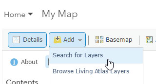
Step 1. Search for the layer you want to use. Click Add, then choose Search for Layers.
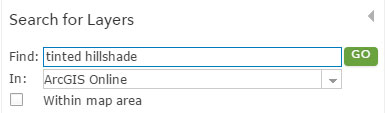
Step 2. Enter a string in Find: then enter a carriage return or click Go to search your content, your organization, or ArcGIS Online for matching layers.
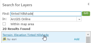
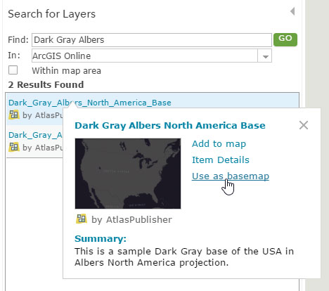
Step 3. Click the title of the desired layer
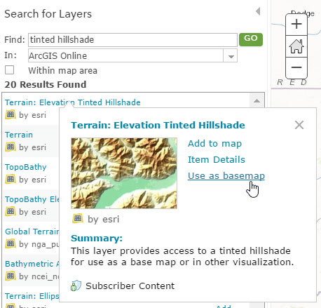
Then click Use as basemap.
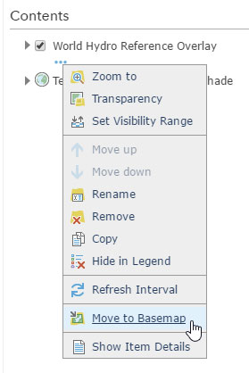
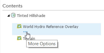
Step 4. Add additional layers to your basemap, like a reference layer, by first adding the layer to your map, then choosing Move to Basemap from the layer context menu.
Step 5. Finalize the layers in your basemap group. If you’ve added multiple layers to your basemap, they will appear in the group. Click the arrow to expand the group.
You can adjust properties of each layer, such as name, visibility, transparency, pop-up, and more using the respective layer options. Your custom basemap will be saved with your map.
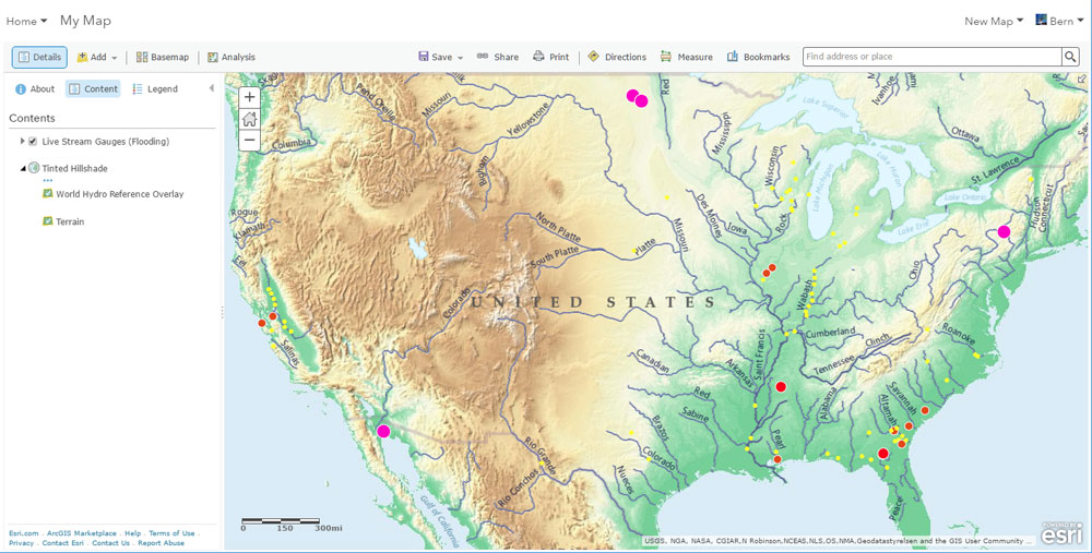
The map below shows stream gauges in flood from the Living Atlas on top of a custom basemap created using two layers: a tinted hillshade and the World Hydro reference.
*
Layers, basemaps, and map projection
The majority of ArcGIS Online basemaps are published in web mercator auxiliary sphere using the Google/Bing Maps tiling scheme. This provides a common foundation for all basemaps, maps, and layers and facilitates their interchange.
Some organizations publish services using a spatial reference other than web mercator auxiliary sphere, perhaps one that’s been established as a state, local, or regional standard. When you use a layer as a basemap, you also set the spatial reference of the web map to the spatial reference of the layer. Other layers you subsequently add to these basemaps will be projected on-the-fly as needed.
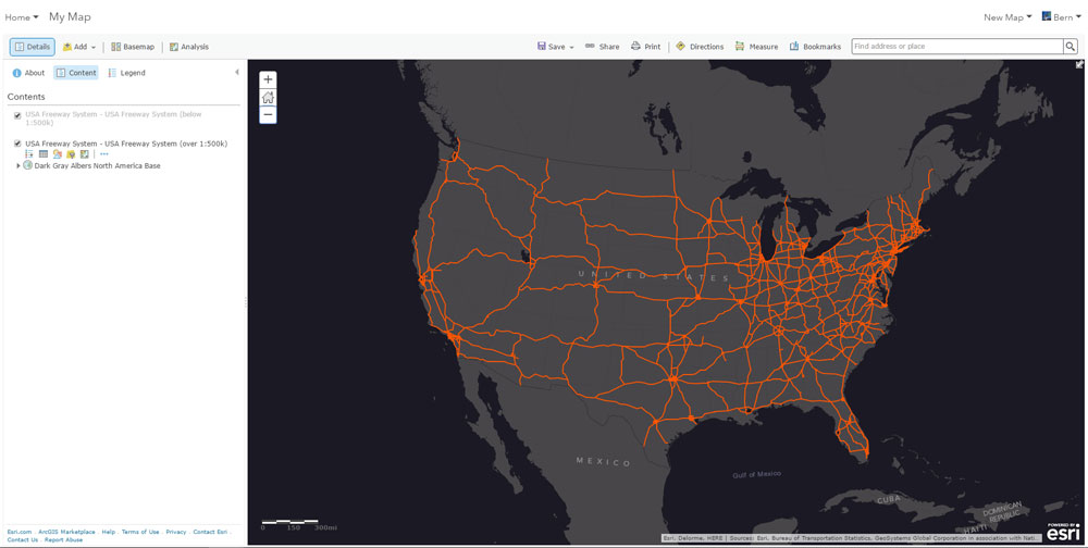
For example, the map below uses the Dark Gray Canvas basemap from the default basemap gallery. The map also includes the USA Streets layer from the Living Atlas. Both are published in the same web mercator auxillary sphere projection.
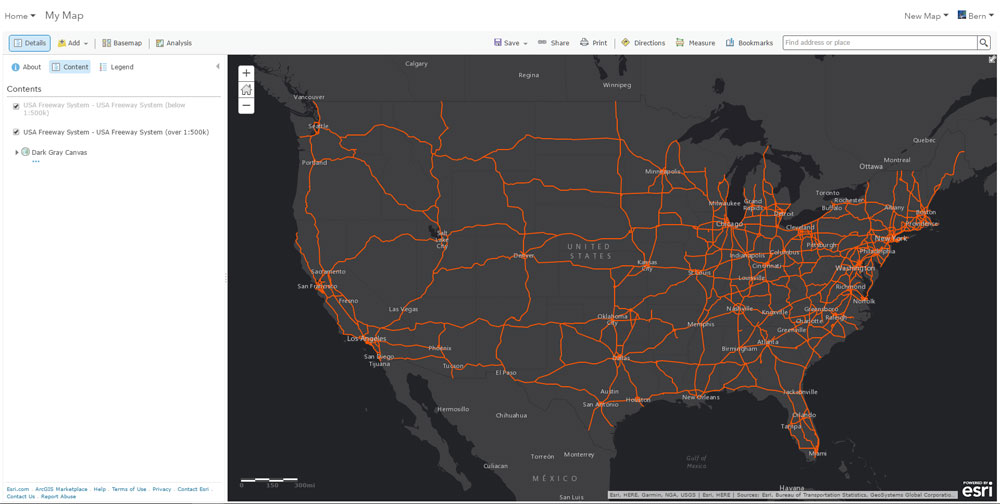
A new basemap was substituted using a dark gray layer that was published in an Albers projection. The layer was added as described earlier in this post.
The new basemap sets the web map to the Albers projection, and the USA Highways layer (published in web mercator auxillary sphere) was automatically projected on-the-fly to match the new projection.
*
More information
This post was originally published on February 2, 2017, and has been updated.

Commenting is not enabled for this article.