June 21st, 2016 marks the 11th year anniversary of World Hydrography Day! World Hydrography Day (WHD) focuses on giving suitable publicity to the International Hydrographic Organization’s work at all levels and of increasing the coverage of hydrographic information on a global basis. It also and urges all States to work with that organization to promote safe navigation, especially in the areas of international navigation, ports and vulnerable or protected marine areas. This year’s theme is “Hydrography – the key to well-managed seas and waterways”.
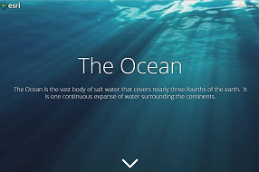
GIS technology is fundamental in visualizing and analyzing our oceans and waterways. Esri is committed to the sustainment of our Oceans by supporting foundational ocean data, and apps that support better decision making. Explore this exciting Cascade Story Map that showcases some of the Oceans Content available in the Living Atlas of the World and ArcGIS Online. This Story Map shows global seafloor bathymetry in 2D and 3D, as well as seafloor geomorphology and other interesting layers. There are embedded videos to help you understand how bathymetry data is collected by NOAA Hydrographers.
World Hydrography Day is celebrated each year on June 21st. More Info

Article Discussion: