We are proud to announce the release of version 10.2.6 of the ArcGIS Runtime SDK for .NET! This release brings support for 3D and KML to .NET developers using the Runtime to build native apps for Windows PCs, tablets, and phones.
Here are a few highlights of new capabilities in the SDK:
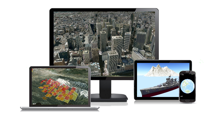
- Just like a MapView and Map are available for 2D, a SceneView and Scene enable you to display and interact with spatial data in 3D.
- Support for KML version 2.2, plus some extensions. KML content can be hosted online or accessed locally and displayed in a Map or Scene.
- Display buildings and structures using the new Scene service and display a variety of local data sources in a Scene, such as tile packages, mobile geodatabases, shapefiles, and local server services.
- Show terrain using online image services or local raster data for elevation sources.
- Extrude 2D graphics to provide 3D context.
- Use pre-defined 3D symbology and custom models to render complex 3D graphics.
- Change camera location to view Scene contents from different perspectives.
For a more complete list of new capabilities, performance improvements, and quality fixes in 10.2.6, please see the release notes.
Download and start using these new features today!
ArcGIS Runtime SDK for .NET Team
I am trying to implement this for my Org. I have followed along up until the configuration of the dashboard – step 5. How do I change the dashboard over to my own set of tables? Is it best to edit the json of the dashboard and replace the sample item id’s with my set? Also – to get the notebook to work – I had to comment out availble credits and assigned credits from the User Admin section of the notebook. Is this configured assuming we have turned on credit budgeting for the users – and if we haven’t… Read more »
Great stuff! We built a very similar dashboard and process for my company. We even made a StoryMap about it (Link below) . Dashboards are such a powerful tool that it can be used for non-spatial solutions as well.
Make an Item Report Dashboard (Public StoryMap): https://storymaps.arcgis.com/stories/136db4d3aaa84151be594b496f423a52
This is really useful – thank you. Having set it up it up for our organisation’s account I’ve noticed a possible issue with the ‘FS Storage’ counter (and maybe some of the total credit measures used in other bits of the dashboard). The total number credits per month given in the FS Storage counter is much higher (almost 2x) than our total monthly credits usage as given by the ‘Overview’ tab in the ‘Organisation’ section of ArcGIS Online (which I’d consider to be the correct/definitive figure). Having had a bit of a search around, I’m wondering if it’s because the… Read more »
Hi Colin, thank you for the note. You are correct on the limitation. Attachments on fs storage is calculated differently, but the script currently does not account for that. When this script was originally developed, I didn’t take into account for your scenario. Having said that, this will be a useful note to share with the community so we understand the limitation. I will make sure to put this in. There should be a way to do this in the script (AGOL does it after all :)) If you (or anyone in the community) develop an enhancement for this –… Read more »
The notebook populates three tables:
But the instructions for updating the dashboard only requires changing the IDs for two of the tables. The user table does not appear to be used by the Dashboard. Is that correct?
Bonnie and Calvin: this is an excellent article! I am working on applying it for my organization. There is no longer an option to choose ArcGIS Notebook Python 3 Standard – 4.0. Instead, I can choose between 7.0 and 10.0. What would be causing that? @Calvin Kwon
I’m trying to implement this for my organisation and when running the notebook for the first (and subsequent) times, I get the following error :
I run this on ArcGIS Notebook Python 3 Standard – 11.0.
I have this same error. Any insight on resolving?
Excellent article! Exactly the item management solution we were looking for for our open data portal.