Authors: Don Kuehne, Chris Andrews
The Esri platform provides the means to make better decisions throughout infrastructure and building asset life cycles within the context of the built and natural environments in which we live. Our users are increasingly asking us about the ability to merge GIS data with design and construction data, often simply called BIM data, as global rates of urbanization, infrastructure renovation, and habitat management increase.
The successes of BIM, Building Information Modeling, include improved design processes, efficiencies in coordinated construction, and streamlined documentation, often performed within tools specifically created for modeling, analyzing, and managing detailed 3D models. BIM has streamlined architecture and infrastructure projects, resulting in faster construction, fewer change orders and delays, and more predictable project costs. Process improvements, such as coordinated visualization and clash detection, along with expectations of standardized reporting and deliverables have helped to reduce the one-off ad-hoc workflows historically associated with design and construction.
BIM is sometimes characterized by different levels of implementation. Level 1 BIM can be said to be focused on getting 2D and 3D design data organized and standardized. Level two includes more standards and assumes that the practitioner is moving toward a practice of integrated 3D modeling for virtual design and construction workflows.
For Level 1 and Level 2 BIM implementations, GIS techniques, data, and tools often play an integral role. During planning, staging and construction phases of large projects, engineers and planners use environmental, geographical and existing infrastructure characteristics to understand projects in context for safety, security, logistics, and regional impact analyses.
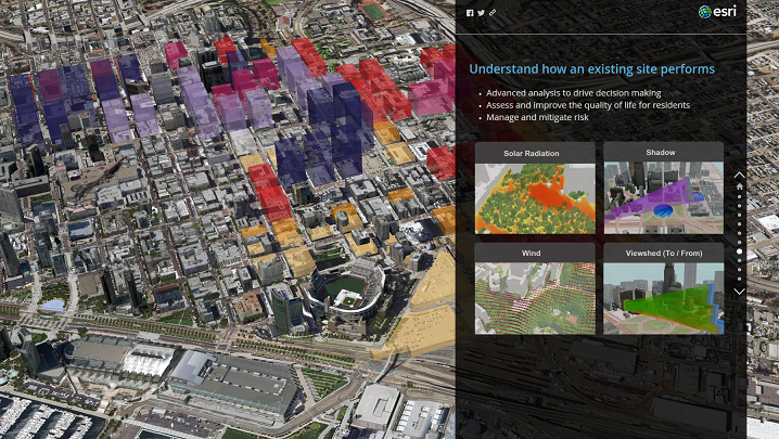
In the GIS world, the term GeoDesign has been used to refer to a scenario-based planning process that applies decision making to spatial problems in the context of local and regional features and characteristics. GIS is widely used for integrating, visualizing and analyzing information about real world assets, such as buildings and transportation infrastructure, with surrounding context that may include environmental, demographic, structural, and scientific information. Frequently, in the initial stages of projects and during regular project updates, maps that integrate GIS and engineering information are used to convey plans and status.
(Explained, Discussed, Stories)
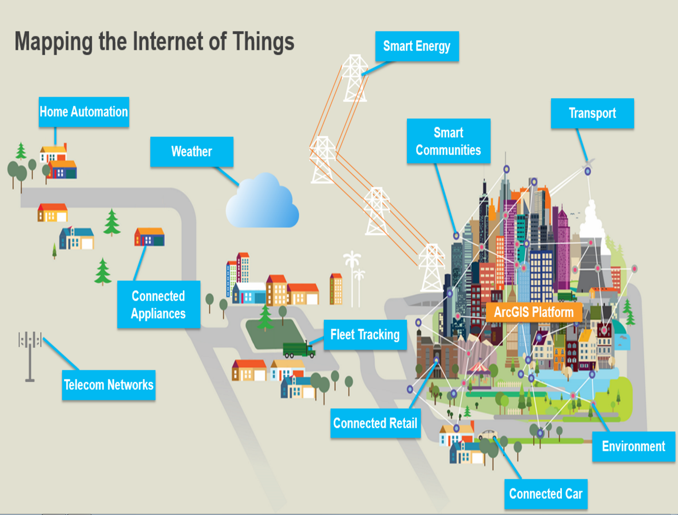
Level 3 BIM describes the use of design and construction information beyond the individual project. At this level, there are increased expectations that data from the Design, Operations, and Management domains will be integrated to be used for facilities management, safety and security analysis and training, and citizen engagement in the pursuit of digital and smart-city initiatives that will contribute to the full lifecycle of infrastructure management. BIM data and BIM’s process workflows are helping to identify and mandate inclusion of important information during the design and construction phases, such as sensor-rich infrastructure and even the placement of devices in Internet of Things (IoT) connected networks.
For many of our customers and users, they expect that detailed design information will prove useful for campus, facilities, and infrastructure portfolio managers of private and public organization, for single structures or an entire City. BIM information repurposed from design data can be a great source of information for ongoing operations and maintenance of infrastructure. Typically, this information is needed in the context of other buildings, infrastructure, and people that make up an entire system.
GIS offers tool for performance and environmental monitoring, allowing you to visualize and analyze the built and natural environments and their impacts on infrastructure systems such as land use, transportation, water resources and the people and life that use or are affected by the infrastructure and the geography it occupies. The Web GIS approach to integration, in which users focus on higher value information products that can aggregate information from a variety of sources in a distributed enterprise, offers a perfect way capitalize on BIM data and synthesize it with other business systems such as asset management, space management at the campus or city scale.
(BigData, with CityEngine, Los Angeles)
GIS has been used to explore and analyze characteristics, behavior, and spatial processes at the scales of cities and larger for years. Now that 3D capability is being delivered across the Esri ArcGIS platform, we are having more users come to us to request tighter integration between BIM and GIS information. We also acknowledge that in many cases, BIM and CAD will perpetually be the source of record for infrastructure or architecture data and that our customers hope to be able to benefit from both design and spatial data not only during planning and construction, but throughout the asset or system lifecycle. The key for us will be to help customers unlock the value in diverse data sets to enable applications including citizen engagement, sustainability analysis, disaster preparedness, and many more operational and management uses.
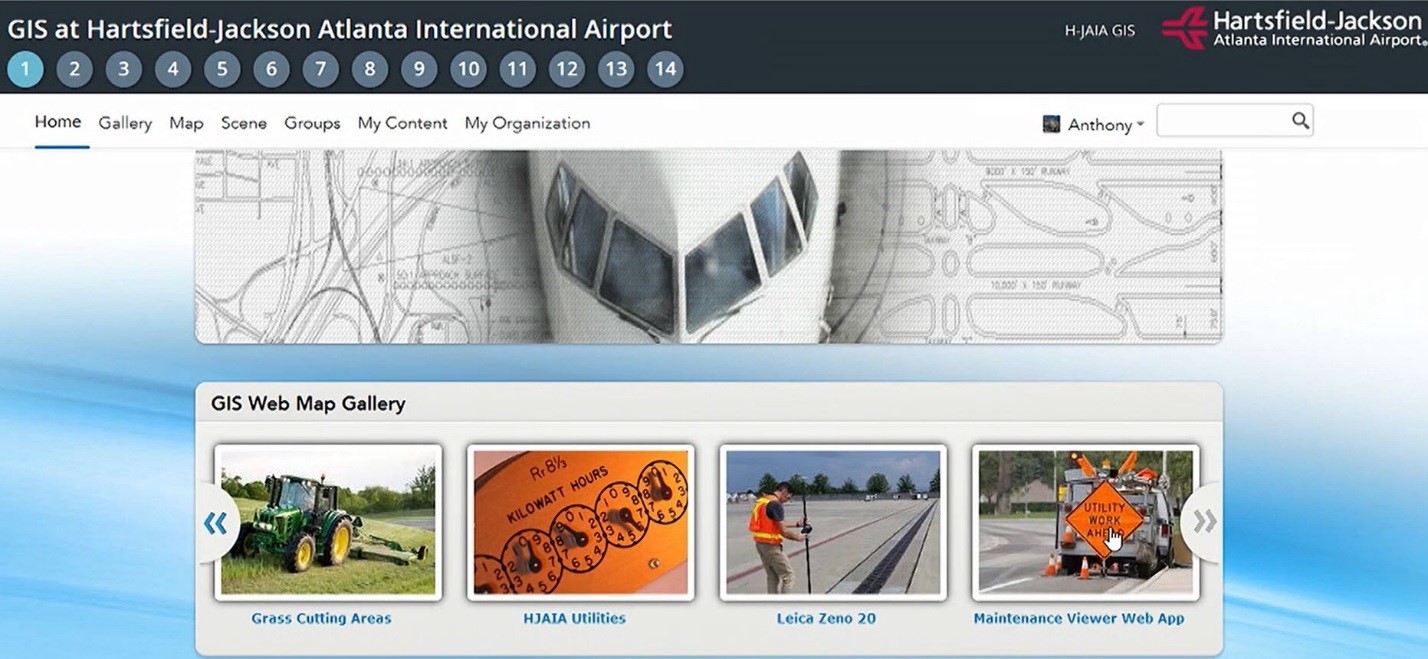
(Crossrail, Masdar City, Hartsfield Airport: Story, Video)
There remain many difficult technical problems to solve as users ask for high end visualization of integrated content, bidirectional flow of edits, interoperation through standards and open specifications, and better tools for using integrated 3D content within more consumer-friendly experiences for communication to large audiences. For example, we are seeing many examples of users attempting to merge GIS and BIM into higher value information projects and running into different issues when using industry-focused exchange formats when compared with agnostic geospatial ETL formats. The density of BIM information is often not only an issue for the traditional geospatial modeling paradigm but also for the end visualization platform which, in 2016, is ubiquitously expected to be either web or mobile.
As we look forward to the future, we will be exploring how we can better adapt and extend our new and emerging 3D platform capabilities for distributing GIS and BIM 3D content, visualizations, and analysis to more completely address the key needs of our customers who want to realize more value from the data in which they have already invested to better manage the full lifecycle of their projects and assets.

Commenting is not enabled for this article.