ArcGIS Pro allows you to create beautiful maps with complex and interesting symbology! Here are some tips for maximizing the display performance of your maps and data in ArcGIS Online.
1) Publish your maps as Tile or Vector Tile layers. They will display FAST and look beautiful in ArcGIS Online. They won’t have any attribute data for popups, but we’ll address that next.
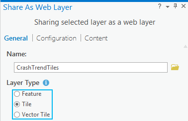
Note: The Tile option creates a Raster Tile layer which is an image (a picture) of your map. For very complex symbology, imagery, raster layers, or when you need the symbology to match ArcGIS Pro exactly, use the Tile format. For vector data, consider creating Vector Tiles instead, as they offer several advantages over Raster Tiles. Vector Tiles represent the features in your map as vectors (points, lines, and polygons), which means they scale beautifully and look great, but they use a simpler symbol model than ArcGIS Pro, so the resulting symbols may not match ArcGIS Pro precisely.
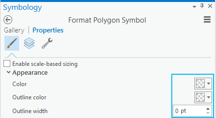
2) After creating a layer file to preserve your cartographic symbology (just in case you need it later), render your map layer using invisible symbology and publish it as a feature layer:
a. Set the color and outline color for all features to none and zero.
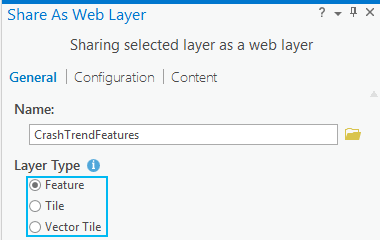
b. Publish the result as a feature layer.
3) Configure the pop-ups:
a. Add both the feature layer and the tile layer to the Map Viewer in ArcGIS Online.
b. Configure the pop-ups on the feature layer.
c. Save the web map.
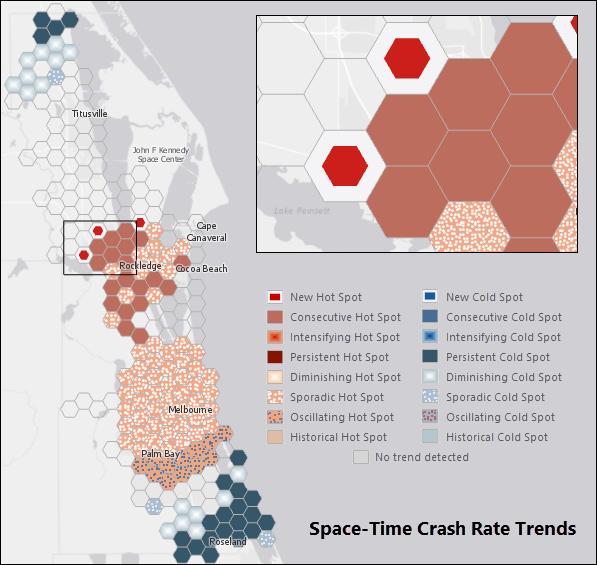
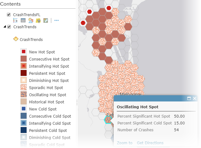
This story map uses the workflow described here.

Commenting is not enabled for this article.