The next version of the ArcGIS API for Python is on the scene – version 1.4.1. We’re constantly working toward getting new functionality into the API while also improving those components you point out could meet your needs differently. Let’s take a look at some new features making their debut at this release to help continue the API for Python’s role as an integral tool in your Web GIS toolbox. View the entire release notes page here!
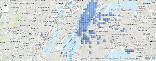
For ArcGIS Online Organizations, we now support offline mapping with a new offline_areas property on Web Maps. This property provides you a manager so you can create areas at specific extents and then confidently work when disconnected and then sync back up with ease once connected to the world again. We amped up the Attachment Manager so you can filter when downloading and query to find out what you need about supplementary information attached to your features. It also can handle much larger attachments (..think video!) than the original manager.
We know you’re into data that’s big, so we’re really excited to add new tools to the geoanalytics module for Working with big data: you can now make your data bigger with the append_data tool. With the overlay_layers tool, mash content from a whole stack of layers into one information layer that rules them all. And with the build_multivarable_grid tool, you can compile information from many data sources into one continuous layer. See Using the GeoAnalytics tasks for more details on each tool!
We know security is one of the biggest concerns to any organization when working on the web, so we’ll always be looking into augmenting the authentication experience with the API for Python. This release adds the ability to use pfx files when modeling a GIS and gives you more detailed error messaging when credentials aren’t valid. You also now have the power to decide whether content accessed with Portal makes external requests to the internet through enabling or disabling the content_discovery property. The buzzword is control!
We’ve improved how the clone_items() function handles some output pathways, and also made it faster when it queries certain information. Understanding the importance of the group, we knew it was time for an update to update so it changes those properties you need it to, and pared down some of the warnings and messages sent when not needed. With more improvements added to geometry objects and filtering capabilities, along with fixes on the search method and the Web Map remove_layers() function, the state of the ArcGIS API for Python looks grand for all kinds of management, information dispersal, and data science!
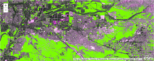
The Python API in Jupyter notebooks is great for exploratory data analysis. Check out a sample notebook using the API for Python to overlay multiple raster datasets and analyze them to find the best areas for travelers looking to escape the noise and congestion of human activity: A GIS Overlay Analysis. Add the ArcGIS for Developers Sample Notebooks tab here to your to-do list to learn how you can take care of business with the ArcGIS API for Python.
If learning and using the Python API isn’t your top priority, we encourage you to consider making it just that. Check out this video recording of the GeoDev Webinar Series to broaden your perspective of what you can do with the API. Also take a look at this clip from the 2018 Developer Summit, as well as many other videos here!
Head over to the ArcGIS for Developers website for resources to get you started!


Commenting is not enabled for this article.