Maps help people plan, envision, and connect to the places around them. With ArcGIS Hub, you can share maps using sites and initiatives (ArcGIS Hub premium feature) to show your team or community where park improvements are needed, how many grocery stores are within a ten minute walk, or where a proposed school or housing development is planned. Whether you want your map to take center stage or supplement a project outline, sites enable you to connect people with the content they need to stay informed and provide feedback.
Now, it’s easier for you and your team to create engaging sites and pages using 3D maps and other spatial content.
The 10.8 version of ArcGIS Enterprise includes the following enhancements for Sites users: support for scenes and vector tile base maps and an upgraded mapping API.
Map card, now in 3D
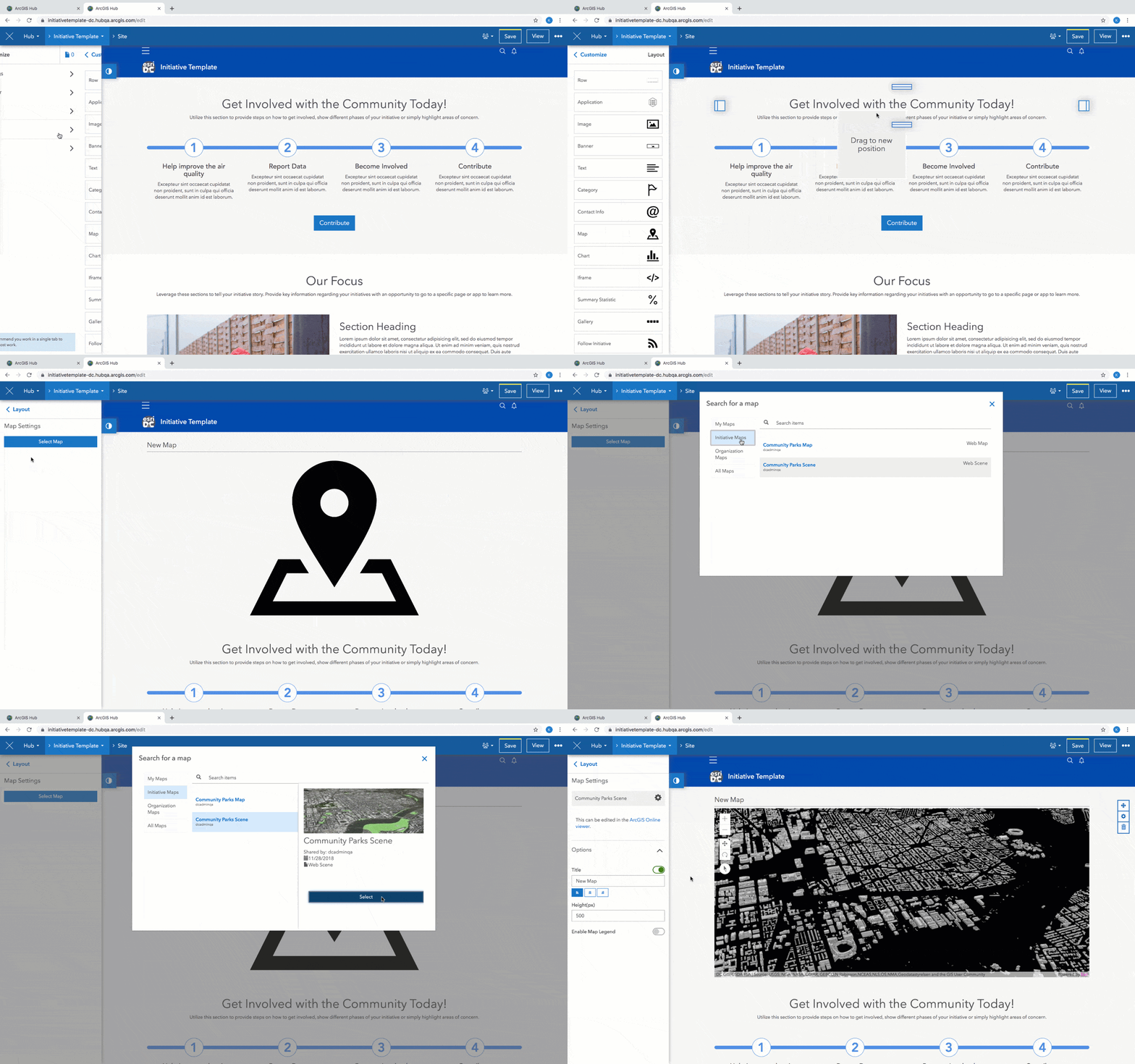
You can now add 3D web scenes to your sites and pages using the map card. Scenes create an interactive 3D model for showcasing a variety of scenarios, like proposed development, underground utilities, and more.
To add one to your site, drag-and-drop a map card onto your site’s layout and select a map that’s your own or one that’s been shared with your team or organization. You can also choose from publicly shared scenes.
Don’t have a scene, yet? Learn how to create one for ArcGIS Hub or for ArcGIS Enterprise.

Support for vector tile base maps

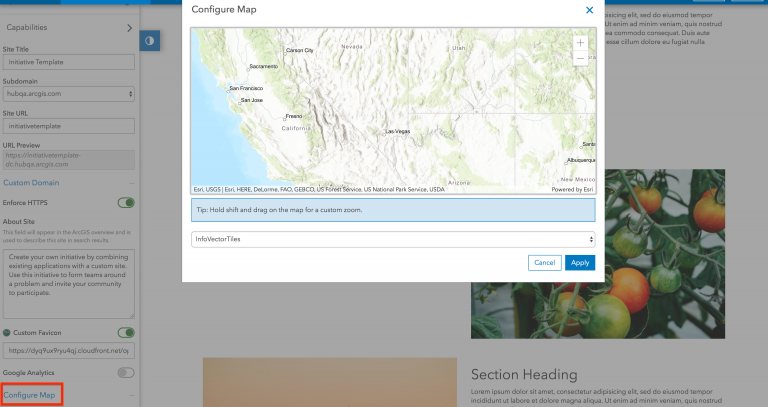
To configure this for your site, follow these steps:
- Make sure that the vector tile basemap you want to use belongs to your ArcGIS Online organization’s or Portal’s Basemap Gallery.
- Open your site in edit mode.
- Click Settings on the Customize panel.
- Click Configure Map.
- Click the dropdown menu to choose your basemap.
- Click Save.
Boundaries in search results
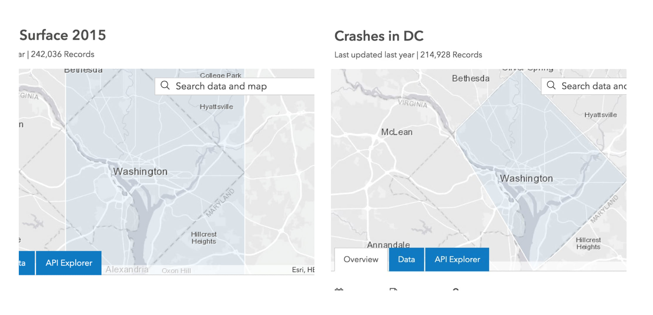
When you search for data by location, we now show the boundary of public feature layers to offer a more accurate representation of the layer’s spatial footprint compared to its extent. This helps people differentiate between multiple layers that share a jurisdictional extent. Try it out by entering near before a query in the search bar at hub.arcgis.com. Here’s an example.

Showing features when it makes sense

This means that we’re retiring the Hub’s geohash visualization capability in preparation for new visualization techniques for layers with very large numbers of features. In the meantime, we’ll show either the layer’s boundary (public layers only) or its extent until zoomed in. Don’t worry, you won’t have to click zoom-in over and over again. You’ll start to see features in as few clicks as possible even for statewide, nationwide, or global layers.

An upgraded mapping API
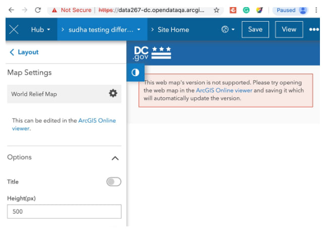
We’re making the switch from version 3 to version 4 of the ArcGIS API Javascript so that our team can deliver mapping features and performance improvements. This transition won’t affect your content, sites, or events. However, if you notice that older versions of your web map don’t work, follow the ArcGIS Online or Portal viewer link provided in the warning message to open your map. Just save the map again, and we’ll take care of updating it to the latest version.

What’s next
Stay tuned for more good things to come. Updating the ArcGIS Hub to version 4 of the ArcGIS API for JavaScript has already unlocked the exciting new features we just talked about. It also laid the foundation for more new mapping features coming next year.
If you’d like to receive updates like this one, sign up for our e-newsletter. We also invite you to get involved with the Hub User Lab, a place to learn more, provide feedback, and take a sneak-peek at what’s coming.


Commenting is not enabled for this article.