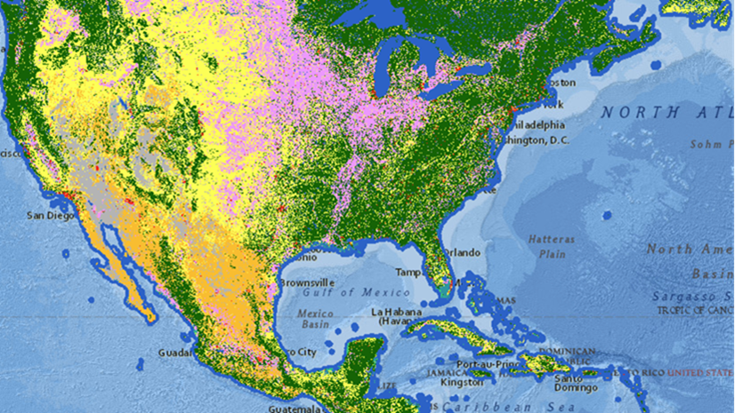
Hosting imagery in ArcGIS Online is versatile and scalable—it can be used to supplement your existing imagery workflows or be used as your organization’s primary imagery workstation for image management and analysis. Imagery itself is versatile and can take on many forms in a GIS; you can use it to simply add context to your maps and apps or leverage it to create derived information products so you can monitor changes in any given environment. ArcGIS Online is a way to maximize your imagery investment by creating layers that can be shared throughout your organization.
In this blog, I will discuss three different ways to incorporate ArcGIS Online into your organization:
- Hosting imagery in ArcGIS Online to your existing ArcGIS Image Server installation.
- Using ArcGIS Online as your Image management system
- Accessing the computing power of ArcGIS Online for imagery analysis
1. Adding ArcGIS Online to your existing Image Server installation
Both ArcGIS Online and ArcGIS Image Server create imagery layers that can be used in similar ways, so why would you want to add ArcGIS Online to your existing deployment? The simple answer is flexibility. With ArcGIS Online, you have a SaaS application that can grow or contract depending on your usage. For instance, say you have been an ArcGIS Image Server user for a while and have created many different image services and plan on continuing to use these image services. You have determined the necessary hardware to support your usage for the next few years and are comfortable with the process. Now you have decided to incorporate drone-collected imagery into your organization to inspect new assets or to handle emergency situations. You aren’t sure how many new assets will be added nor are you sure how many emergency situations you will encounter. This is where ArcGIS Image can be the answer to this situation.

Unlike ArcGIS Image Server, ArcGIS Online can create tiled imagery layers that provide a lighter-weight image service that can be shared with your entire organization or with everyone through ArcGIS Online. If you have a bunch of new assets to catalog, ArcGIS Online storage can grow with your usage and once those imagery layers are not needed, you can delete the imagery layers. Imagery layers from ArcGIS Online can also be secured within ArcGIS Image Server and accessed alongside the existing image services. For organizations who are saturated with existing image service commitments and storage concerns, ArcGIS Online can be a way to continue to add additional imagery capabilities. With ArcGIS Online, you have additional ArcGIS Image Server capabilities without the need to stand up additional infrastructure and can also create a different type of imagery layer.
2. Using ArcGIS Online as your Image management system
For organizations that already have an ArcGIS Online organization, ArcGIS Online can be used to add imagery management capabilities. Organizations can create imagery layers that can be hosted and used throughout the organization. These imagery layers can be processed to enhance the interpretation and use of the imagery layers through raster functions and adjusting the imagery display properties. The imagery layers can be used in desktop applications, web applications and mobile apps depending on the desired workflow. There is no additional infrastructure to deploy with ArcGIS Image, all you need to do is obtain a user type extension and the functionality will be available for the named users.

So, for organizations that previously did not have the resources to staff and maintain system architectures, ArcGIS Online is managed so you can focus on creating the imagery layers for your workflows. This is a great way for small organizations to share imagery layers with a larger audience. Educators looking to maintain imagery layers for their students can replicate desktop workflows in a SaaS environment, organize their classes or assignments using ArcGIS Online’s folder structure, and share student products between departments or larger audiences. Besides educators, the image management in ArcGIS Image promotes sharing among teams in larger organizations, which allows for mixed teams to leverage imagery layers to plan and share analysis.
Image storage is charged based on the size of the imagery stored and the type of imagery layer, which provides flexibility to use it as necessary. With ArcGIS Online, you have imagery layer hosting without the need to acquire and manage new infrastructure.
3. Accessing the computing power of ArcGIS Online for imagery analysis
For many analysis projects, particularly imagery analysis, many processes require a lot of computational power to generate output on the desired data. Between traditional image classification, multidimensional analysis, and deep learning, the demands for processing power can be extreme. ArcGIS Online lets you conduct analysis in the cloud, which eliminates the need to increase your local system’s computational processing. The analysis functionality also allows your imagery experts to create derived information products from the imagery layers and share them as well. In addition to the increased capacity for analysis, the output from ArcGIS Image is an imagery layer for most tools. This means that the analysis output is ready to be shared, is already hosted, and can subsequently be used for additional analysis.

For some smaller organizations, students, or those who would rather not invest in additional hardware, credits can be used with ArcGIS Image to complete the analysis faster and over a larger area than what may be possible for some users locally. These imagery analysis tools are available in the map viewer, which for some users, eliminates the necessity of installing desktop software altogether. In the ArcGIS Online Map Viewer, there are many familiar raster analysis tools to analyze your imagery with multidimensional and deep learning analysis tools. In addition, there are raster functions that can be used to prepare your imagery for interpretation, create custom visualizations, and perform even more image analysis. You can also process your imagery in an internet browser. With ArcGIS Image, you can access powerful analysis tools to process larger areas faster and not have to invest in local hardware.
Conclusion
These three examples are just some of the ways that hosting imagery in ArcGIS Online can be beneficial to your existing ArcGIS. There are many different imagery workflows that can be accomplished in ArcGIS Online. If your organization is interested in learning more about how ArcGIS Online can add image management or imagery analysis to your organization, then the Product Team is interested in your thoughts and ideas as you explore. Influence the direction of future releases when you visit us and leave a comment via the Esri Community.
Are you still exploring what ArcGIS Image Online can do for you? Watch a demo and see what others are saying about the product, such as Skytec, LLC, the City of Johns Creek, and the City of Yakima.

Article Discussion: