Your organization can contribute its local, authoritative content to the Community Maps Program, which is a part of the ArcGIS Living Atlas of the World. Your data is integrated with data from other providers, and published and hosted by Esri as part of ArcGIS Online reference and thematic basemap layers.
New Communities and Updates
We are just completing a significant release cycle, the last one for the year. Our GIS user community has contributed new and updated content for 100 communities in Austria, Canada, Germany, Spain, Sweden, and the United States!
Community Addresses
Our Community Maps contributors have been asking how they can help improve Esri’s World Geocoding Service (WGS). Many of our contributors are managing progressive communities, where new residential and commercial areas have been constructed. Some are enhancing their city or county 911 system that uses ArcGIS Online mapping as an essential component.
Since last August the Community Maps and Geocoding teams have brokered hundreds of thousands of unique address points from our contributors, and this number is growing each week. The testimonials below speak for themselves.
The AGOL WGS is working great. I am able to locate the new addresses, which were previously missing. I am so glad you were able to process them into this release. I am very happy that the Community Maps Program now includes addresses. It is reassuring to know that as our city continues to grow and develop the AGOL WGS will be able to keep up with our progress.
Prior to the update we used our locator view and a locally stored composite locator (road ranges and address points) in web maps and web apps. However, having two locators could get confusing to users from the public who are not familiar with GIS and would not know the differences between the two. With our address points incorporated into the WGS we will be able to consider dropping our locally served locator and just use the locator view.
To learn how you can share your address data, click here.
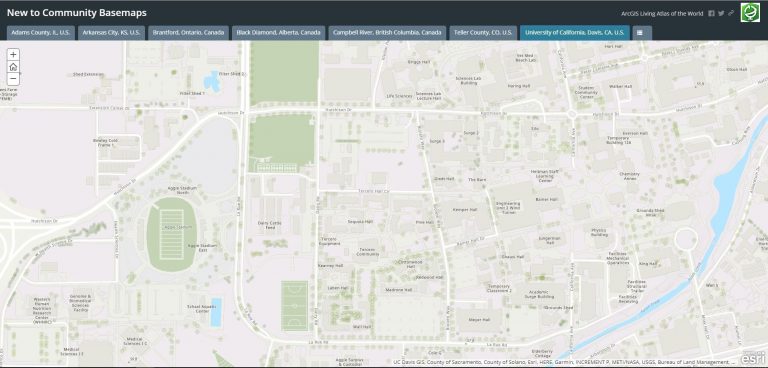
Community Basemaps
New content includes large-scale basemap layers, high-resolution aerial-photography, and drone captured imagery. Let’s take a tour of these new communities. Click on the Story Maps below to view interactive maps of our newest communities.
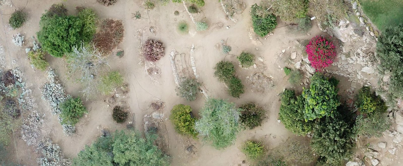
Community Imagery

Many communities and campuses are beginning to capture and share drone imagery. Drone use has become increasingly popular in the areas of urban and community planning, promoting tourism and capturing events. Drone technology is cheaper and faster in collecting data than satellites and aircraft, and can be deployed very quickly.
Here’s a great example captured by the University of California – Riverside.
How do I contribute?
It’s easy! The Community Maps Program works with authoritative GIS data contributors to build the ArcGIS Living Atlas of the World consisting of reference and thematic maps covering a wide variety of topics. Community Maps Program contributors participate by sharing data to one or more of these communities.
You can begin contributing by registering here!

Commenting is not enabled for this article.