In ArcGIS Online there are different types of scene layers that are supported in Scene Viewer, 3D Templates, 3D Web AppBuilder apps and the 4.x JS API. In ArcGIS Online you can publish scene layers from feature layers with point or multipatch geometries. You can also create scene layers (Point, 3D Object, Intergrated Mesh & Point Cloud) from scene layer packages which are uploaded to ArcGIS Online that will then generate a scene layer (This follows the same pattern as tile packages that you upload to ArcGIS Online and create a tile layer.)
What are all these different types of Scene Layers?
Before I go into the new beta feature of publishing of scene layers in ArcGIS Online, I want to quickly go over the scene layers that you will be publishing from feature layers.
Point Scene Layers
A Point scene layer is composed of points in a scene layer. Using point scene layers allows you to add a large number of points into the web scene. The thing you will notice about point scene layers is the auto-thinning on the features within the scene layer. This means when you zoom away from the layer you will see a fewer points and as you zoom in closer more features will zoom in. This is done to improve the performance of the scene layer you are visualizing. You can also leverage the new smart mapping feature in the scene viewer on point scene layers.
3D Object Scene Layers
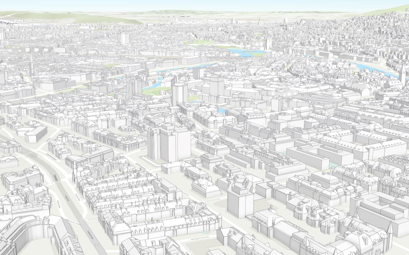
3D Objects are features that are configured to represent 3D models like buildings. These features can be textured or un-textured. The features do not always have to be building models, for instance if you have a multipatch feature for a geologic body that can be published as a scene layer. Since I last wrote this blog we have added the ability to style your 3D Object scene layers with Types and Unique styles. You can also remove textures and apply our latest enhancement – edges to your features.
Integrated Mesh Scene Layers
Integrated mesh scene layers are generally created for citywide 3D mapping; they are often captured by drone and cannot be restyled. This type of scene layer can only be published by uploading a scene layer package to ArcGIS Online and publishing a hosted scene layer from it.
Point Cloud Scene Layer
Point cloud scene layers provide fast display of large volumes of symbolized point cloud data. The point cloud scene layer is optimized for the display and sharing of many kinds of sensor data, including lidar. You can publish a point cloud scene layer by uploading a scene layer package to ArcGIS Online. When the scene layer has been published you can use the attributes in the scene layer to style your layer. The available styles for your point cloud scene layers are RGB, Classify, Elevation and Intensity.
Publishing Scene Layers with associated Feature Layers
In the Dec 2016 release of ArcGIS Online we added in the ability to publish scene layers from feature layers. This means you can take feature layers that contain layers that are only point or only multipatch geometry and publish a scene layer from them. The output will be a point scene layer from the feature layer containing only points or 3D Object scene layer from the feature layer containing only multipatch features. You will create the feature layers by uploading a zipped gdb or publishing a feature layer from ArcMap or ArcGIS Pro. The main thing you will need to make sure of is to not mix the geometries in the feature layers. They need to be either all point geometries or all multipatch geometries, if you have mixed geometries you will not see the publish option for scene layers. Also unsupported renderers like heatmap or ones using Arcade will not show the publish option. Trial and Developer accounts are currently limited to only publishing point scene layers. I am going to cover the two ways below you can publish these scene layers with associated feature layers.
Publishing from ArcGIS Pro 2.1 to ArcGIS Online
With the release of ArcGIS Pro 2.1 publishing scene layers just got easier. You can now publish 3D Object, Point and Point Cloud scene layers in just a couple clicks.
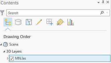
1.First you will need to have a scene open in ArcGIS Pro. You can use at least one of the supported layer types (Point feature class, Multipatch feature class or LAS data) under the 3D Layers category of your content in your scene that you want to share to ArcGIS Online
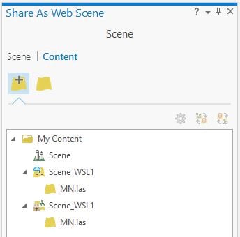
2. Next you can right click on the layer and click on Share As Web Layer to share just the layer to ArcGIS Online or You can go to Share as a Web Scene to share the web scene and the layers together to publish everything at once. You can also choose to publish a scene layer with an associated feature layer for point and 3D Object or you can create a local cache in a scene layer package and that will be uploaded to ArcGIS Online and generate a scene layer. For point cloud scene layers there will only be the option to create the local cache.
When you are ready to publish your scene layer click the share option and the publishing process will begin. You can track the progress of the scene layer generation under the Jobs pane in ArcGIS Pro.
Publishing Scene Layers in ArcGIS Online
You can also publish scene layers directly in ArcGIS Online. Follow the steps below you see how.
1.You will need to publish a feature layer with Point or Multipatch data. This can be done by uploading a zipped gdb or shapefile. You can also publish this layer type from ArcGIS Pro or ArcMap.
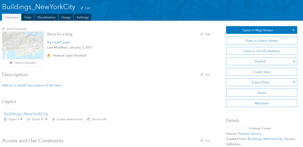
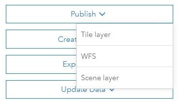
2. On the item details for the feature layer click on the publish button and click on the Scene Layer option to begin publishing the scene layer.
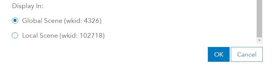
4. In the publishing dialog you have the option to display this scene layer in a global scene or a local scene. For this scene layer I am going to select it to display in a global scene: 4326 (WGS84) because I want to use my organizations basemaps which are supported in global scenes. If I wanted to use this in a local scene I would have selected the local scene option with the projected coordinate system of NAD 1983 StatePlane New York Long Island (wkid: 102718).
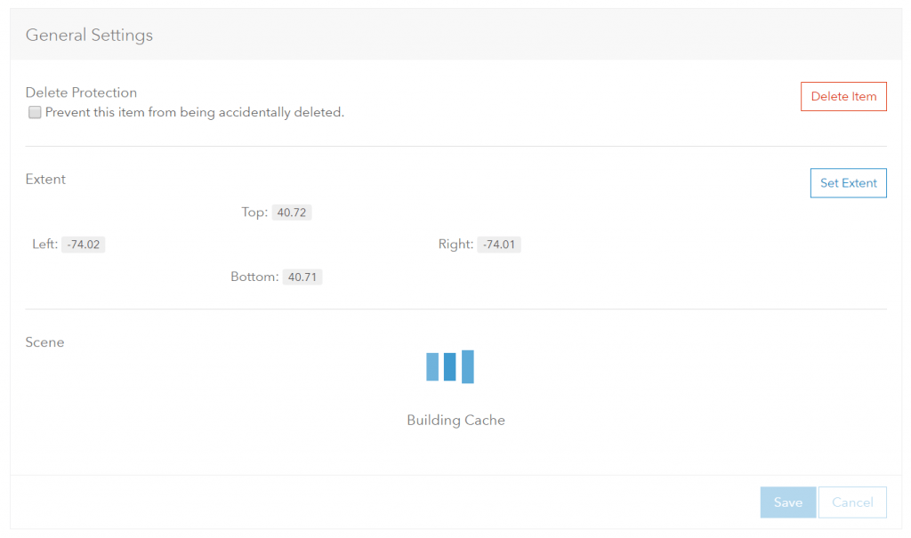
5. The scene layer is now being published which is shown by the “Building Cache” notification on the item.
Once completed you can then add it to the scene viewer through the item details or in the scene viewer itself by searching for it under My Content.
Publishing times can vary depending on many factors like the number of fields and attribute information in those fields, the number of layers within the feature layer and how the features were symbolized with textures or not. Some examples on times you can expect to see –21,000 multipatch features with no textures generated from building footprints with only one attribute took roughly 5 minutes to build the scene layer cache. A smaller feature layer of 3,500 points took 1 minute and 30 seconds with 7 fields. Also depending on the traffic/load on the system publishing times can be impacted.
Scene Layers and Coordinate Systems
In the publishing steps covered above I briefly covered the coordinate system options you have when publishing scene layers from a feature layer. When publishing these scene layers you will have the option WGS84 which is supported in global scenes or you can leverage the feature layers projected coordinate system. Because other geographic coordinate systems outside of WGS84 are not supported in the scene viewer today, data that is in a non-WGS84 geographic coordinate system will be automatically published to WGS84. The reason why the coordinate system can matter when you are publishing this data is because it is cached which means in clients that are light weight like the scene viewer or other web applications cannot re-project the scene layers to the web scenes current coordinate system. This is the same restriction you will see on other cached datasets like tile layers and elevation layers. However if your data is in Web Mercator however this can be used in both global and local scenes with other Web Mercator cached layers. By default scene layers in Web Mercator will load in global scenes but you can open a new local scene and add the scene layer through the scene viewer Add Layers.
Why would you want to publish these scene layers from feature layers?
There are a few reasons why you may want to publish your scene layers. Here are a few reasons why you may want to publish a scene layer from your feature layer:
- The feature layer you are loading has more than 2000 features. Currently in the scene viewer there is a limit on the number of features contained within a feature layer that can be loaded into the scene viewer. If you have a feature layer that contains more than 2000 features you will want to publish a scene layer which can handle millions of features.
- You want to view the multipatch features. The scene viewer does not support viewing multipatch feature layers so you will need to view these features as scene layers.
- Configurable popups. Currently in the scene viewer there is not an option to configure popups for layers. When you publish the scene layer from the feature layer this creates a relationship where the popups can be pulled from the feature layer from which the scene layer was published from. This means you can configure the popup for the feature layer at any time after the publishing of the scene layer and the scene layer will pull the latest popup configuration.
- You want to be able to update the scene layer. Use Update Data to update existing features or append new ones on the feature layer and rebuild the scene layer cache under the scene layer item settings.
Creating Scene Layers from Scene Layer Packages
Besides being able to create scene layers with associated feature layers, you can also create scene layers from scene layer packages. The scene layer packages are uploaded to ArcGIS Online and then published to generate the scene layer. This workflow mirrors that to uploading a tile package or vector tile package and publishing tile layers and vector tile layers. These packages are generated by a few of our other products and I am going to quickly go over them. Note that these workflows are not in beta so credits will be consumed with these scene layers.
ArcGIS Pro
In ArcGIS Pro you can create scene layer package by using the GP tool – Create Scene Layer Package. In ArcGIS Pro 1.3 this currently supports creating scene layer packages with multipatch data. The output will be a scene layer package with data in WGS84 which means the output scene layers will only support global scenes. In the coming release of ArcGIS Pro 1.4 you will be able to create scene layer packages with point, multipatch and LAS data. This will then allow you to create Point, 3D Object and Point Cloud scene layers. Also the scene layer package tool will support different coordinate systems allowing you to create scene layers outside of WGS84. For larger scene layer packages you will need to use the Share Package tool to be able to upload them to ArcGIS Online instead of through the browser using Add Item.
CityEngine
Since the release CityEngine 2016.0 you could create scene layer packages from the multipatch data in your CityEngine scene. These packages support different coordinate systems and you can upload them to ArcGIS Online through Add Item > My Computer or use ArcGIS Pro’s Share Package tool. An additional note on CityEngine exports. You can also export out your data into a file geodatabase. You can zip that geodatabase and upload it to ArcGIS Online and then publish it as a feature layer which can then generate a scene layer from the feature layer.
Drone2Map
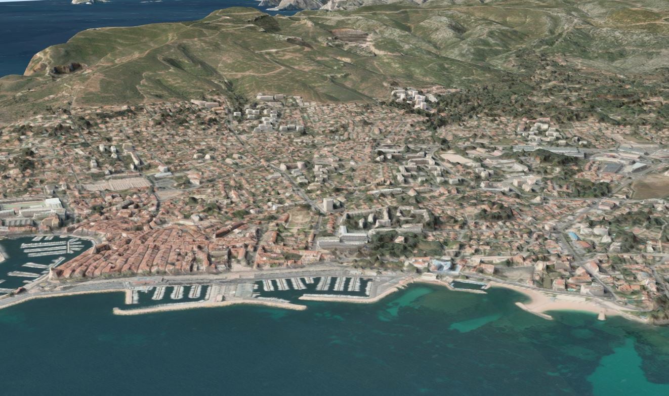
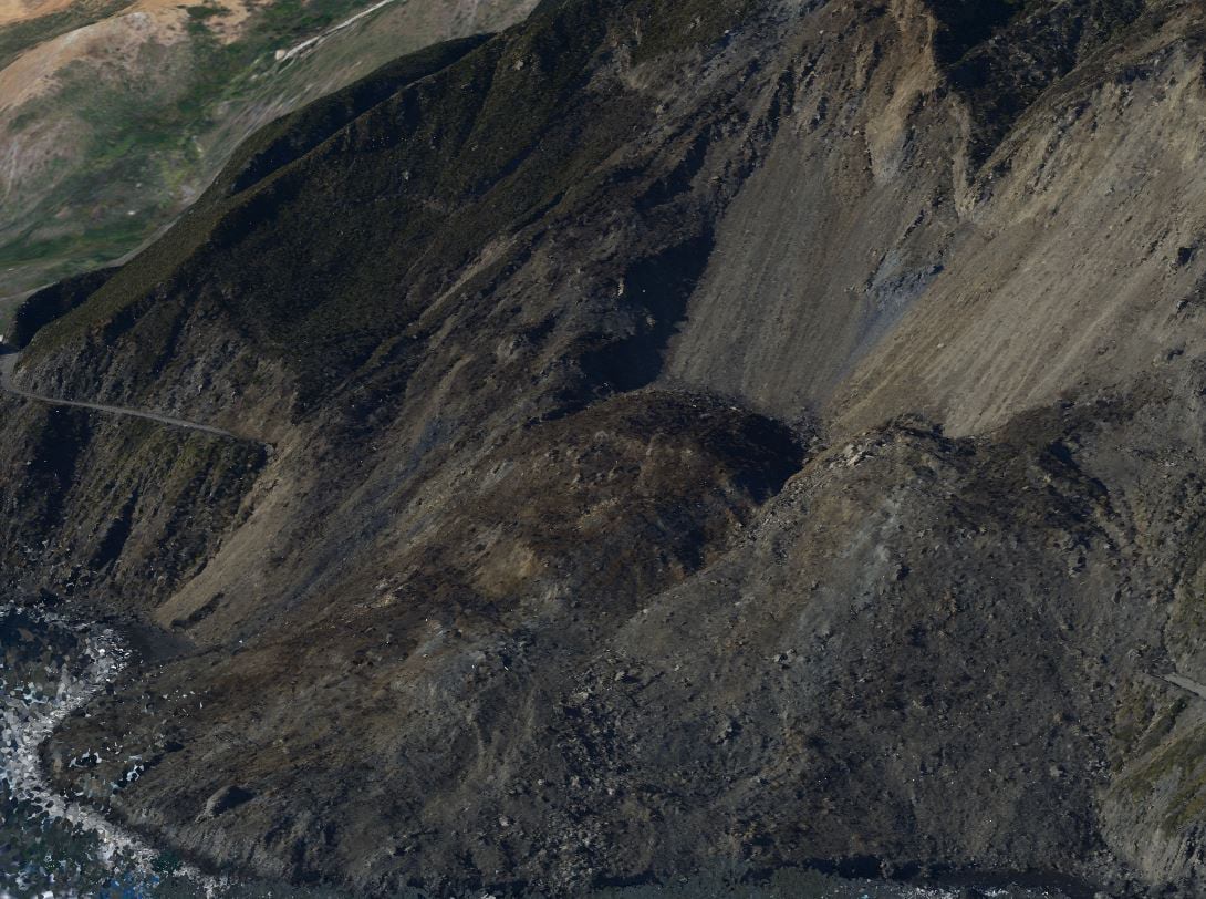
With drone to map you are able to create scene layer packages that can be used to publish integrated mesh scene layers. These scene layers are generated from a number of overlapping photos. The output can capture man-made structures like buildings but can also be useful for capturing terrain or natural features like trees, hills or cliffs.
Additional Resources:
Configure Layers in Scene Viewer
Indexed 3d Scene Layer (I3S) Specification

Commenting is not enabled for this article.