ArcGIS has enabled many 3D capabilities over the years. In 2016 I3S as an OGC standard to stream large 3D content on the web was introduced. Around the same time 3D Tiles, another OGC standard, was introduced by Cesium. Since then both OGC standards have evolved and are adapted by various GIS and non-GIS communities.


You can visualize scene layers (i3s) and 3D tiles layer in ArcGIS applications like ArcGIS Pro, Scene Viewer, ArcGIS Maps SDKs , or other web viewers created with CesiumJS.
Besides visualizing you can also host the layer as services in ArcGIS Online. With both OGC standards supported in ArcGIS the question is which format is best to use for your 3D layers?
To answer this question you have to think through your requirements. Here are some considerations that help you to make the best choice.
Type of 3D layers you need
In GIS spatial information is represented as a layer and visualized in maps or scenes. 3D layers are often used as a foundation to build digital twins. Here are some examples of typical 3D layers and the supported data formats:
Meshes visualizes realistic “skin of the earth” type of data. Meshes are captured with high accuracy, showing many different real world objects in one layer. Both 3D tiles and scene layer (i3s) can be hosted as integrated mesh type of web layer in ArcGIS Online and consume in ArcGIS Pro or Scene Viewer. If you are working with ArcGIS Enterprise only scene layers are supported.
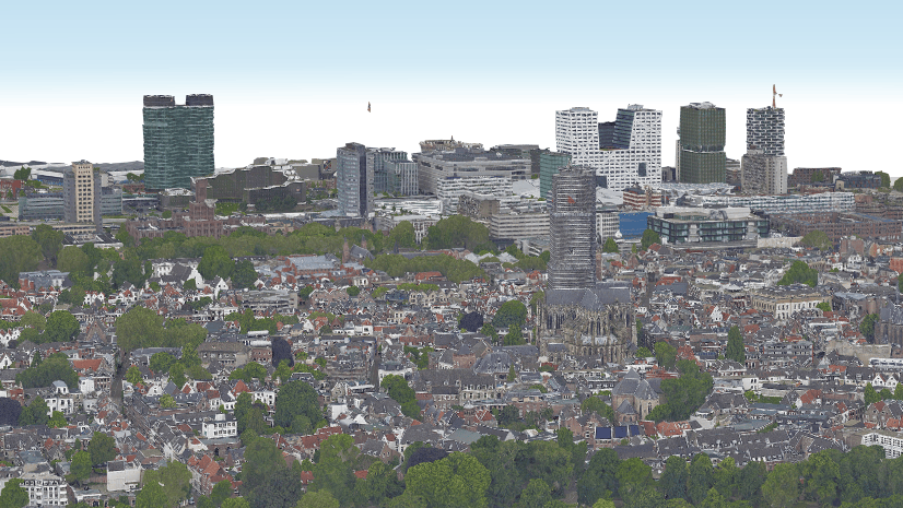
3D Objects like buildings capture individual features like buildings for a city. Both 3D tiles and scene layer (i3s) can be hosted as 3D object type of web layer in ArcGIS Online and consumed in ArcGIS Pro. If you are working with ArcGIS Enterprise only scene layers are supported.
3D BIM models created from IFC or revit files can be can be hosted and consumed as building scene layer (i3s).
Point Cloud layer created from LiDAR or terrestrial point cloud data can be hosted and consumed as scene layer (i3s).
Voxel layer are multidimensional 3D representation, for example, subsurface underground models and can be hosted and consumed as scene layer (i3s).
Conclusion
If you need layer types beyond reality mesh and 3D objects you will have to persist your data as scene layer. You will be able to view attributes in a popup for 3D tiles but you can’t use query definitions to filter for specific attributes. If you want to work with 3d object like you do with feature layer consider scene layers with associated feature layer.
The spatial reference required for the 3D layers
The spatial reference is an often overlooked topic but essential to think through before starting any GIS project regardless if you work in 2D or 3D.
There are many different reasons to pick a specific spatial reference. For example, there might be government regulations requiring you to use the national spatial reference for your country. If you already have layers in your GIS system you want to make sure that any new layer has the same spatial reference so you can visualize them all together in a scene without having to apply transformations.
Spatial references can be grouped in geographic, projected, and vertical coordinate system. Based on this grouping the following spatial references are supported in I3S and 3D tiles.
Geographic coordinate systems
A typical example is WGS 1984 as geographic coordinate system. It is used to represent global layers that represent the entire world. Both scene layers (i3s) and 3D tiles layers support WGS 1984. Scene layers (i3s) supports other geographic coordinate systems as well.
Projected coordinate systems
Projected coordinate systems are often state or country wide data or local data. These type of spatial references are often used in 2D GIS to reduce distortion cause by “flattening” the data. But also 3D data representing none global data are often using projected coordinate systems. Scene layer (i3s) support projected coordinate systems.
Vertical coordinate systems
When working in 3D, the vertical coordinate of layers is important. For example, most GIS data are using gravity related heights where the z value is based on the sea level. ArcGIS assumes that if no vertical coordinate system is defined the z values are in gravity-related heights. 3D tiles layers have a fixed ellipsoidal vertical coordinate system. Any layer with a gravity-related vertical coordinate system needs to be reprojected. If no vertical coordinate system is defined the layer will not align properly with the 3D tiles layer.
Combine 3D layers with other layers in a scene
One of key advantages in ArcGIS is the ability to bring a variety of data together and build a representation of a city, for example. The layer can be 3D with absolute height or 2D and draped on the ground.

You can visualize layers with different spatial references in ArcGIS Pro since the layers will be projected on the fly to the spatial reference of the scene. However, other ArcGIS applications like the Scene Viewer require all layers in a scene to have the same spatial reference.
You have following options when working with many 3D layers in a scene:
- All layers have the same spatial reference. All layers will line up when drawn in a scene since all layers have the same spatial reference.
- All layers have a vertical coordinate system. If the vertical coordinate system are not the same you will have to apply a transformation to assure the layers will line up.
- Some layers do not have a vertical coordinate system. The layer without vertical coordinate system will not line up correctly. For example, if a scene contains 3D tiles layer the scenes vertical coordinate system is ellipsoidal. You can share as web scene. 3D tiles will be drawn in EGM 96 gravity related heights to assure layers in your scene draw at the correct height.
Conclusion:
3D tiles layers can only be combined with layers in WGS 1984. The vertical coordinate system will be projected to EGM 96 when visualized in ArcGIS Maps SDK apps or Scene Viewer.
If you want to work with 3D tiles layers you will have to use ArcGIS Pro to project all layers into your desired projection or you will have to make sure you are working only with WGS 1984.
Analyze 3D layers
Besides bringing different geospatial information together you might also want to explore them by using measure or exploratory tools like viewshed or elevation profile. This type of exploratory tools are all available for both scene layers (i3s) and 3D tiles layers:


Conclusion
You can apply exploratory tools to scene layers (i3s) as well as 3D tiles layers. In addition, when working with scene layers you can use appropriate geoprocessing tools in ArcGIS Pro. For example, project, clip or extract multipatch from mesh.
Data management
Data changes over time and you need to be able to capture these changes in your 3D system of record. Since the geometries and attribute storage for 3D layers are very different you have following options to update and maintain your 3D layers.
3D Tiles
You can represent integrated mesh or 3D object type of data. To update a 3D tiles item on ArcGIS online for example, you will have to create a new layer.
Scene layer (i3s)
When working with voxel, integrated mesh, point cloud, 3D object, point, or building scene layer you can replace the web layer. Any web scene with the layer will show the new data. In case you work with feature based scene layers like 3D object, point and building scene layer authored as scene layer with associated feature layer you can make edits and update the scene layer with the changes to the feature.
Summery
The decision to use 3D tiles or scene layers (i3s) should be based on the layer type you need to represent, the spatial reference required, and the layers you need to combine in your scene. ArcGIS enables you to host both OGC standards in ArcGIS online and work with them in ArcGIS Pro and Scene Viewer.

Article Discussion: