As a curator for ArcGIS Living Atlas I often see formatting issues in a layer’s description. Inconsistent size, font, color, and other properties detract from the important information contained in the description. Often these formatting issues are the result of copying text from a webpage or other document. Enthusiastic iteration can also result in undesirable formatting quirks.
These four tips will help you avoid formatting problems and give your work the professional polish it deserves.
#1 Remove Format Tool
If you run into formatting challenges while designing your description you can use the Remove Format tool. Simply highlight the section you need to clean up and click the button that looks like a pink eraser.
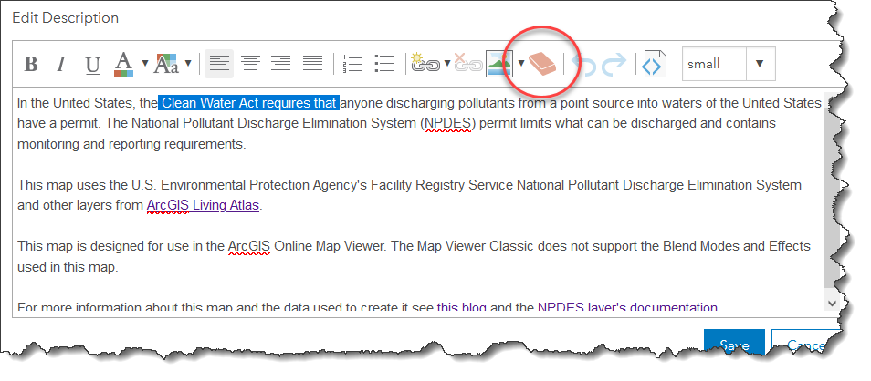
The Remove Format tool is handy for cleaning up your layer’s description.
#2 Paste as Plain Text
As I mentioned previously, copying text from a webpage or document can capture undesired formatting that may not match your description when you paste it in. You can avoid a lot of clean up work if you take a moment to copy and paste carefully. To paste without including any formatting try right clicking and select Paste as plain text. You can also press Control + Shift + V in Windows or Option + Shift + Command + V in macOS.
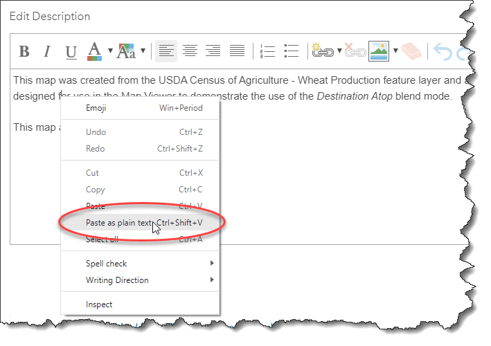
In Windows you can paste without including formatting by right clicking and selecting Paste as plain text from the menu.
#3 Notepad
In more difficult cases you can copy your text and paste it into a text editor like Notepad. Copy the text from the text editor and paste it into the discussion and it should be free of formatting. Note that you should delete everything and then save the change to clear any remaining formatting from the description.
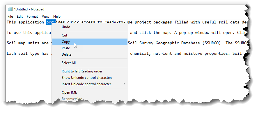
Copying to a text editor like Notepad and copying from there to your description is a sure-fire way to get rid of even the most stubborn formatting.
#4 View HTML Source
More advanced users can edit the tags that control formatting using HTML Source View. The button looks like a little set of tags (<>) and toggles between the HTML view and the regular editing view. The HTML view enables you to make fine adjustments to your formatting. Its also a good way to confirm that all formatting has been removed before pasting.
Editing the formatting tags is a great way to make your work stand out. You can control text colors and make them match your map, create tables, and much more. A full list of tags that you can use is available here.
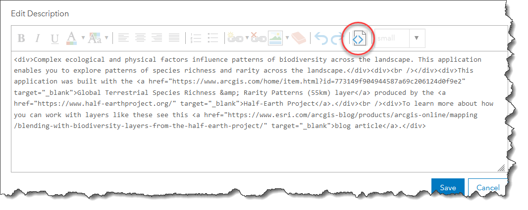
The HTML Source view provides access to the tags that control formatting.
Take a couple of minutes to make your work shine and clean up those unruly fonts. Polished, professional-looking documentation will reflect the hard work you put into your layer and give it an authoritative presence.


Article Discussion: