Imagery is so much more than a pretty picture. It is captured with the goal of extracting information from it, whether through visualization or analysis. However, imagery must be shared before it can be used and this can often be a time consuming process. This article outlines the advantages of using ArcGIS Notebooks for direct publishing. - Adapted from "A Guide to Sharing Imagery and Raster Data"
Motivation
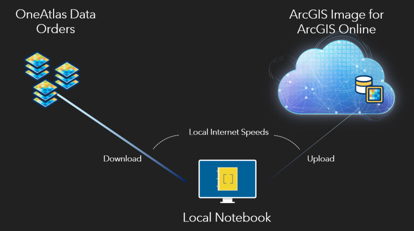
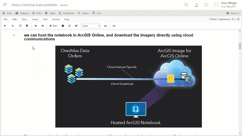
When working on an imagery project, significant time can be spent on file transfers. Imagery providers leverage delivery technologies, including FTP and HTTPS, for customers to download their imagery locally. After downloading, users then need to upload their imagery in order to publish services in ArcGIS Image for ArcGIS Online. While this publishing workflow is fully supported, the imagery is transferred twice over the user’s local internet connection, where download speed—and more commonly, upload speed—can be limiting.
Solution
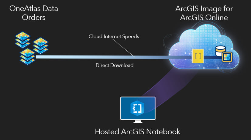
This article describes the use of ArcGIS Notebooks hosted in ArcGIS Online to decrease the time requirement for file transfers when publishing hosted imagery layers. When hosted in ArcGIS Online, the notebook executes code within a container inside the user’s ArcGIS Online organization. Therefore, imagery downloads directly into ArcGIS Online and does not rely on the internet speed at the user’s computer. Furthermore, while publishing, the imagery is already inside the ArcGIS Online organization, making the upload step very fast. When directing these data transfers with code in an ArcGIS Online hosted notebook, the user maintains full internet bandwidth at their local computer.
Airbus Case Study
Recently, the Airbus Pleiades Neo satellite constellation captured a series of images over St. George’s, Grenada which is available to order using OneAtlas Data, which also offers archive, and tasking products from SPOT 6, SPOT 7, Pleiades 1a, and 1b.
Pleiades Neo provides 30 cm pansharpened multispectral wavelength bands for red, green, blue, near-infrared, red edge, and deep blue. Red edge, and deep blue are new additions to the Pleiades satellite constellation. The red edge band supports improved measurement of plant biophysical parameters including Leaf Area Index (LAI) and leaf chlorophyll content, as well as the potential for earlier detection of plant stress than possible using near-infrared. The deep blue band helps characterize atmospheric conditions at the time of acquisition, supporting atmospheric correction and dehazing. Deep blue also enhances coastal mapping up to a 35 m depth, with better characterization of water quality and turbidity.
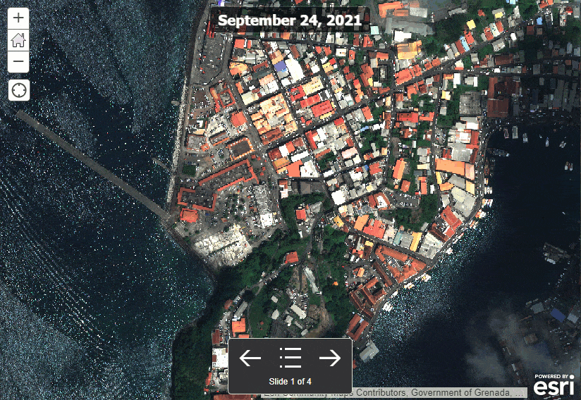
In this case study we published tiled imagery layers in ArcGIS Image for ArcGIS Online using our API key from OneAtlas Data API to explore all six multispectral bands of Pleiades Neo, across four acquisition dates: Feb 1, 2022, Jan 6, 2022, Sep 24, 2021, and Nov 4, 2021 (see below).
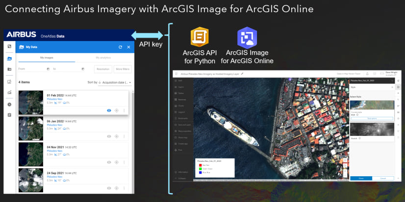
Esri’s ArcGIS API for Python delivers a set of classes, methods, and functions to perform data conversion, reclassification, change detection, and more. Esri has also added ArcGIS Image for ArcGIS Online support, so you can automate the creation of hosted imagery layers, by transferring the imagery directly from OneAtlas Data to ArcGIS Image for ArcGIS Online.
Methodology
The solution is achieved using an ArcGIS Notebook (click here to download a copy), which can be run interactively or scheduled to run automatically, publishing ongoing Airbus imagery orders for your area of interest. Note: To take advantage of direct file transfers, be sure to add the ArcGIS Notebook as an item in your ArcGIS Online organization before using it.
Result: Visualizing Hosted Imagery
The resulting hosted imagery layers can be explored in the embedded Web Map below, or explored in more details in a separate browser tab:
All of these capabilities – hosting imagery with the full data model including all bands, and full bit depth, sophisticated raster analytics, and automating content delivery—are now all possible using ArcGIS Image for ArcGIS Online.


Article Discussion: