In Map Viewer there are multiple ways to add symbols to style your features. Map viewer supports uploading SVG, PNG, JPEG, and GIFs through symbol styler which allows you to use these uploaded images in your maps without having to manage the images being hosted somewhere else. This allows the image to be stored in the map so when the image is removed from Symbol styler it will not break any existing maps. To learn about uploading images and using them in Map Viewer check out this blog. You can also use Esri default web styles or configure your organization settings to use web styles published from ArcGIS Pro and use them in Map Viewer for members across your organization. To learn about this workflow check out my blog on how to publish a web style.
The Map Viewer February 2024 release has now made adding web styles in Map Viewer easier. You can add web styles in symbol styler without needing to set up a group in your organization admin setting. Add your web styles, search your organization or ArcGIS Online to add these web styles inside Map Viewer. This will make it easier to test or prototype your styles before sharing them widely, using a style for a one-off project that does not require to be in the default gallery selection or maybe you caught an interesting style someone else had published in ArcGIS Online and want to use that to style your features. Adding web styles in Map Viewer can be used in smart mapping and sketch. Once you add the web style it can be used with smart mapping and sketch. This means you do not have to add the web style twice to have it used elsewhere. If the symbol contains symbols for a mix of points, lines, and/or polygons you only have to add it once. This means you do not have to add it each time for each geometry being styled. The styles also are saved in the list of symbol galleries until you remove them yourself or the web style is deleted. This means the styles are available when creating new web maps or updating an existing one and they do not have to be added each time.
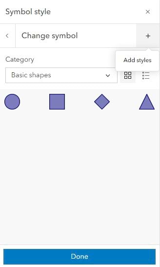
How to add Web Styles in Map Viewer
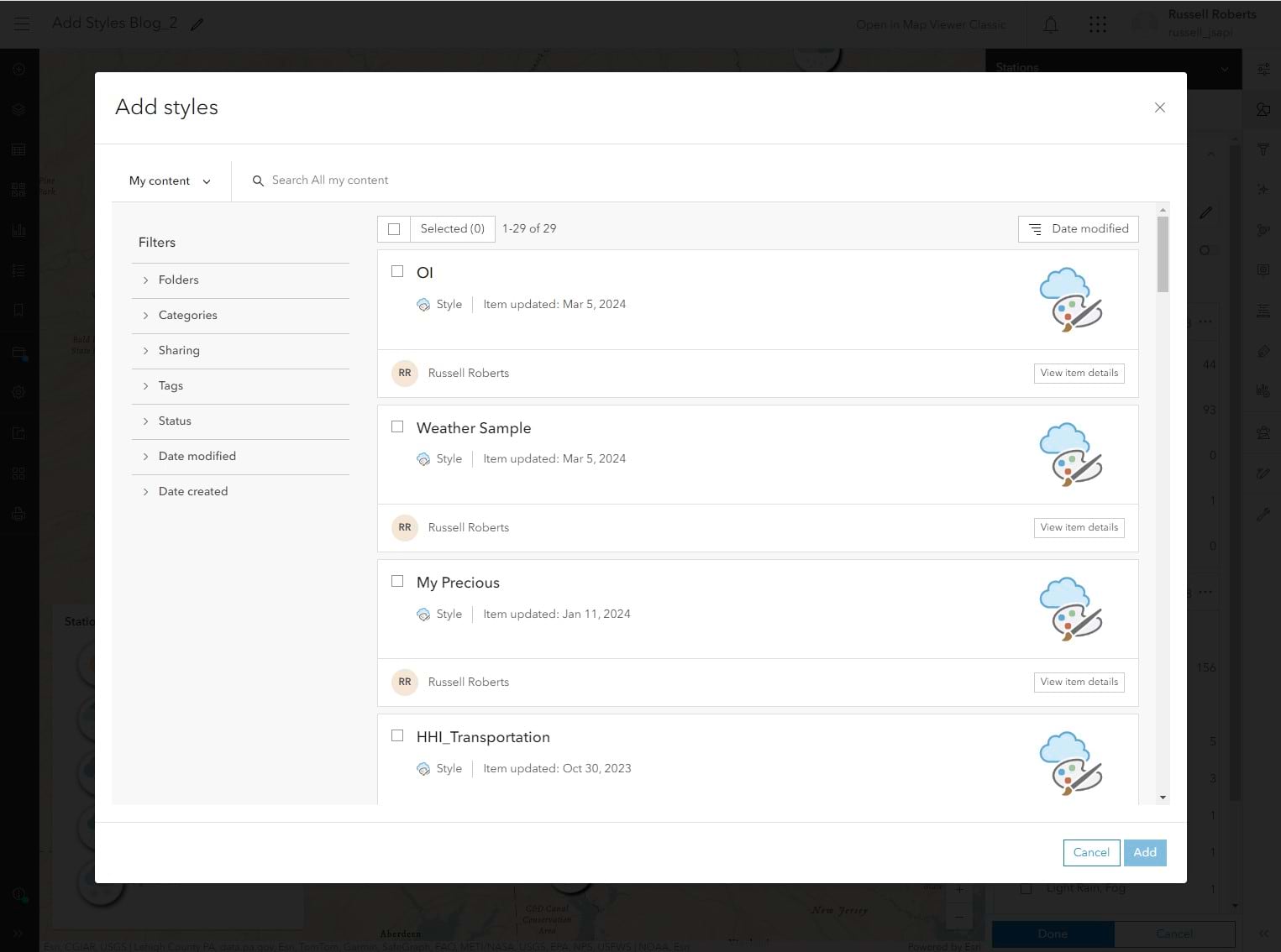
With the symbol styler in the smart mapping styles panel or the sketch panel open, you will see a new + button. Clicking on that will open the item browser where you can search and add the web styles you want to use. The styles you see presented will contain symbols for the current geometry being styled. This means you won’t see styles that won’t be compatible with the current symbol geometry being used. You can select one or multiple web styles and have them added in, making it easier to test, compare, and use multiple web styles quickly.
The example map I have is looking at the reported weather current weather layer from Living Atlas. Using a Weather web style published from Pro I can select it from the item browser which will add it to Symbol styler.
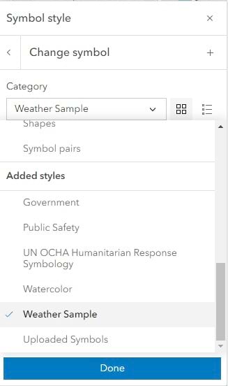
The style will automatically open after you click Add and it will be under the Added styles section under the list of symbol categories in layer styling and sketch.
Next, you can use it to style your layer symbols. Here I am assigning the correct symbol for the listed value of types.
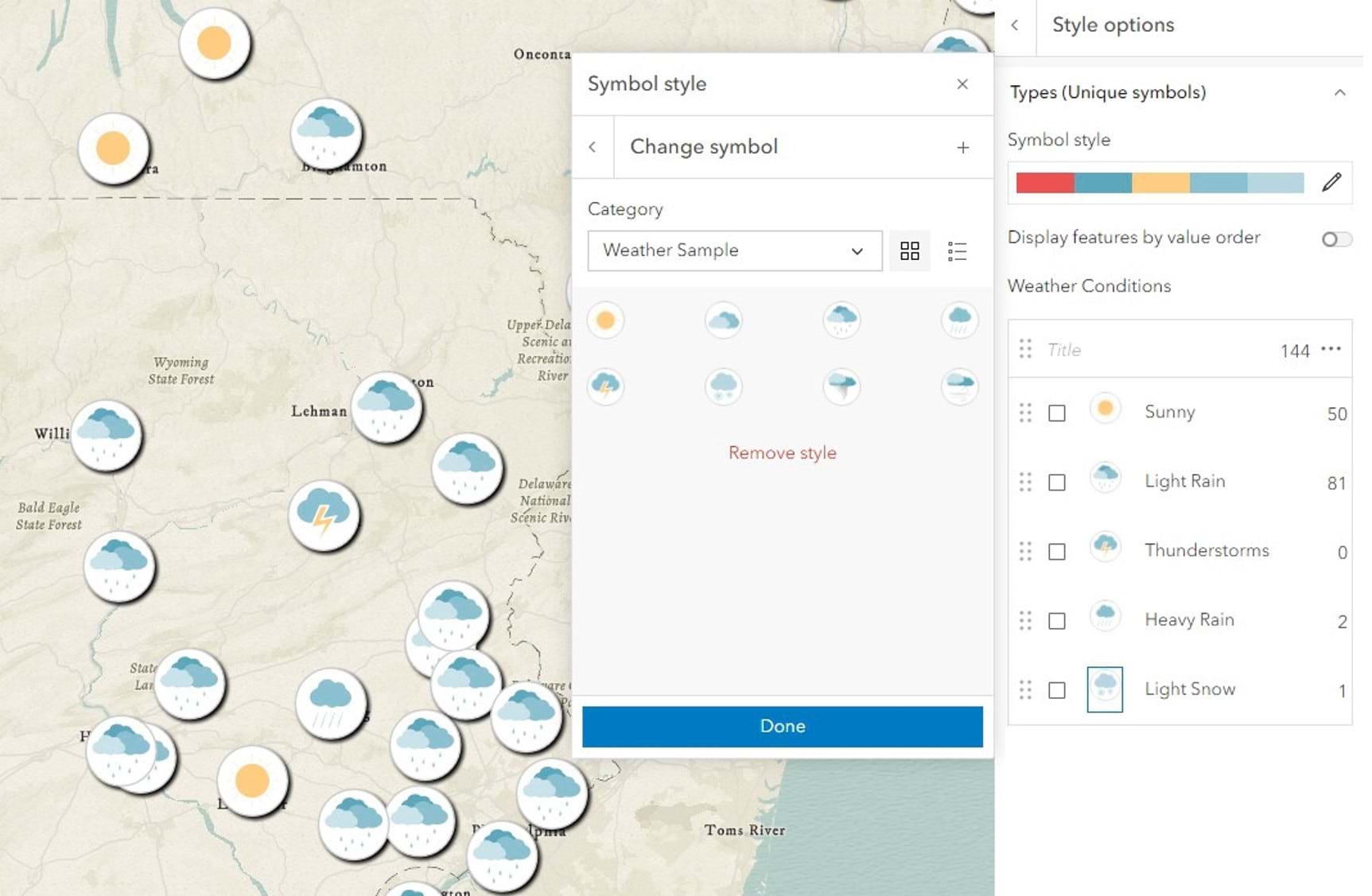
Once completed with this style I can click on Remove style to clean up my gallery or leave it for use in another map or open up Sketch and use it to markup the map.

Article Discussion: