Map Viewer supports aggregating your point features using clustering, chart clusters, and binning. If you are new to aggregation in Map Viewer, I recommend checking out this blog by Mark and this walkthrough blog on binning. The February 2024 update made some additional updates that will be covered in this blog.
The first enhancement is the support for setting a scale threshold on your aggregated features. If you have used ArcGIS Pro aggregation functionality, you would have seen the option to set your scale threshold. The scale threshold allows you to set a scale level that will disable the aggregation method used and show the individual features without any clustering or binning applied. Before this release, the workflow would have been to set up 2 layers, one with clustering or binning set and scale visibility range, and then a duplicate layer with no aggregation applied and a scale visibility range outside of the aggregation layer. This could be most noticeable with binning, where this is applied at a fixed size and does not change with map scale. With a scale threshold, this makes it easier without having to manage this additional layer in your map. This new property is available across clustering, chart clustering, and binning.
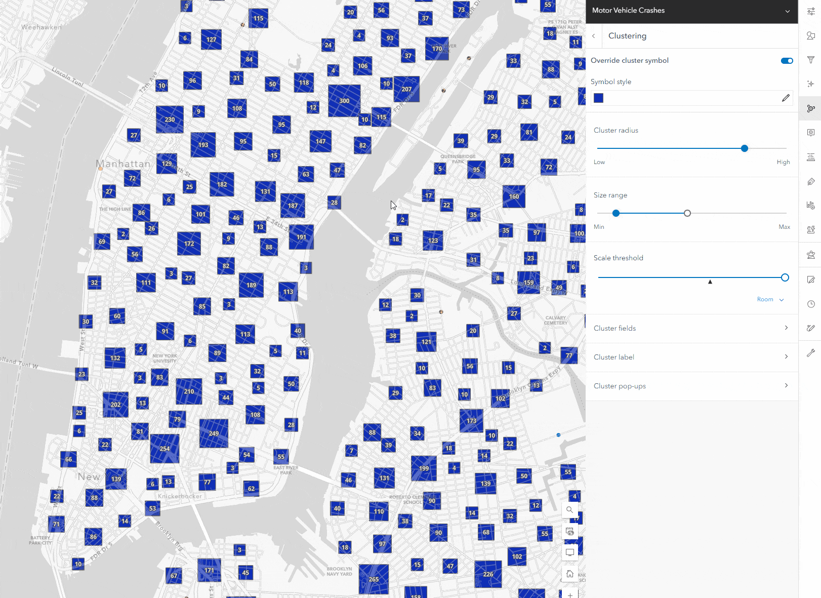
How to set the scale threshold for clustering
Opening the clustering panel, you will see the configuration controls, like setting a symbol override, cluster radius, and size. Below that is the scale threshold. In the gif below, you will see that zooming in and out will change the clusters, but they will remain. Once you set the threshold, you will see that zooming past that set level in the map view will disable clustering, and you will see individual features
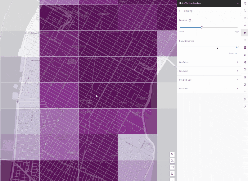
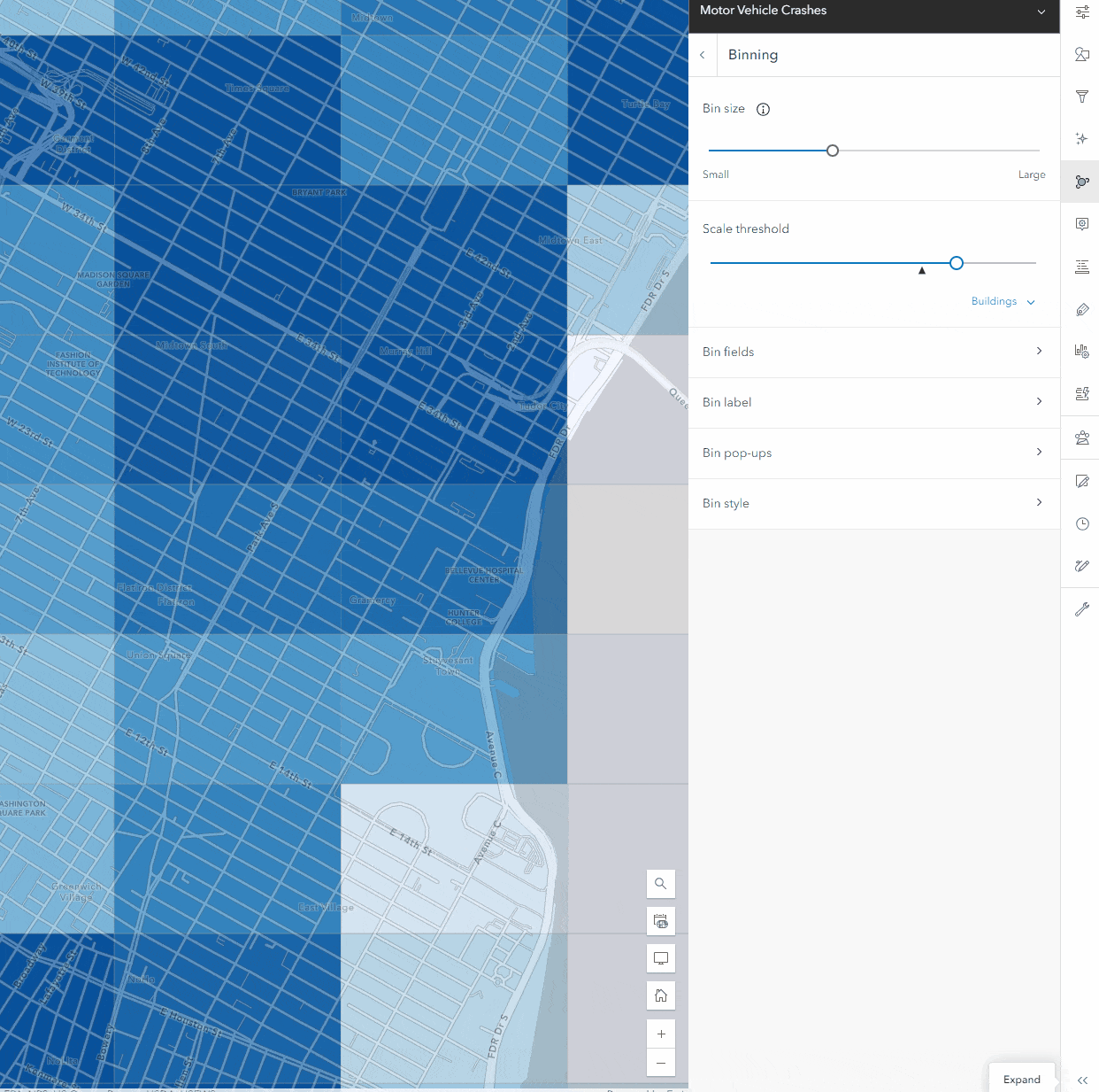
How to set the scale threshold for binning
When binning is enabled, it will generate a set bin size suitable for the map scale currently being viewed, which can be customized. The size does not change like clustering when you zoom in and out, as you will see in the gif below. This makes setting a scale threshold for binned data particularly useful when zoomed in to a level where the size of the bins does not help the viewers understand any aggregation patterns. Setting the bin threshold is in the same place as clustering, and once you see the level that will help the users, the features will be displayed without the binning applied.
Updates to configuring bin style
Before this release, when binning was enabled on the layer, there was no way to see individual features unless binning was disabled. This meant you could not configure individual feature styling, and the Styles panel was only used for styling your bins. With the scale threshold present, you can now style your bins and your layer’s non-binned view. The new bin styling is available inside the binning panel now. This matches the same workflow as adding new statistic fields, popups, and labeling.
We hope these updates make authoring aggregated features and look forward to seeing what you create!

Article Discussion: