Improvements
We improved the Classify LAS Building geoprocessing tool in ArcGIS Pro 2.4.
- Greatly reduced commission errors (i.e., other objects misclassified as buildings) and omission errors (i.e., buildings unclassified or misclassified as other objects).
- Consistent results when the tool is run repeatedly. There were minor differences between each run in earlier releases.
- Classified dome and arch shaped roofs.
- Significantly improved the classification of photogrammetric point clouds and Geiger mode lidar data.
- Improved the performance speed by 2~4 times.
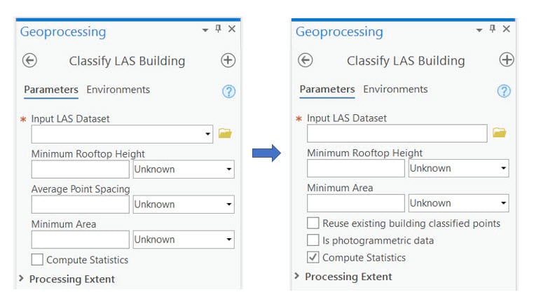
User interface changes
Here are the changes in the Classify LAS Building geoprocessing tool’s user interface (Fig.1):
- The parameter Average point spacing. Previously, we used it to set a more accurate point spacing. The tool now accurately estimate point spacing, so this parameter is no longer needed.
- A new parameter called Reuse existing building classified points has been added. This provides an option to keep existing building classifications. Choose this option if you are satisfied with the existing building classification and don’t want them to be reclassified.
- A new parameter called Is photogrammetric has been added. When it is selected, this tool tailors its internal parameters to handle photogrammetric point clouds, which are usually very dense and noisy, and lack return information.
- We changed the definition of the parameter, Minimum Area. It now means the smallest area of the building footprint, and not the roof patch nor the building roof. Previously, it meant the smallest area of the planar patches of the building roofs.
Examples
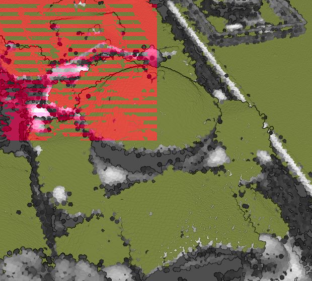
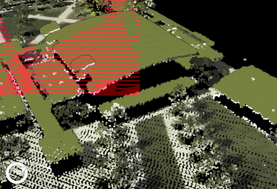
Below are some examples demonstrating the improved building roof classification results from ArcGIS Pro 2.4. The classified building points are displayed in red, while the background is rendered in RGB or in intensity.
Figure 2 shows a residential area where some houses are connected to or partially covered by the dense tree canopies. This poses a big challenge to building classification algorithm because dense tree canopies can be easily misclassified as buildings if their shapes look similar.
As you can see, the results are pretty good. Most building points are correctly classified and only a few tree points are misclassified as buildings.
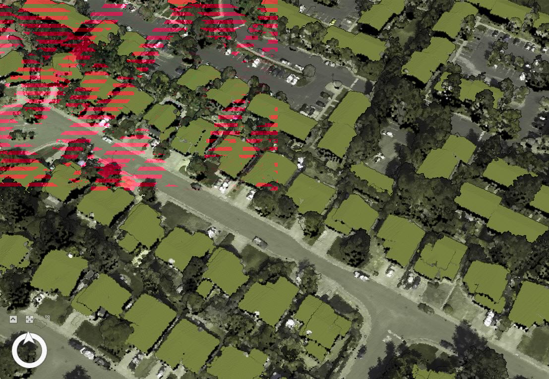
Figure 3 and 4 show small planar patches correctly classified, while the tree points are not misclassified as buildings.
In previous releases, you needed to choose a suitable value for the Minimum Area to classify small planar patches. This value is usually the smallest area of the roof patch you want to classify. Choosing a suitable value was difficult. A larger value could result in smaller roof patches being unclassified, while a smaller value would cause tree points to be misclassified as buildings.
Now in ArcGIS Pro 2.4, choosing this value is much easier. You only need to choose the minimum area of the building footprint that you want to classify. The tool will classify all of the roof patches, even if their areas are smaller than the specified value of the Minimum Area.
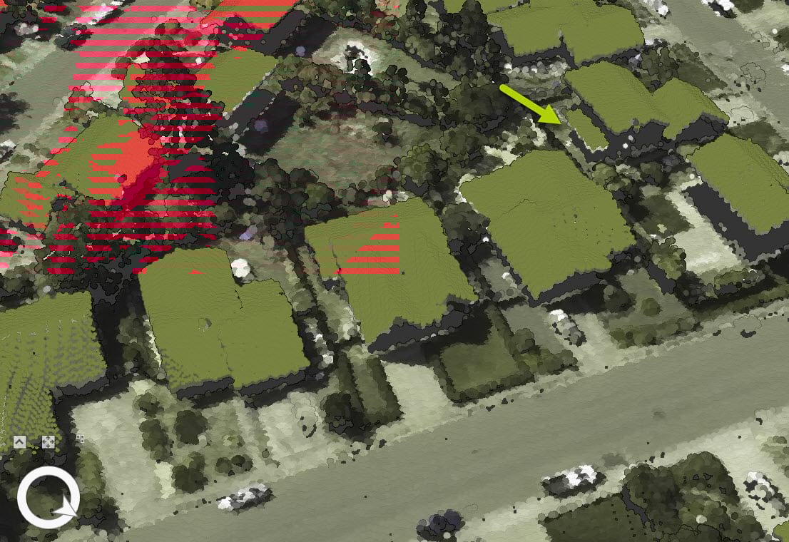
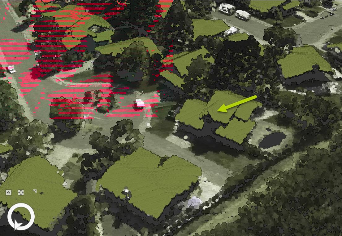
Figure 5 shows a classification of large buildings with multiple levels and complex structures. You can see how building roof points are correctly classified.
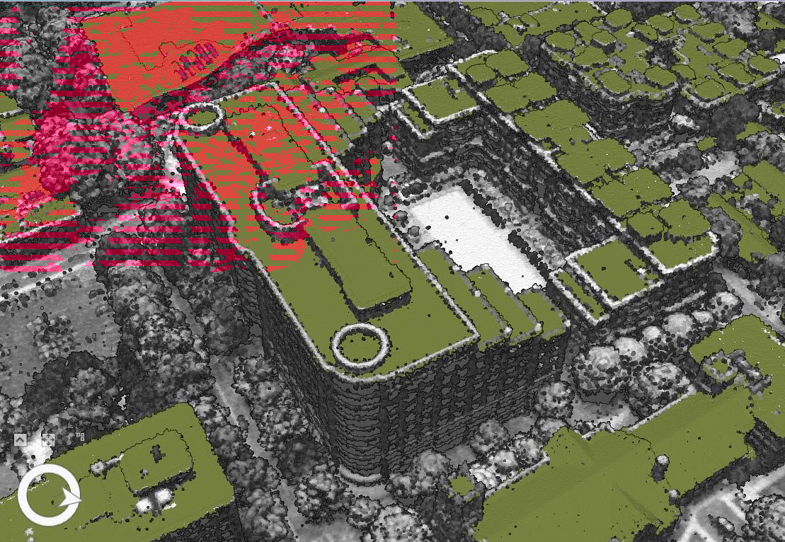
In ArcGIS Pro 2.4, the tool can also classify domes (Fig.6) and arch shaped roofs (Fig.7).
Data credit: NASA Grant NNX13AP69G, the University of Maryland, and the Sonoma Vegetation Mapping and LiDAR Program (for Petaluma data); USGS (for Charlotte data).

Commenting is not enabled for this article.