This release brings new functionality and optimizations for your no-code integrations. These updates will be covered in a two-part blog. In this blog we will cover new visuals, formats, and format support improvements which include:
- Geodatabase
- New field types
- Upsert mode
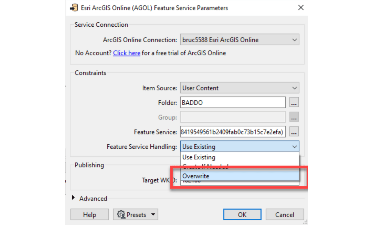
- Overwrite mode
- EsriJSON format
- Snowflake
In the second blog we will cover transformation enhancements.
Let’s look at some highlights!
A New Look for Application and Tool Icons

New Format Capabilities

Format Support Improvements
- Geodatabase has received some attention. Feature datasets are now optionally read into feature type names, which can then be used at write time to organize data into feature datasets. Non-spatial tables will not be written into feature datasets. Field index creation is now supported for all geodatabase types.
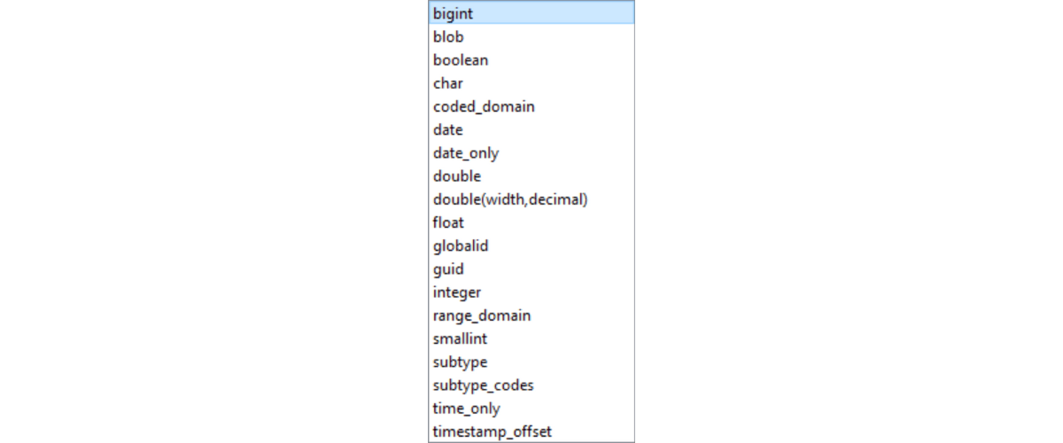
- The new field types of bigint, date_only, time_only and timestamp_offset are now supported, and GlobalID in file geodatabase can now be preserved from read through to write, which is key to many workflows needing dataset synchronization. The date_only type is how dates should always have been handled in shapefiles, so now you can!
Be aware the new field types cannot be used (yet) with the API-based file geodatabase writer, the one with short format name ‘FILEGDB’.
Geodatabase Field Types
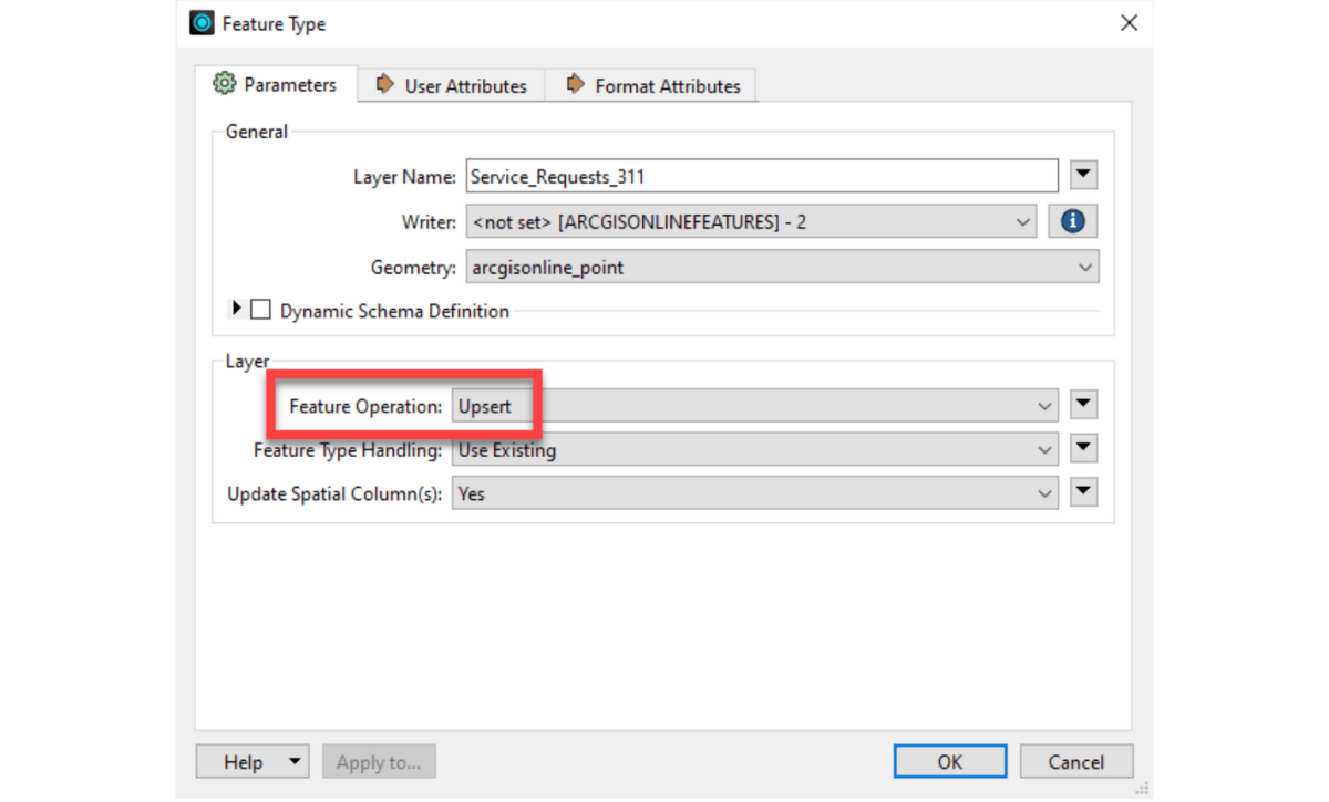
3. ArcGIS Online hosted feature service writing now supports an Upsert mode. This will make use of GlobalID as the row identifier field and either insert new rows or update existing rows. In a near-future release we will add support for a user-defined row identification field.
4. A new Overwrite mode, which if a service exists it will be replaced with new data, but otherwise behaves like Create If Needed.
5. The EsriJSON format, used internally by Esri tools, is now fully interchangeable with Esri-created data, including the field definition dictionary and coordinate system properties. This makes EsriJSON a good data payload in distributed workflows.
6. Snowflake keeps growing in spatial capability and general popularity; support for Snowflake’s spatial references is now included (not just their original spherical rendition of WGS84). Variant columns containing XML are properly returned with other columns, and if you’re writing spatial data into Snowflake, you can use the first written feature to set the spatial column properties.
Part two of this blog will include the following:
- OpenAPI Specification
- AttributeManager
- DateTimeRounder
- UniqueIdentifierGenerator
- Data Inspector
- Compare Workspaces
Learn more about ArcGIS Data Interoperability.


Article Discussion: