The June 2022 release of Oriented Imagery is here! We’ve added support for ArcGIS Pro 3.0, more robust video functionality, the ability to create an oriented imagery catalog from a mosaic dataset, the option to set a default image and location in your oriented imagery catalog, and more.
Use the Oriented Imagery add-in in ArcGIS Pro 3.0
The Oriented Imagery has been updated to work with some of the breaking changes introduced in ArcGIS Pro 3.0. Because of this, note that the June release requires Pro 3.0+, and won’t work in previous versions of Pro.
Leverage more robust video functionality
We’ve expanded support in the ArcGIS Pro add-in for additional video formats:
| Video Format | Audio Format | Codec |
| WebM/MP4 | OGG/WAV | VP9 |
| WebM | OGG/WAV | VP8 |
| MP4 | OGG/WAV | HVEC |
Video will still need to be hosted in the cloud to play in Pro.
Video support on the web still includes all the formats/codecs supported by Chromium.
Oriented imagery catalogs created using the Geospatial Video option now better handle frames pointing to the horizon, and we’ve improved support for 360-degree video.
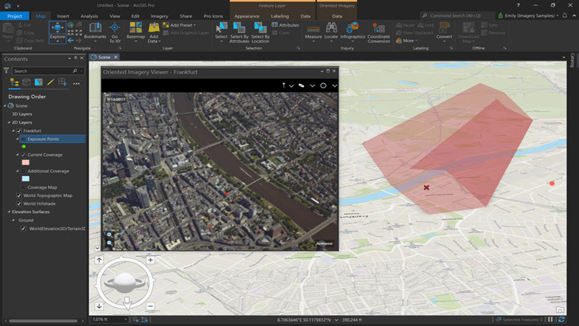
Create an oriented imagery catalog from a mosaic dataset
If you’ve got imagery managed using a mosaic dataset, the Add Images to Oriented Catalog GP tool now allows you to use that mosaic dataset as input to create an oriented imagery catalog.
Note that the mosaic dataset should be created using a frames table, and still needs to contain the required orientation parameters to be correctly used within Oriented Imagery. This tool is compatible with ArcGIS Pro 3.0+. Learn more in the Oriented Imagery Management Tools doc (installed with the Management Tools by default at C:\Image_Mgmt_Workflows\OrientedImagery\Documentation\OrientedImageryCatalogManagement_UserGuide.pdf.)
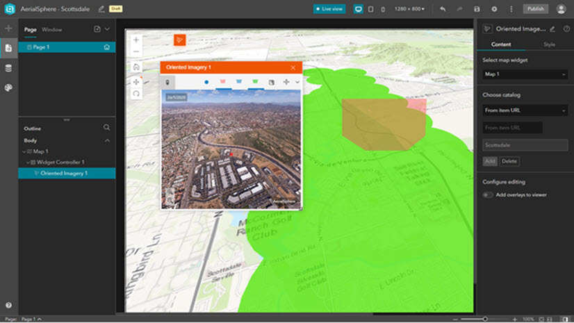
Set a default image and location in your oriented imagery catalog
In your oriented imagery catalog, you can now define a default image that the viewer will display as soon as the app or widget is initialized, as well as a default search location, meaning the app or widget will automatically search for and return all images of that location as soon as it’s initialized. Learn more in the Oriented Imagery Catalog schema doc.
…And more
Additional enhancements and bug fixes include:
- Improved support for iOS devices
- Improved support for authentication types in Enterprise portals
- Improved support for depth images (not supported for 360 images)
- In the add-in, use camera overlays to navigate
- Bug fixes:
- You can now create correct coverage maps for oriented imagery catalogs in coordinate systems other than Web Mercator (EPSG 3857)
- Create an oriented imagery catalog from a feature service with attachments
- Editing workflow and vector overlays now work as expected
Bonus sneak peek—Mapillary imagery coming soon!
Mapillary has an open database of more than 1.5 billion images from around the world, and pretty soon you’ll be able to use the Oriented Imagery widget for Experience Builder to add them to your web apps!

Watch for a new Mapillary OIC that anyone can use—create an Experience Builder app, add the Oriented Imagery widget, and load it up with the Mapillary OIC. You’ll be able to click on a point in your app’s map to explore street-level images of that location taken by cell phones, action cameras, and 360 cameras.
Oriented Imagery Ideas
Have an idea for an Oriented Imagery enhancement you’d like us to implement? We’re listening! Check out the new Oriented Imagery Ideas board in Esri Community to share your ideas and upvote ideas you’d like to see us make happen.


Article Discussion: