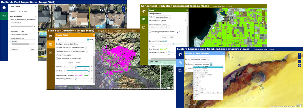
Building a web app to showcase your imagery is a quick and powerful way to make imagery accessible to your audience.
Esri has Instant App templates designed specifically for imagery, so you can create an app quickly, easily, and with zero programming. Three options let you target a variety of end users and applications.

Options for creating imagery apps
There are three configurable app templates designed to work with imagery—Imagery Viewer, Image Mask, and Image Visit.
Imagery Viewer
With Imagery Viewer, create apps that let users visualize and explore collections of imagery through time and space. Depending on how the app is configured, users can:
- Visualize imagery layers (and non-imagery layers) from the app’s web map
- Apply any rendering options attached to the image service
- Compare two imagery layers (or single images) using a swipe tool
- Explore an imagery layer through time, selecting specific images to visualize
- Zoom to bookmarked areas of interest (or bookmark their own)
- Export an area of interest to the user’s local machine or to the user’s ArcGIS account
- Collect and edit feature layers, take measurements, and more
Image Mask
Use Image Mask to create apps that let users do two things—identify areas of an image that have changed over time, and identify areas that meet user-set thresholds for common indexes, like NDVI. Depending on how the app is configured, users can:
- Use the Change Detection tool to compare two images in a layer. For both images, the tool will calculate common spectral indexes for vegetation, burned areas, and water, then highlight areas that have increased or decreased.
- Use the Mask tool to highlight areas that meet a user-set threshold for common spectral indexes for vegetation, burned areas, and water. For example, use the tool to highlight all the areas in an image with NDVI values above 0.25 to find vegetation.
- …plus, use many of the same navigation and exploration features available with Imagery Viewer.
Image Visit
With Image Visit, create apps that let users quickly review imagery at a predetermined sequence of locations, reviewing and editing attributes as needed. Imagery for the upcoming location is pre-loaded to minimize wait time. For example, you can quickly create an app to check ground control point locations or the accuracy of deep learning labeling. Depending on how the app is configured, users can:
- Use a “Visit” layer (an editable hosted feature layer) or a web map’s bookmarks to quickly review imagery at a predetermined sequence of locations.
- Use an optional “Notes” layer (a second editable hosted feature layer) to add or edit features associated with the Visit locations.
- Use an optional “Status” field to set the status of each Visit location as it’s processed.
- View information about the Imagery, Visit, and Notes layers in a dialog window.
To get a better idea what’s possible, check out some example apps built with the configurable app templates for imagery.
Get started building an imagery app
Regardless which configurable app you choose, the process for creating an app is the same:
- Build a web map with at least one imagery layer in the Map Viewer.
- Share your web map using a configurable app template for imagery.
- Configure your app.
- Share your app!
Learn more about creating configurable apps in ArcGIS Online. To get an idea how to get started creating apps for imagery, check out the web map used to create this sample imagery app. You can save the map to your own ArcGIS Online account and try creating your own version of the app. You can also follow this tutorial to create your own Image Visit app.
If you’re looking for more advanced, customizable options for creating imagery apps, visit the Imagery Apps GitHub repo to find source code for ArcGIS imagery apps that you can expand or customize. You can also check out the WAB-Image-Services-Widgets GitHub repo to download a set of customizable Web AppBuilder widgets designed to work with image services.
Still have questions? Visit GeoNet to ask the imagery community.

Article Discussion: