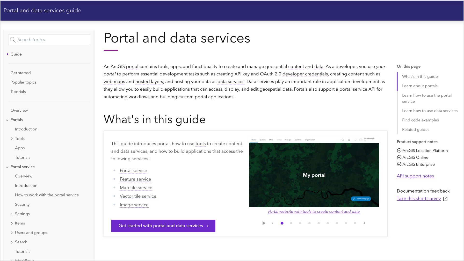
We have recently released the new Portal and data services developer guide. The guide is designed to help developers use tools and build geospatial applications. This article provides an overview of what you can expect to find in the guide including key developer topics to help you build applications with the portal tools, portal service, and data services.
New to the guide?
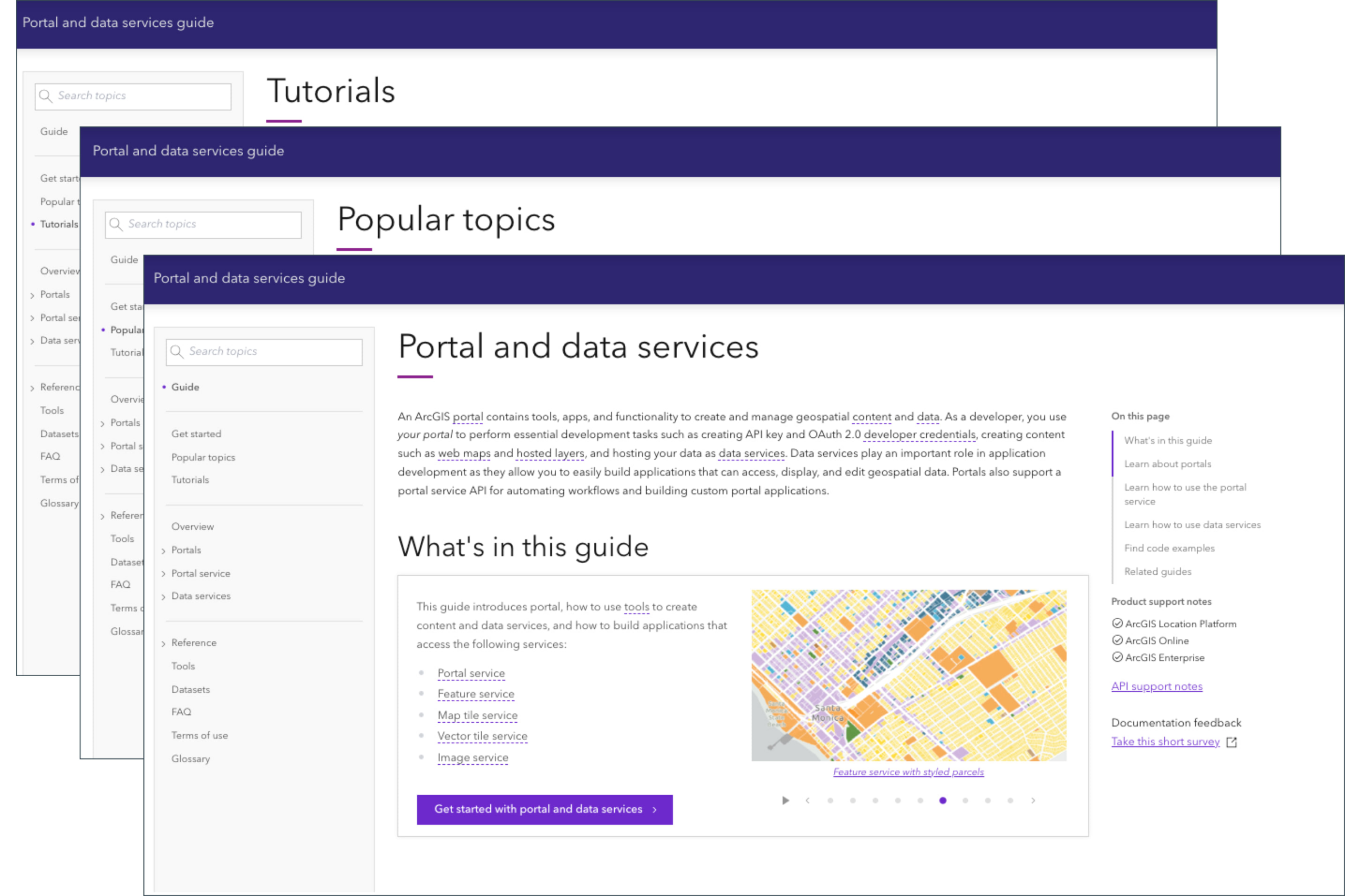
If you are new to our guide, it provides information about what a portal is, including its capabilities, the portal service (the backbone of the portal), and data services you can create with a portal. The guide contains topics, how-to’s, code examples in various APIs, and tutorials.
Introduction to portals
The portals chapter introduces ArcGIS portals and tools for developers. Portals are important because they provides a way to create, manage, and access geospatial content for your apps. If you are new to ArcGIS, this is great place to start. Here are some of the things you’ll learn:
- What is a portal
- What you can do with a portal
- Tools it provides for content and geospatial data management
- How to prepare content and data for your apps
Portal service
This chapter provides information on how to develop with the portal service. It covers what you can do with it, and the tools and functionality the service provides. It also explains how you can access and use the portal service to create content and data for your apps you are building.
Here are few topics you will learn about:
- Securely store and access your geospatial content and data.
- Create and manage users and groups.
- Set sharing levels for your content.
- Access, filter, and search your organization’s content.
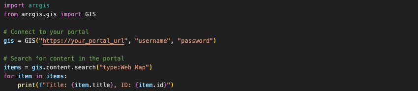
Here’s a quick example of accessing your portal using the portal service to list content.
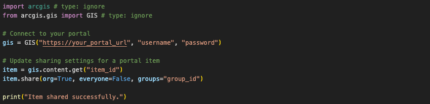
Here is another example of setting the sharing level of a content item.
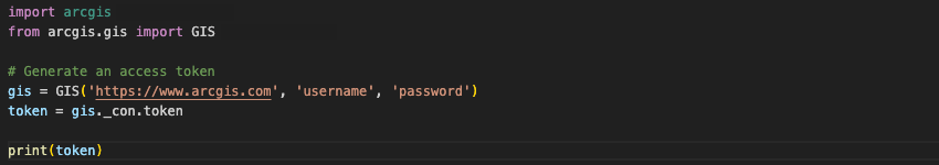
An example of generating an access token using the portal service.
Data services
The chapter show you how to create and develop with data services. Data services are important because they allow you to securely create, manage, and access your geospatial data in ArcGIS. Once your data is hosted as a data service, it can be easily access by ArcGIS Maps SDKs, open source libraries, and scripting APIs.
You will learn how to:
- Create, manage, and access data services for use in maps and apps.
- Configure and optimize feature services like creating spatial queries and caching.
- Edit and deploy vector tile services for high-performance mapping.
- Serve pre-rendered map tile services for fast and efficient map display.
- Manage and analyze raster data using image services.
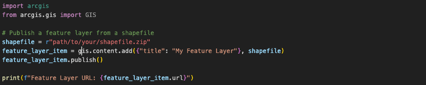
Here is an example of using ArcGIS API for Python to create a feature service and hosted layer in a portal.
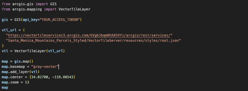
A quick example of displaying a vector tile service in ArcGIS Notebooks.
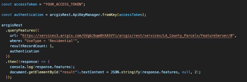
Another example of accessing and querying a hosted feature layer with a SQL where clause using ArcGIS REST JS.
Tools and applications
The guide introduces you to portal tools and applications that can use to enhance your development workflows:
- Create, organize, manage, and share your geospatial content items with content and data management tools.
- Use the Map Viewer and Scene Viewer for creating and visualizing 2D and 3D maps.
- Customize basemaps and vector tile layers using Vector Tile Style Editor to match your project’s needs.
Ready to get started
To start using the portal and data services, you can sign up for an ArcGIS account, create an access token, and make the API requests to run an operation like searching, sharing, and editing portal content.
To learn more, visit the Get started section in the developer guide.
We want your feedback!
Please take our survey to let us know if the guide was helpful and how we can improve it.


Thanks for this article. I’ll use this information for Data Analysis.
When will support for hosted tables be added? The layers work great but we have a bunch of tables in our services as well. thanks
Thanks for the feedback. Our team has started exploration into adding this capability. It’s still in the early stages, so we don’t have a timeline to share.
dougbrowning – Support is added for the hosted tables. You can now add and edit data of standalone and related tables layers hosted on ArcGIS Online and Enterprise in Excel worksheet, and seamlessly bring data from Survey123 layer in ArcGIS to Excel for reading and editing purposes.
Hello, these screenshots are for an older version of the add-in. Is it possible to update them to the newest version of the Excel add-in?
Appreciate your feedback, we updated the screenshots with the new UI screenshots, thanks.
Really liking the progress on this add-in, the ability to edit feature services in AGOL is very welcome. I just wondered if there are any plans to add enhancements such as a setting to prevent users deleting rows and an option to only sync edits with the push of a button? I’ve mentioned this add-in to some of my colleagues and their concern is that users may accidentally delete or change records en masse by accident and the changes will be automatically synced to the portal. Excel allows us to edit data much quicker but also allows for users to… Read more »
The feature layer settings include an option that prevents deletion – https://community.esri.com/t5/arcgis-enterprise-portal-questions/disable-deleting-features-while-maintaining-create/td-p/1120403