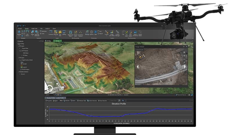
ArcGIS Drone2Map v2022.1 is now live, and we are excited to share all the new features and enhancements with you!
This release implements a new processing engine for significantly improved quality of the 3D point clouds, 3D Mesh generation as well as visual detail in the orthomosaics. There is improved definition of vegetation and manmade features, and the outputs look even more realistic. The refined processing engine based on Esri’s SURE technology also enables processing of larger projects and in many cases it is also faster. Now let’s take a deeper dive into all the features that you can expect with this software release! Be sure to also check out our What’s New page for more information.
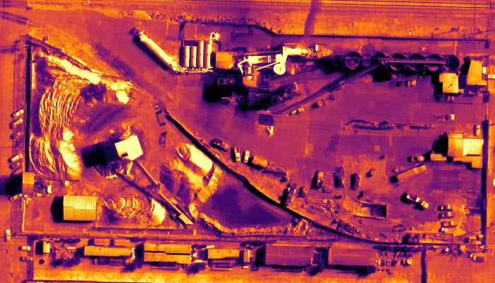
1. Thermal processing capabilities
Visualize temperature values on your map using Drone2map’s new thermal processing capabilities. For example, organizations in utilities or agriculture that use thermal infrared cameras now can create orthomosaics that depict temperature in either Celsius or Fahrenheit. Such variations in temperatures can reveal a great deal of information such as irrigation leaks in fields.
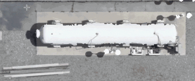
2. Redesigned multispectral camera support
Organizations working with multispectral datasets captured using cameras such as Micasense RedEdge or Altum now have tools to improve quantitative analysis of their data. Use radiometric calibration panels to create reliable imagery products across multiple dates and conditions and identify problem areas in your imagery data such as unhealthy vegetation. This feature is particularly helpful in the areas of agriculture and environmental monitoring.

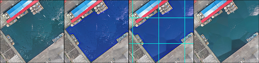
3. Pre-processing tools for quality control
For improving orthomosaic results, tools like Correction Feature and Waterbody Mask enable users to edit the DSM point clouds to improve the resulting orthomosaic tiles. Instead of recreating the entire orthomosaic, save time by just recreating the tile that falls within your area of interest.
Similarly, the Project Area tool helps constrain the processing results to the user specified area. The tool is particularly useful when working with oblique imagery or flights with low overlap where confidence in coverage at the flight boundaries may be questionable.
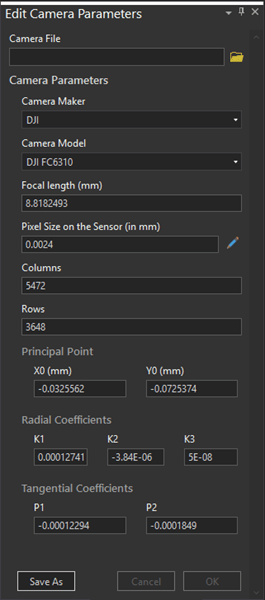
4. Redesigned Edit Camera pane
Re-use the existing parameters for a camera model that has previously been calibrated, or for a highly accurate metric camera via our redesigned Edit Camera pane. Quickly load your previously saved camera parameters without having to manually enter it for every project.
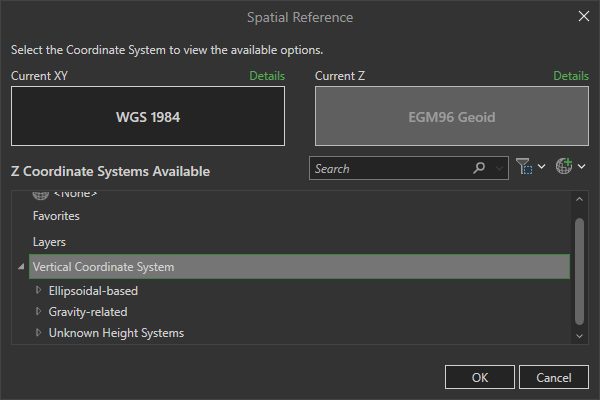
5. Improved vertical coordinate system support
The vertical coordinate system support in Drone2Map has been expanded dramatically. Users can now define accurate vertical coordinate systems, such as NAVD 88.
6. Create and share animations of your results
Drone2Map now has a built-in ability to quickly generate animated flythroughs or guided tours of your outputs, export the files in different formats and then post them on social platforms like YouTube, Instagram, and Twitter. This is a wonderful way to create and share intuitive and dynamic views of your project data with people outside your organization.

Licensing Information
Drone2Map is now available in two license levels, Standard and Advanced. The Standard version has been optimized for organizations that require fast and simple 2D products (including orthomosaics and elevation models), and the Advanced version includes all features of Standard plus the ability to create 3D products including point clouds and 3D meshes.
Note: To support these two license levels, we’ve implemented new licensing.
- Users must download the new software from My Esri and apply new licensing – existing users should find “Drone2Map Advanced” licenses in their organizational accounts (starting June 23, but note provisioning of licenses may take a few days)
- Version 2.3.x will continue to function until the end of your annual subscription. Note that users can install and run both versions if desired, but these cannot be hosted on the same computer.
If you have any questions or ideas, we’d love to hear from you! Visit the Esri Community page and let us know what you think.

Article Discussion: