The latest release of Esri’s powerful, drone mapping software is here and it delivers a lot of what you’ve asked for.
Our Drone2Map for ArcGIS 2.1 team continues its mission of bringing you the new tools, workflows, and capabilities requested by our user community.
Here are some of the new items you can expect to find in Drone2Map 2.1:
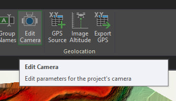
Camera Models Updates
Esri maintains an internal camera database which is updated along with Drone2Map several times per year. In addition to the internal camera database, Drone2Map also has a user camera database. With the Camera Model Editor tool, users are now able to edit existing cameras from the internal camera database and store the modified camera models in the user camera database.
This enhancement provides support for high quality metric cameras, where the photogrammetric lens parameters such as focal length, principal point, and distortion are stable and known. Drone2Map already supports consumer cameras, so that these parameters may (by default) be adjusted during processing. For metric cameras, the Camera Model Editor tool allows users to input known, high accuracy parameters when applicable and keep those values throughout processing.
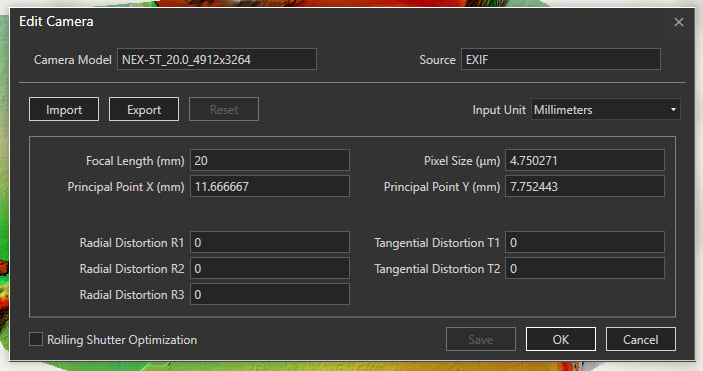
Additionally, when a successful project has been processed and you are happy with the results, the .d2mx file from that project may be imported into the camera model editor of a new project and those optimized camera parameters from the imported project will be stored in the user camera database and allow those parameters to be used in future processing jobs. This helps to standardize results and reduce processing times.
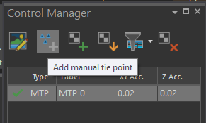
Project Control
The enhanced Control Manager pane provide users a better way to manage project control with the ability to view properties of each control point, filter based on type of control, and launch the links editor all with a few clicks. Users will now be able to create and link manual tie points to images.
Some geographic features, such as water, can be difficult to generate sufficient tie points and successfully match those tie points using automated algorithms. Now users can create and link manual tie points to images to successfully process imagery in geographic areas that previously caused issues.
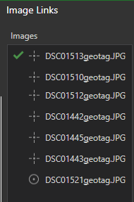
Linking control to your images can be a time-consuming process. At Drone2Map 2.1, we have introduced assisted image links. This workflow requires initial processing to be run, and after you enter one link, the software is able to automatically find your control markers in subsequent images and provide visual feedback as to the accuracy of that link. Once satisfied with the positioning of the control to the images, simply click Auto Link and Drone2Map will link the verified control for you.
Elevation Model Improvements
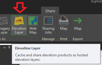
o Share DEM as Elevation Layer
Drone2Map users are now able to publish their own custom surfaces on ArcGIS Online or ArcGIS Portal for either an ortho reference DTM or top surface DSM. These surfaces can be used in 3D web scenes to ensure accurate height values for point clouds and meshes generated by Drone2Map.
o Add custom DEM into the Drone2Map project
Users may add their own elevation surface into the project (on top of the default World Terrain surface), to ensure that any 3D views incorporate the authoritative elevation surface. This can be very useful in project areas that are captured on multiple dates (e.g. agriculture) and/or where an accurate input terrain is important (e.g. an airport, construction site, or a site hosting material stockpiles).
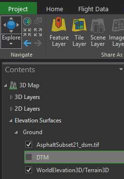
In addition, if ground control points are subsequently extracted from the map, the Z values are provided by the custom elevation surface. This is important to ensure date-to-date consistency for sites that are processed and analyzed over time.
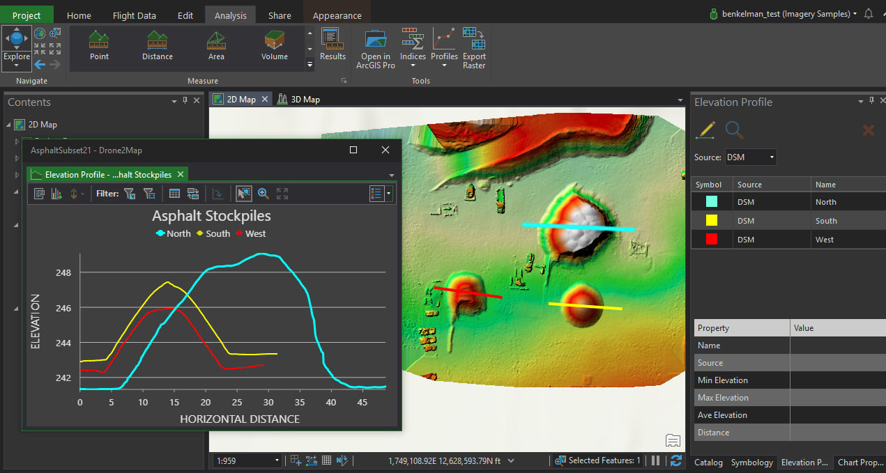
o Elevation Profile and Spectral Profile for additional analytical capabilities
Users are now able to generate cross-sectional elevation profiles in any Drone2Map projects that are processed to create output surfaces (DSM and/or DTM).
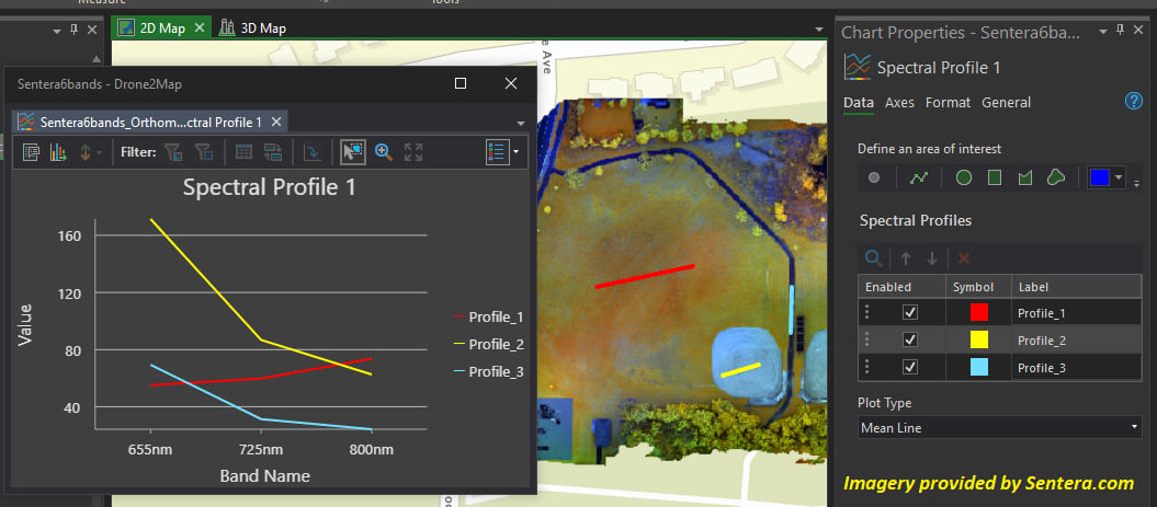
For users with multispectral cameras, Drone2Map also allows extraction of spectral profiles (defined by point samples, linear transects, or 2D areas of interest) to support detailed analysis of vegetation or other landcover surface types.
Colorized Indices improvements so that indices created from multispectral imagery products are now colorized by default.
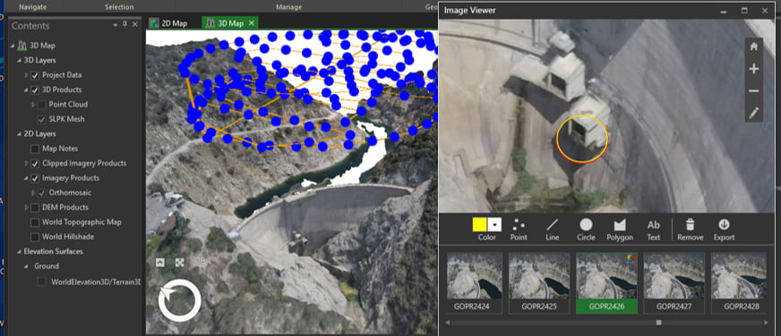
New Inspection Template
The inspection template has been added to all users who wish to create projects that are focused on inspecting, annotating, and sharing raw drone images.
Additional software enhancements have been made as well. Full release notes for Drone2Map 2.1 are available here.

Commenting is not enabled for this article.