For my father’s birthday this year, I decided to make him a…gasp…hand drawn map. I’d broken the seal on hand-drawing maps back at Christmas, when I made my sisters maps of their hometowns (Cheryl’s map, Carol’s map). What an exhilarating, sort of scary, frequently humbling, experience that turned out to be!
Dad’s map would be of the Straits of Mackinac. Where else?
Digital
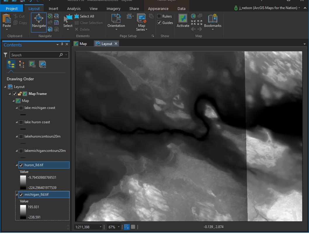
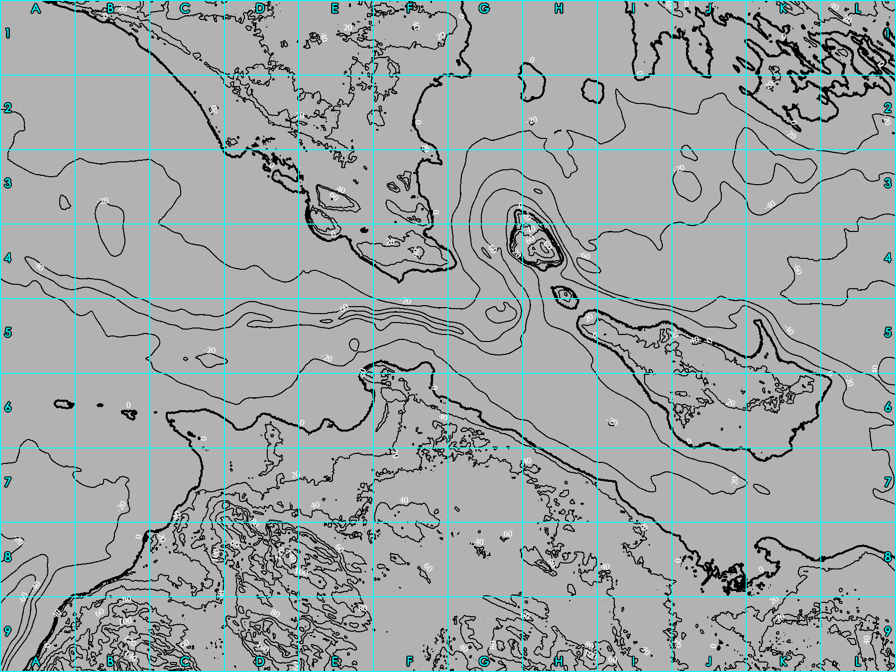
I created a reference contour map in ArcGIS Pro, to make my life much easier (as is my way). I downloaded a set of outstanding DEM geotiffs from NOAA with elevation data above and below the coastline.
Here are the DEMs of Lake Michigan and Lake Huron (the Straits of Mackinaw is/are where they come together).
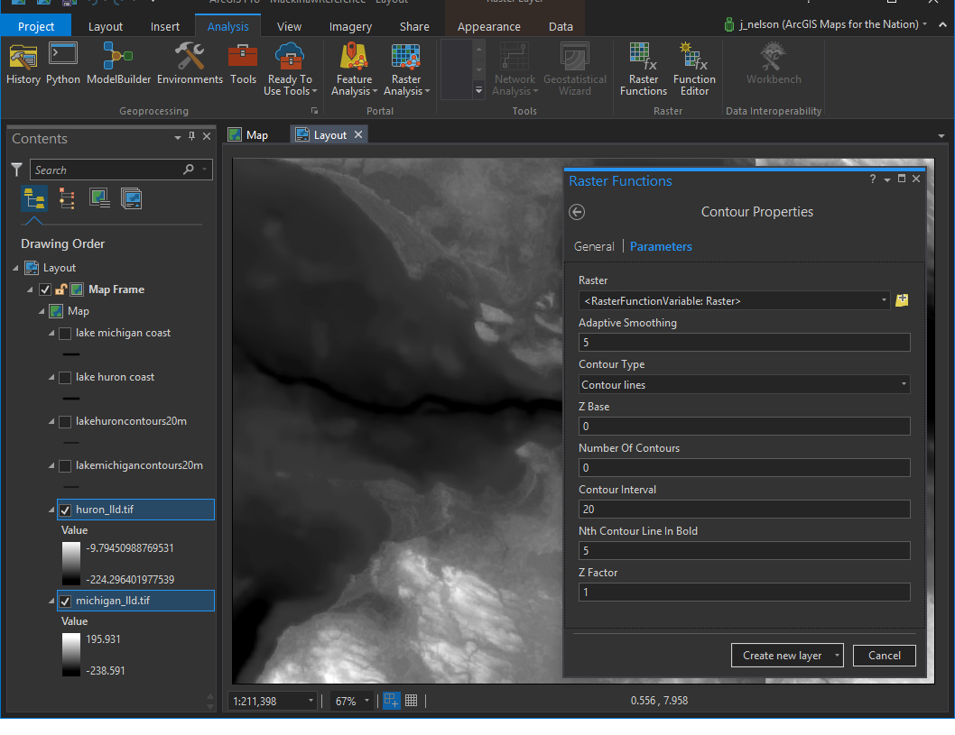
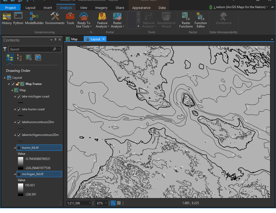
I used a glorious, almost magical, raster function to create contours, every 20 meters.
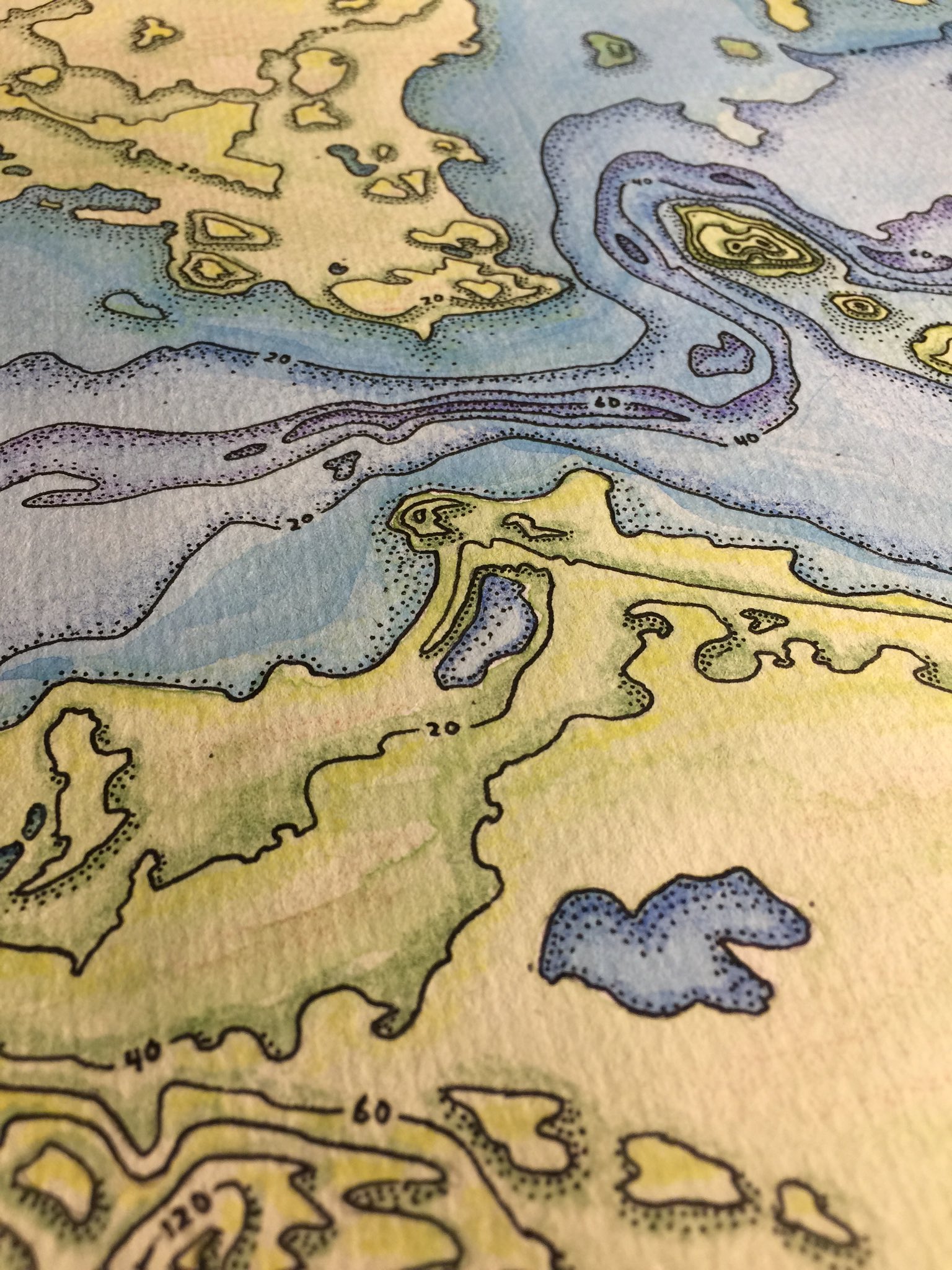
…Which gave me these bad boys…
Then I exported the image, and added a grid overlay as a reference for my manual process of transcribing mappy data from pixels to graphite. My watercolor paper is 12 inches by 9 inches. So I gridded the map to match. This is the reference image that I would look at (on my phone) while I drew…
Hand
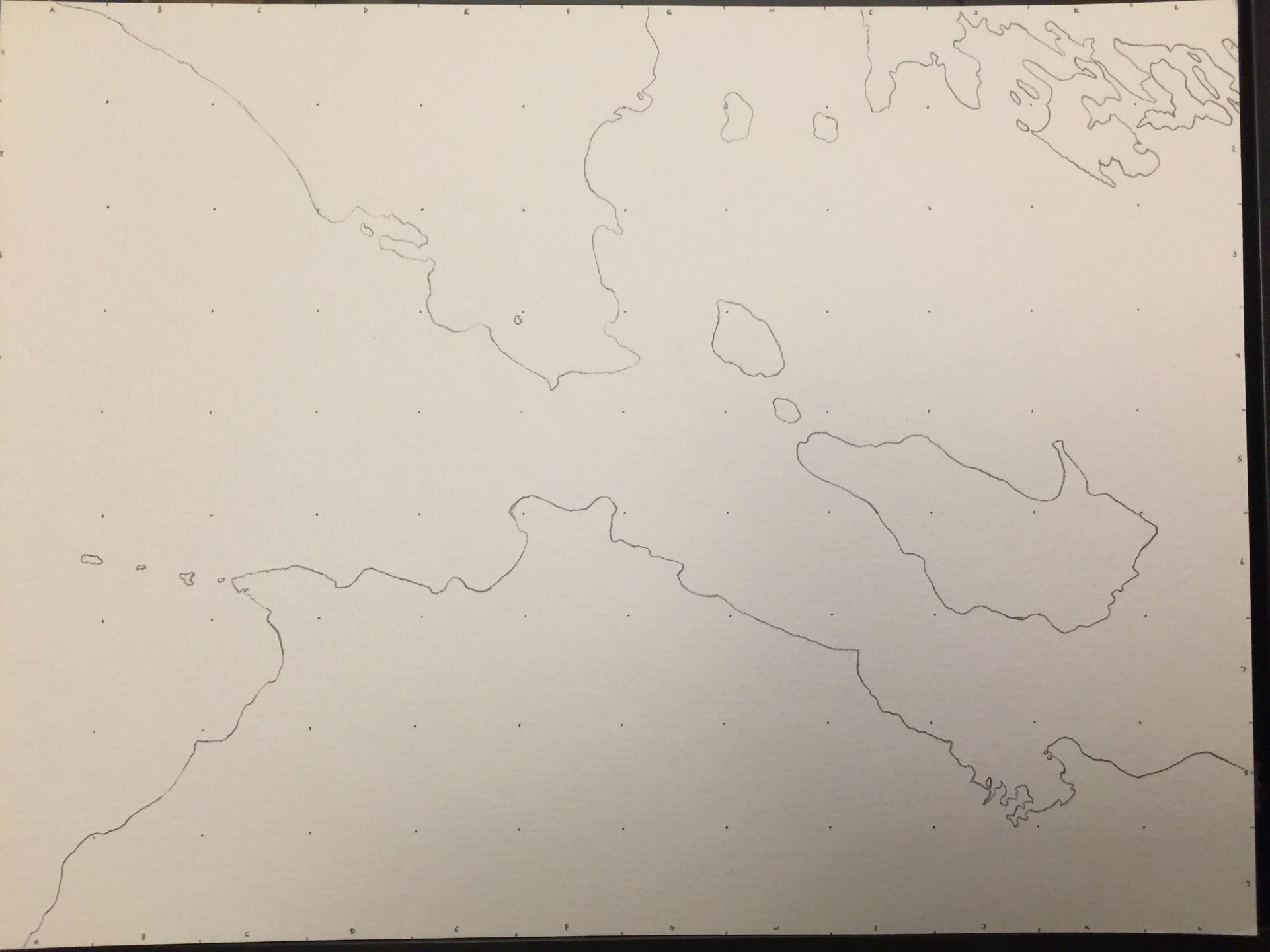
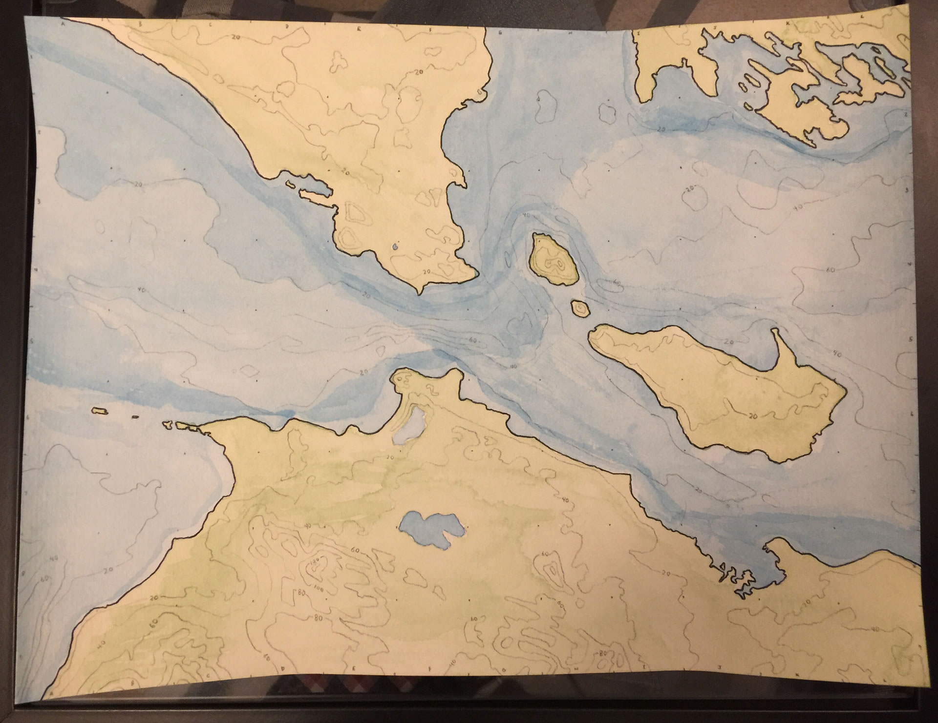
And this is the paper I drew on. On this 12×9 sheet, I drew a reference grid to match my contour map. It was actually a pretty tedious process.
Now I just needed to draw 109 little maps. It keeps the overall proportion of the map and lets me focus on little details that would be hard to keep to scale otherwise. This is a trick my middle school art teacher taught me, among other things.
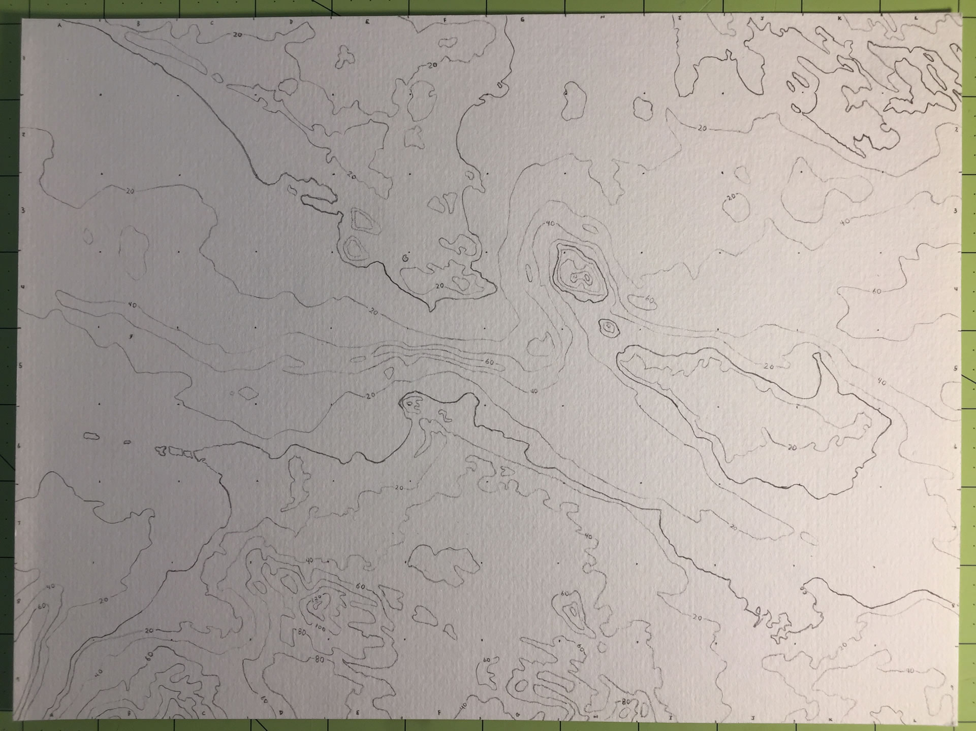
Ah watercolor. I struggle mightily with watercolor. I had watched a few YouTube videos and thought I’d nail it. Not so.
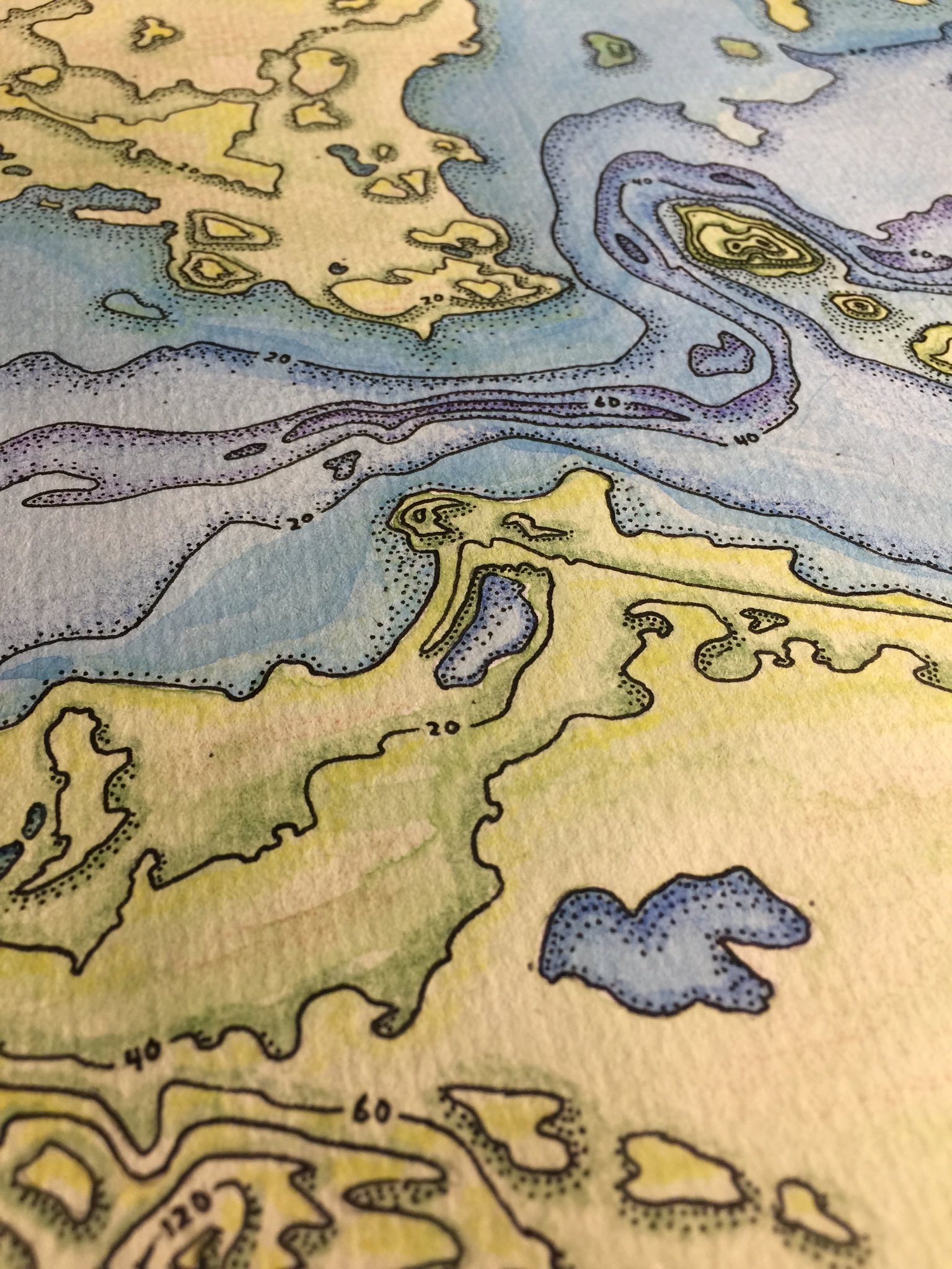
It’s ok, I’ll sauce it up with the pen. Lots of scribing…
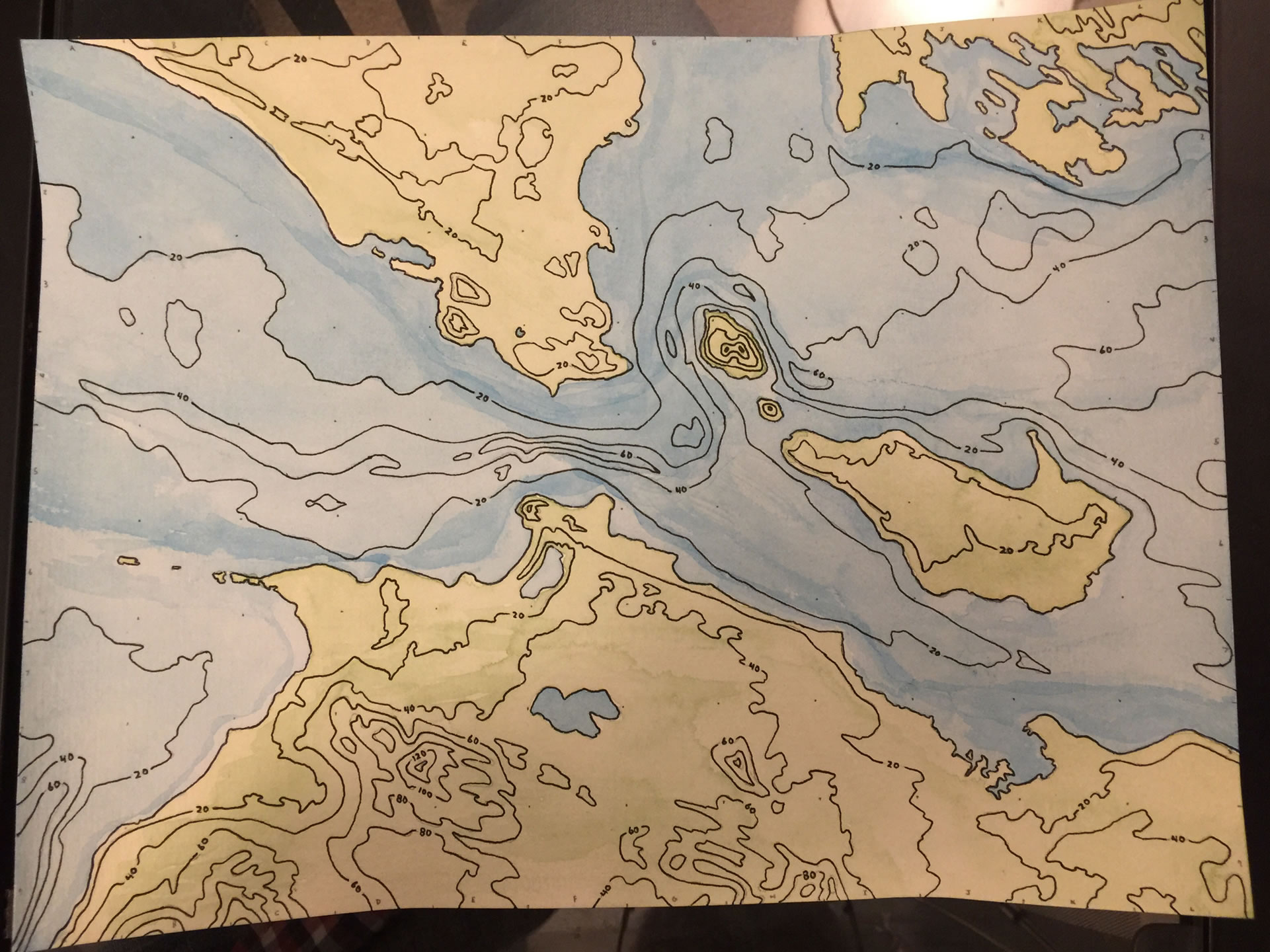
…and stippling. Plus some colored pencil around the contours to help sell the depth…
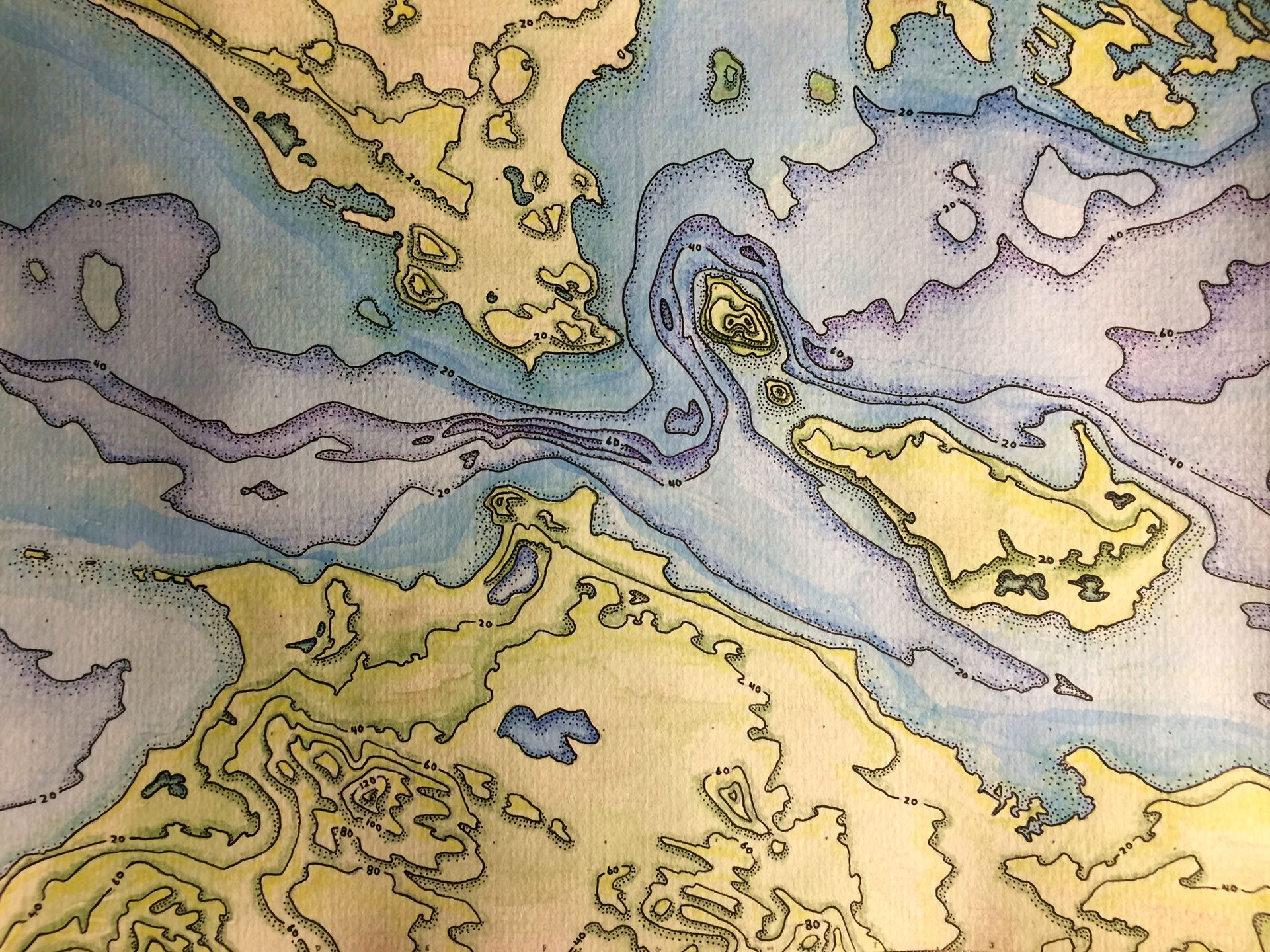
And that’s where I called it good! I think he’ll like it; I’m optimistic anyway. Like any son, I want my dad to be proud of me. On a personal level, this experience gave me an opportunity to meditate on who my father is, as I asked myself what he might appreciate in a map. And that has given me fresh appreciation for Burton Nelson. What’s more, as a father myself, it gives me added context for how I might understand, and certainly appreciate, my children’s perceptions of me, what it means to give and to receive during our short time together.
Lessons
This recent dive into hand-drawn mapping is a new one for me. I had’t actually drawn a map since I was a kid. There was a remarkable feeling that came with the process that, if I’m being honest, I sort of expected. The tangible process of using my hands to apply graphite, ink, and paint, to a sheet of actual paper brought me closer to the not just the intrinsic awesomeness of the craft of cartography, but provided a vigorous appreciation for how easily things can be styled and manipulated in the digital environment. Want to nudge the composition over a bit to the east? Forget it. Paint over a couple islands in the northern bay? Oops -scratch some green colored pencil atop.
On the other hand, creating an offset stippled shading technique was super simple (not fast though). And I reveled in the texture of the paper’s fiber and the irregularity of the graphite’s scraped strokes and the organic varied saturation of the watercolor hues. The digital environment can be so precise, and confident. I rather enjoyed the wabi-sabi of this form factor’s many imperfections. And at the end I held in my hands an actual thing.
Common to any creative process, the experience of creating a map by hand has inevitably fed into my design thinking in the digital environment. Are they really all that different? Tools are means that take us to our ends. Am I able to take the qualities that I appreciate in the manual aesthetic into the amazingly accommodating realm of ArcGIS Pro? I think so. I’ll walk through that process in the sequel to this blog post, where I circle back to the digital environment, with you along, informed by the material lessons of this hand drawing.

Article Discussion: