Updated December 8, 2017: The Esri Vector Basemaps were recently updated to a new version (v2). The best way to access them in ArcGIS Online is through the Esri owned Vector Basemaps group, which contains the latest set of web maps and tile layers. See What’s New in Esri Vector Basemaps (December 2017) for information related to this update.
—
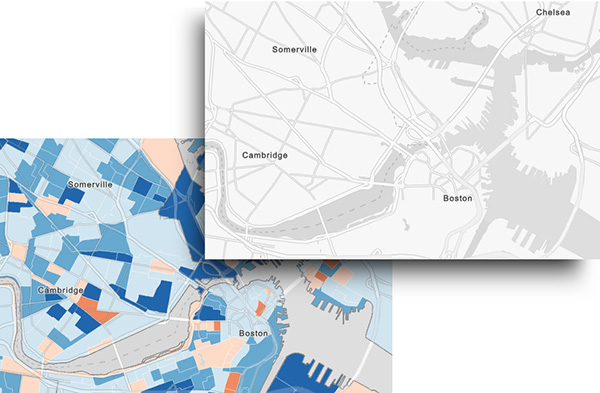
Esri just released a new sample vector basemap that is built specifically to make maps of subjects related to human geography. Just as the Topographic Basemap supports so many wonderful maps that require topography on a colorful basemap, the Human Geography Basemap is likewise tailored to make maps of human geography better.
Human geography maps include thematic maps of statistical data, demographics, etc.
Originally the map was built to support our sample story map atlases. It has similarities to the Light Gray Canvas map (it could be mistaken for it at first), but there are some very specific differences in the way that it is constructed.
Think of the map as modular. It consists of 3 separate vector tile layers, designed to work together, but available separately if you want to use them in a different context. All are grayscale.
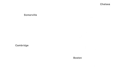
The Label Layer
This is built as a reference layer (it sits on top of your work), and includes labels for administrative areas, cities, towns and neighborhoods,and street names at larger scales. All labels have pale gray haloes to help them stand out without overpowering the other information.
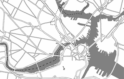
The Detail layer
This is also built as a reference layer, and includes all line and polygon features: larger water polygons, administrative boundaries, road and highways. All symbols are very dark, to allow for a significant amount of transparency, which you can apply yourself. Think of 60% as a good starting point, then adjust it to suit your particular map.
The Base layer
This is effectively a blank canvas, although the land areas are shown in a very pale gray to give it some substance.

The final structure of a typical map is this:
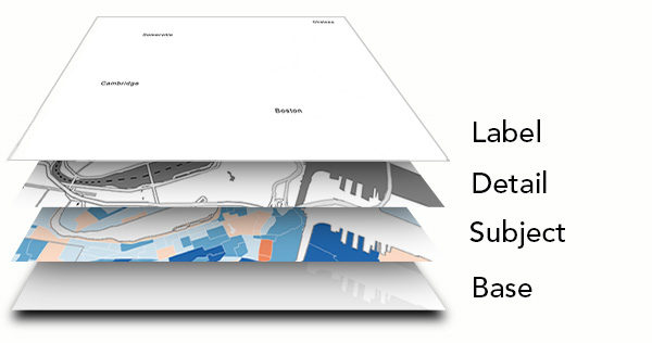
The combination of these three layers should provide the map with strong contextual detail, without upsetting the visual coherence of your information. As with all of our vector basemaps, the layers we provide are only a starting point. We would encourage you to customize them to suit your particular needs on a project.

Commenting is not enabled for this article.