ArcGIS World Geocoding is a purpose-built capability, designed specifically to work with ArcGIS software to provide high quality match rates and coverage. It provides a consistent geocoding experience across all Esri products ranging from ArcGIS Desktop, ArcGIS Enterprise to mobile applications and SDK’s.
Geocoding is the process that converts your addresses and place names into coordinates and displays them on a map. It the first step to start making sense of location information. Before data can be visualized, it must be assigned a unique spot on the Earth’s surface. It must have a location. This location is a point or position on a map that serves as the fundamental element for any geospatial analysis.
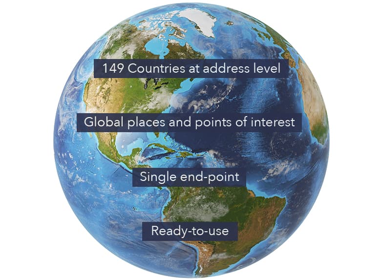
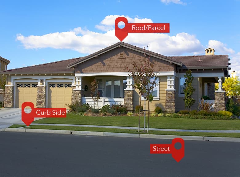
Esri offers very high quality, accurate and fast geocoding across its ArcGIS software. It offers a complete geocoding experience, you can find and display individual addresses, places, businesses, and points of interest on a map. Plus, locate multiple addresses or places at the same time using batch geocoding. Or, reverse geocode to obtain a place name or readable address from geographic coordinates. ArcGIS World Geocoding provides worldwide coverage with support for local alphabets and languages. It is built with the most-up-to-date data from authoritative sources that include community, commercial, and government providers. It is designed to provide the most precise, accurate, and reliable results as the ArcGIS World Geocoding engine looks for the best available match level from rooftop to curb side to street level.
Geocoding can benefit a wide range of applications, from simple data visualization and analysis to distribution techniques and customer management. ArcGIS software offers tremendous flexibility to use the geocoding capability. You can deploy it in the cloud, on-premises behind a firewall, or a combination of both. Use geocoding when you need it, with any ArcGIS application, on any device anywhere, anytime. For organizations collecting and managing their own asset and address data, ArcGIS enables custom locators. Developers can integrate ArcGIS World Geocoding capability into their own applications using the REST or SOAP APIs.
Let us look at all the Geocoding products that you can use with the ArcGIS software:
- ArcGIS Online World Geocoding Service: Global geocoding coverage from a ready to use cloud-based service.
- World Geocoder for ArcGIS: Global coverage deployed behind an organization’s firewall for added privacy and security benefits.
- StreetMap Premium for ArcGIS: Offers local and regional (region, country or state) level geocoding.
- Build your own geocoding: Search against your own data. Collect and manage asset and addressing data and search against them using custom built locators.
- ArcGIS for Developers: Developers can subscribe to the ArcGIS for Developer subscription and get 1,000,000 geocoding transactions for free every month.
Geocoding is a strategic requirement for companies around the globe that want to visualize data and perform analysis to make key decisions to obtain a competitive edge in the market place.
To read more about ArcGIS World Geocoding, please visit the website.
Commenting is not enabled for this article.