
GIS has expanded from primarily mapping outdoor spaces to include indoor spaces as well. College campuses, shopping malls and airports are some of the places we see indoor maps every day. The ArcGIS Indoors Information Model supports the management of indoor datasets by standardizing data to represent different sites, facilities, and levels. These datasets are shared throughout the ArcGIS System as web/mobile maps and scenes. Now, an exciting new Toolkit tool, Floor Filter, has been added to allow users to navigate floor aware maps and scenes.
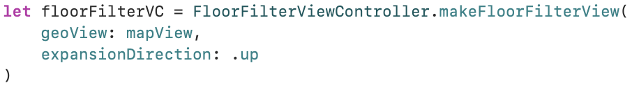
Floor Filter uses the data contained in a map or scene’s Floor Manager via the Runtime API. Developers can quickly add this tool to mapping projects with only a few lines of code. The snippet below illustrates how easy it is to integrate the Floor Filter using Swift in an iOS project (full sample here). Other Toolkit platforms follow a similar paradigm.
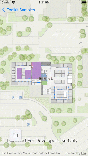
Floor Filter is available now for all ArcGIS Runtime SDK Toolkit platforms using version 100.14.0+.

Article Discussion: