Mobile GIS capabilities have grown significantly over the last 10 years, with ArcGIS Field Maps being a large part of that growth. Whether it’s supporting sophisticated, form-based data collection or high-accuracy GPS positioning, Field Maps has evolved with the growing needs of the mobile workforce. Yet, mobile GIS has historically been confined to outdoor locations—outside of the facilities you work in and around every day. With the more recent releases of Field Maps, I’m happy to say that we can start to broaden where mobile workflows take place. After a couple of key enhancements, Field Maps can now support indoor workflows.
In the 21.4 release, Field Maps started to support floor-aware maps, introducing the Floor tool that empowered mobile workers to change which floor was visible in the map. This allowed mobile workers to filter which floor they were viewing, seeing only the floor plan and features on that specific floor. This instantly enabled Field Maps to adapt to more nuanced indoor data models and offer greater operational awareness when working indoors.
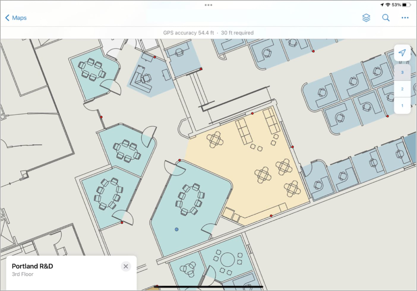
With the 22.2 release in June, Field Maps added support for indoor positioning systems or IPS. At its simplest, if you take the time to survey your facilities, the indoor position in Field Maps will be drastically improved. Placing the “blue dot” exactly in the hall or room you’re currently standing in.
At our current 22.4 release, we made other tools and capabilities in Field Maps “floor-aware.” For example, editing is a very popular capability of Field Maps. Now, if the map you are editing is floor-aware, floor information will be stored with new features when they are captured. This includes a streamlined experience for changing the floor attribute when editing existing features.
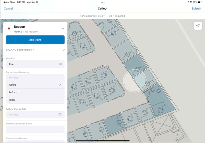
Other capabilities of the app, like geofences and location sharing are also now floor-aware at this release. This ensures, for example, that mobile workers will only get notified by a geofence when they are on the specific section of the floor that the geofence was authored to be on. Location sharing has also been improved to store floor information—not only will the X and Y location of a mobile worker be recorded, but also the floor that the mobile worker is on when they share their location.
Bringing Field Maps indoors reflects our desire to expand mobile workflows, allowing all the capabilities of the application to work wherever you work.
How does one Disable http or have http redirect to https with WABde?
Web AppBuilder Developer Edition inherits these settings from the portal it is associated with. To achieve the desired affect you’ll need to disable HTTP in your portal settings. Here is a help link that describes that process for an ArcGIS Enterprise portal – https://enterprise.arcgis.com/en/portal/latest/administer/windows/configure-https.htm. It is a similar process in ArcGIS Online (if the option exists in your Organization…depending on a few factors it may not be there as all new Organizations are HTTPS only at this point).
Hi Craig, I noticed I am not able to reply. the Blog returns a ‘sorry , that user name already exists!‘ when I try to sign in. I am using one of our support accounts instead. Our portal is already ‘https only’ enabled and yes, a redirect occurs when first hitting the 3344 port where WABde resides – against the portal chosen, however, one can modify the URI from https to http in the browser, hit enter and WABde loads non SSL (not secure) and does not redirect at this moment: [uri] :3344/webappbuilder/?action=setportalurl. Though if one continues signing into the… Read more »
Hi Michael, I believe I’m following what you’re saying and can replicate the behavior on this end. I’ll inquire with the core development team as to whether there’s an alternative solution to this (i.e. to completely disable HTTP) and post the response here if there is. In the meantime I’d encourage you to open a tech support incident on this subject as well.
testing an error when posting comment to the blog
I…am so lost. Just to install OpenSSL it appears I also need Perl, among other things?
Hi Ingrid, I’m not intimately familiar with the prerequisites for openssl. I have never been prompted for Perl, but that may simply mean it already exists on my machine. In doing some quick research you may want to look into using an installer like this – https://www.ssl.com/how-to/install-openssl-on-windows-with-cygwin/. It appears you’d be able to install the Perl prerequisites along with openssl. Alternatively it might be a good idea to work with your IT department to help you get what you need.
The directions in this blog post didn’t work for me, I think is was something funky with the files created in openssl as I already had a signed CA Cert. The directions in an ESRI technical support article named “How To: Use a CA-signed SSL certificate for Web AppBuilder for ArcGIS (Developer Edition)” allowed me to get the WAB Dev Edition secured . Search for it if you get stuck, here’s the current link. https://support.esri.com/en/technical-article/000014185