The November 2024 update for ArcGIS Survey123 brings a host of exciting features to enhance your survey design and user experience. From creating your survey forms to working with the Suvery123 mobile and web apps, this release offers increased flexibility and efficiency.
Updates in this release include:
- Grid layout support in the Survey123 web app
- Enhanced Language Support in Translation Assistant (Beta)
- The new signIn URL parameter allows sign-in for public surveys
- ArcGIS organization setting to enable Survey123 AI assistants
- New persistent offline default map in the Survey123 mobile app
Grid layout support in the Survey123 web app
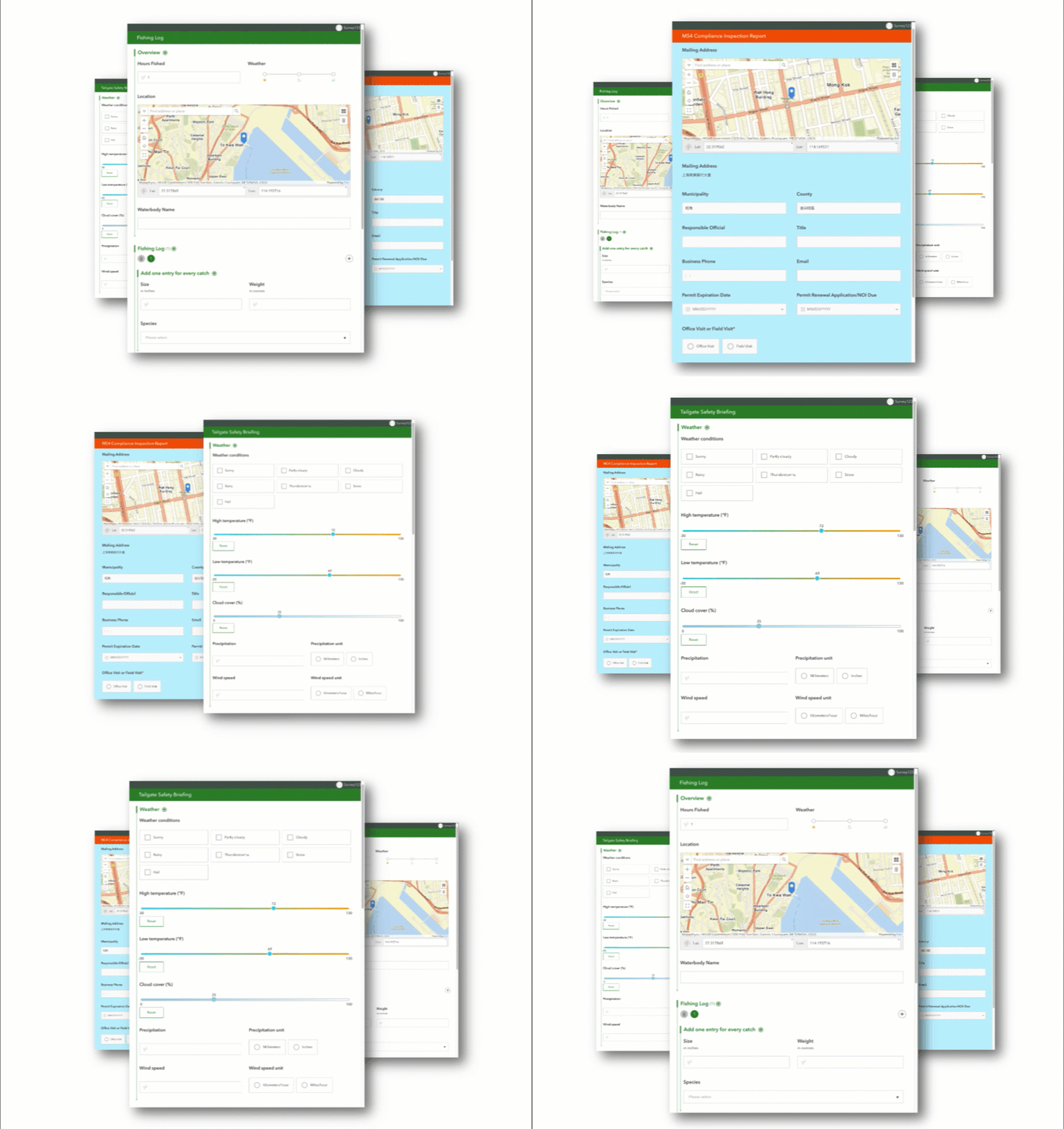
Grid layouts are an excellent way to customize your forms created ArcGIS Survey123 Connect. By grouping questions together and arranging them side by side, grid layouts increase flexibility in your survey designs. This feature not only makes your digital forms visually appealing but also mimics the familiar look of traditional paper forms. Additionally, grid layouts can significantly reduce scrolling, enhancing the overall user experience when completing surveys.
Previously, grid layouts were exclusively available in the Survey123 mobile app. Our users have enthusiastically embraced this feature, frequently requesting its inclusion in the Survey123 web app. We are excited to announce that with this release of Survey123, grid layouts created in Survey123 Connect are now fully supported in the web app. This enhancement empowers you to design more flexible and visually engaging surveys for web sharing.
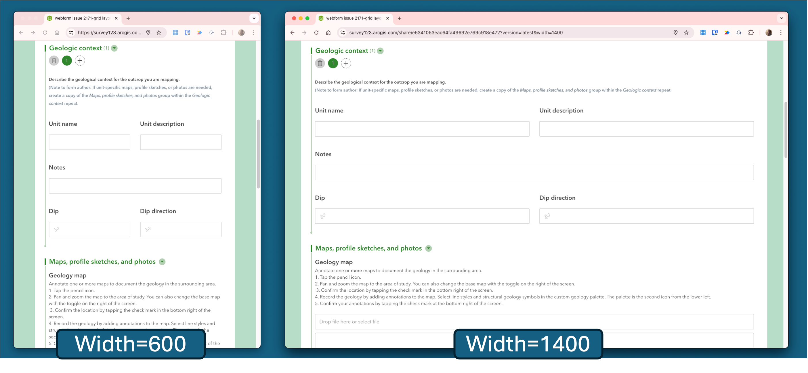
In addition to grid layouts, we’ve introduced the “width” parameter, allowing you to control the width of your form. For example, you can now design forms that make the most of widescreen monitors, providing an optimized viewing experience.
To adjust the form width as needed, you can use the ?width= parameter.
Enhanced Language Support in Translation Assistant (Beta)
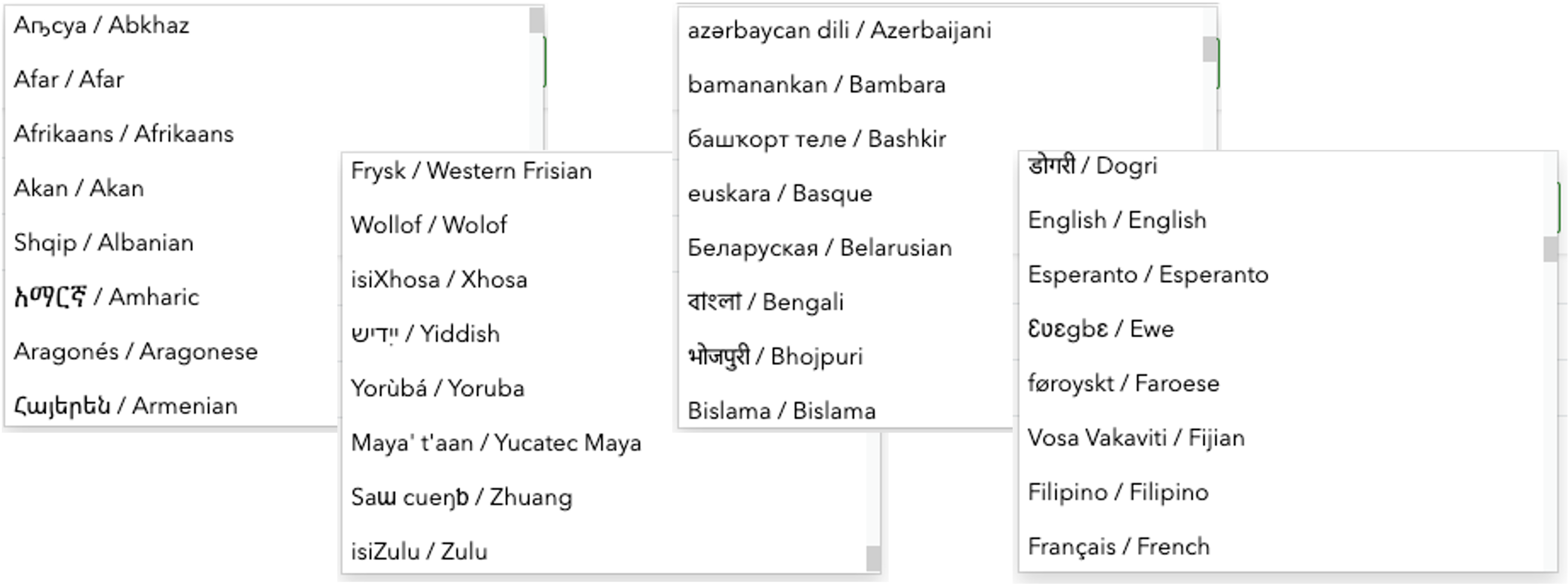
We are excited to announce that the web designer now supports a wider range of languages for translating your survey designs. The translation assistant (beta) feature enables a survey designer to effortlessly translate question labels, choices, hints, and all text within your form into another languages using advanced machine translation. This feature has been implemented with strict adherence to privacy and security guidelines, ensuring that no data is ever shared with third parties.
The translation service previously supported over 42 languages. With this release, we are thrilled to announce support for over 100 languages! Currently utilizing the Microsoft AI Translator, please refer to the detailed table for a complete list of supported languages.
New Sign-In URL Parameter for Public Surveys
The Survey123 web app now includes a new signIn URL parameter that facilitates sign-in for public surveys. By default, the web app does not offer a sign-in option for public surveys. However, some features, such as the ability to extract a signed-in user’s email address through calculations, require user authentication. With the new signIn URL (signIn=show) parameter, you can easily display a sign-in button in the navigation bar at the top of the web app. By adding the required option (signIn=required), users will be guided to sign in with a redirect to the sign-in page. This enhancement provides greater flexibility for distributing public surveys while enabling access to features that are available only to signed-in users.

ArcGIS organization setting to enable Survey123 AI assistants
This past year we have brought new AI assistants (beta) to Survey123, to enhance survey design and functionality in several ways:
- Use a chat conversation to assist in designing surveys within the web designer.
- Extract valuable information from images directly in the web app.
- Translate survey designs seamlessly in both the web designer and Connect.
The Survey123 AI assistants utilize advanced large language model (LLM) and machine learning technologies, specifically leveraging the Microsoft Azure OpenAI service for the assistant and the Microsoft Azure AI Translator Service for translation tasks. Rest assured, these assistants adhere to data security and privacy guidelines established by ArcGIS Online.
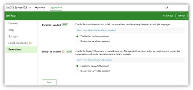
In the latest release of Survey123 and ArcGIS Online, these capabilities are disabled by default and can only be activated by an organization administrator who opts in. To find this setting the ArcGIS organizaiton administrator needs to navigate to Organization | Settings | AI Assistants.
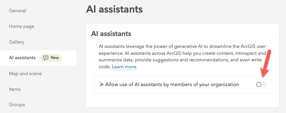
In addition to the ArcGIS Online AI organizational settings, an administrator can still manage individual capabilities on the Survey123 website | Organization tab | Extensions tab.
New persistent offline default map in the Survey123 mobile app
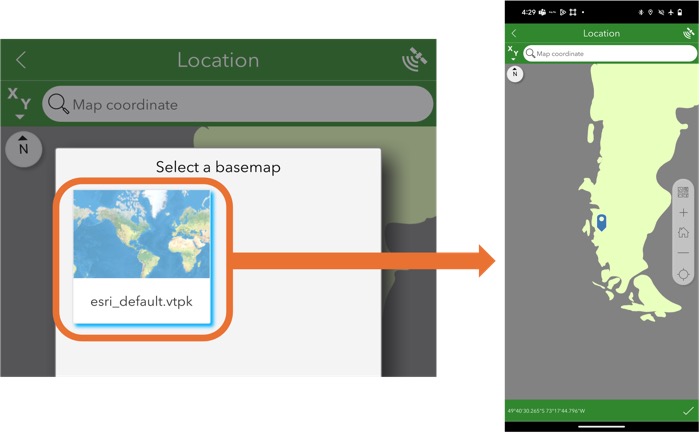
The Survey123 mobile app now includes a new persistent offline default map, designed to enhance your experience when working without an internet connection while capturing geographic feature data. The new offline provides a simple reference map of the entire world. This map is stored as a vector tile package (VTPK), ensuring it occupies minimal disk space while providing valuable context for your data collection efforts.
Other fixes and improvements include the following:
Survey123 field app
- Reliability has been improved when sending location sharing records.
- Fix for issues:
- Calculation mode parameter value of always did not work as expected for date questions.
- Choices with date labels did not display the date in the expected format.
- Location could not be captured in surveys that were opened from the Drafts folder.
Survey123 Connect
- Fixed issue which surveys could not be updated if they had been moved out of the folder they were published to.
- Support was added for querying the submission URL with the pulldata(“@property”) function.
Survey123 website and web app
- Summary information for Location list questions is now shown on the Analyze page.
- The survey footer can include images and formatted text, including links.
- When there is no map question or no geometry values in the survey, the overview map is collapsed by default on the Data page.
- A warning message is displayed when the ArcGIS organization is in read-only mode.
- When printing a report, the report template file name is used to name generated reports instead of the survey name.
- A bug was fixed in which reports would fail when the template included a map and the web map contained a large amount of data.
- The Survey123 assistant (beta) better distinguishes between an existing survey design that is being modified and a new survey that is being created.
- Video files added to a File upload question can be previewed.
Other enhancements and bug fixes – Website, web app and report service
- ENH-000141114 Allow for including images in a Survey123 form built using the web designer without requiring the images be shared with Everyone
- BUG-000170893 When using a hosted feature layer from ArcGIS Online as the source for a drop-down question in the ArcGIS Survey123 web designer, the drop-down list is not populated in the ArcGIS Survey123 field app
- BUG-000147659 The stakeholder or results view layer created from the ArcGIS Survey123 Collaborate tab generates a duplicate table in ArcGIS Online if the survey uses a hosted table
- BUG-000170825 When the results view layer created from the ArcGIS Survey123 Collaborate tab generates a duplicate table in ArcGIS Online, the survey’s Analyze tab either gets “Cannot get necessary XForms file for the survey” or loads indefinitely if we access the Analyze tab with a non-admin & non-owner account
- DE-000007576 BUG-000134099 ArcGIS Survey123 website does not load the survey when the user owns more than a certain number of Access and update capability groups
- BUG-000144878 When generating a feature report from the ArcGIS Survey123 web app, the report fails when the template includes a map question and the web map contains large datasets
- DE-000003744 ENH-000130822 Make the grid theme available in Survey123 when submitting responses through a web browser
ENH-000155146 Provide the functionality to play a video in Survey123 web form after is selected in a file question
Article Discussion: