ArcGIS Excalibur is a focused web-based imagery analysis application for working with imagery, video, and maps. It offers a simplified search and discovery experience, making it easy to publish and access imagery. You can create mark ups and measurements, count objects, detect changes, and apply image enhancements with built-in analysis tools and ready-to-use workflows, all in one place. Share your results as reports or dashboards with others to support informed decision-making.
Previously only offered within ArcGIS Enterprise, we are happy to announce that ArcGIS Excalibur is now available as a beta in ArcGIS Online, with a full public release planned in the upcoming months!
Included in the ArcGIS Excalibur beta release within ArcGIS Online:
- Deep learning integration
- Identify changes in imagery
- Imagery clip tool
- Batch chipping with the Chip Observations tool
Deep learning integration
Leverage a curated set of out-of-the-box Object Detection and Pixel Classification models in your Excalibur projects to automate the way you extract meaningful insights from imagery. These models can be applied to imagery layers, generating output layers that are available for further analysis and QA/QC workflows.
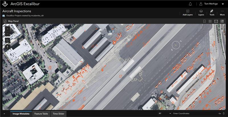
Identify changes in imagery
Gain the ability to detect changes in imagery with visual or calculated comparisons in Excalibur effortlessly. The Detect Change tool allows you to quickly perform automated client-side pixel-based comparisons between two images. As an addition to manually comparing two images of the same location taken at different times, you can now simply select images from the image metadata table, and the tool will automatically analyze and highlight any changes between two images.
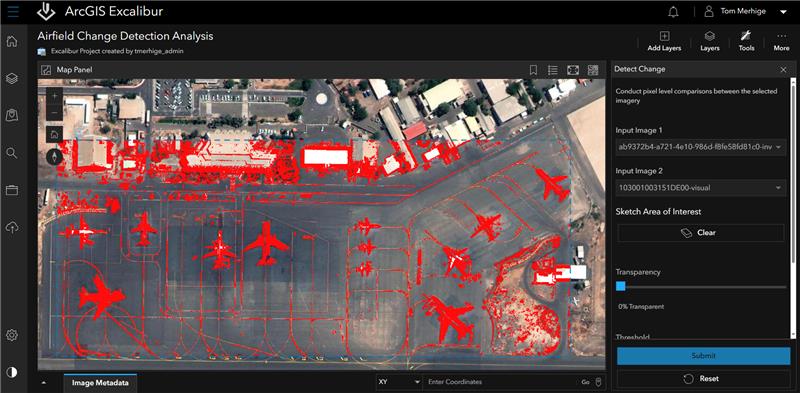
The Detect Change tool can be used in a wide range of applications, from identifying changes in activity to monitoring urban development. It makes it easier to detect if objects have been moved, are missing, or require attention. For example, if you are a city planner evaluating land use changes over time, using the Detect Change tool along with other comparison tools in ArcGIS Excalibur will help you effectively pinpoint alterations in land cover or new developments.
Imagery clip tool
Easily clip imagery using the Clip raster function. This tool lets you extract specific portions of a raster dataset, creating a new raster layer that focuses exclusively on the selected area. The Clip raster function is extremely helpful for handling large imagery layers, as it helps you focus on the relevant area and significantly cuts down on image size. By incorporating this feature into your workflow, you can significantly enhance your analysis capabilities and streamline your imagery processing.
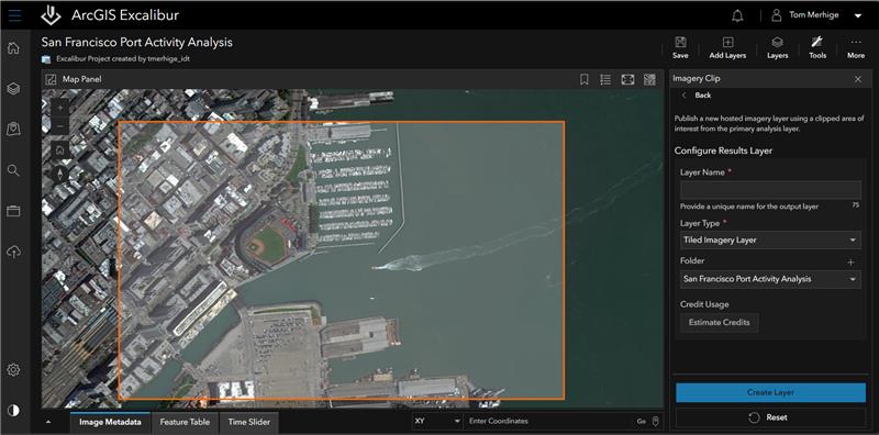
Batch chipping with the Chip Observations tool
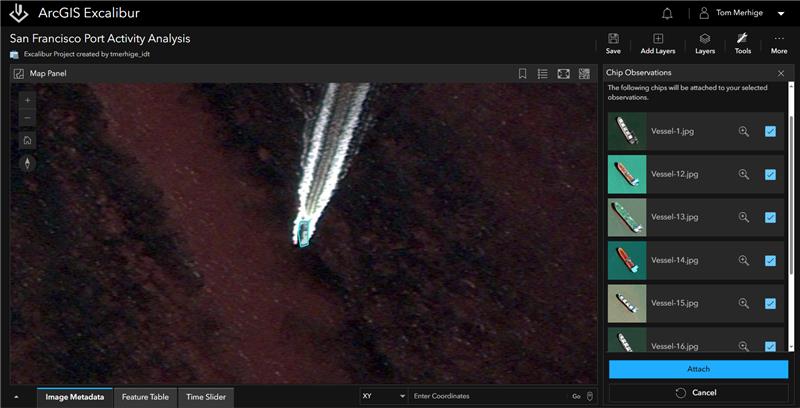
Create image chips for a single observation or multiple observations through a streamlined workflow—now with the Chip Observations tool. This enhancement automatically calculates and attaches image chips for all selected observations based on your area of interest. Batch chipping provides a visual context for observations, allowing you to see just the portion of the image that the observation was originally collected on.
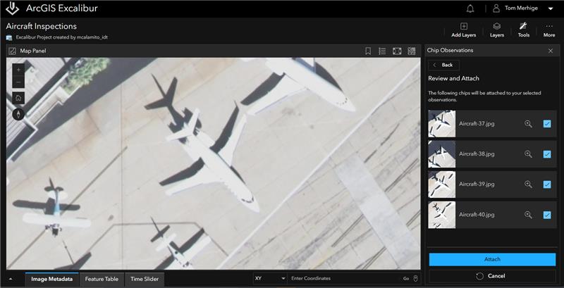
These image chips can offer enhanced context for inspections, allowing for deeper insights into the subjects being analyzed. For example, if you are a logistics manager that is tracking the activity or movement of vessels, using the Chip Observations tool will help you effectively identify specific details, such as alphanumeric codes or unique vessel names. This targeted visual information enables you to efficiently focus on the characteristics that matter most to your operations.
Join the ArcGIS Excalibur Early Adopter Program
For more information on how you can get access to ArcGIS Excalibur within ArcGIS Online, visit the Early Adopter Program (EAC): ArcGIS Excalibur page.
Early Adopter Community (EAC) – a place for you to share your experiences with Esri development teams and gain access to additional resources, such as a getting started tutorial, FAQs, and updates on features and functionalities.
Stay in the Known
We’re excited to introduce these enhancements in ArcGIS Excalibur beta, now in ArcGIS Online, to you! To stay up-to-date on product news, sign up for our newsletter on the ArcGIS Excalibur webpage or visit Esri Community page to ask questions or leave feedback.


Article Discussion: