One of the most common issues that seem to plague our users, is their raster data displaying as a black rectangle. This is especially problematic for data that is 16-bit or 32-bit.
Here is an over simplified flowchart to help you take the first steps in solving your black rectangle problem.
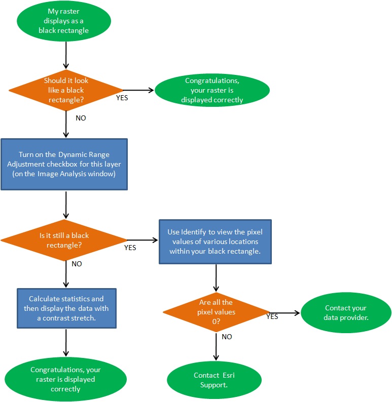
Hopefully this helped you solve your issue, or at least steered you in the right direction. ArcGIS can only render your data based on the pixel values of your dataset. If all your pixel values are zero (or near zero) then it will render it as such.

Commenting is not enabled for this article.