We are delighted to introduce our first release for 2024, brimming with enhancements crafted to enrich your 3D web experience. This milestone update brings a host of significant features, including support for 3D tiles, the capability to edit integrated mesh, adjustable refresh intervals, and expanded editing functionalities, alongside several other refinements. The feature updates and enhancements described in this blog post apply to both Scene Viewer on ArcGIS Online and ArcGIS Enterprise.
Powerful support of mesh layers
Support 3D Tiles
You can now integrate 3D Tiles integrated mesh layers into your scenes. Like the existing Integrated mesh scene layer, a 3D Tiles integrated mesh layer can represent built and natural environments through realistic textures and elevation information and be used in combination with other geospatial content.
3D Tiles are an OGC standard used to visualize large amounts of 3D content, similar to Indexed Scene Layer (I3S) specification scene layers. 3D Tiles can be of type integrated mesh or 3D object data. This release of Scene Viewer focuses on integrated mesh support, with more data types slated for future updates. You can publish a 3D tiles layer from a 3D tiles package (.3tz) that you add to ArcGIS Online. After you published it, you can add the layer in Scene Viewer and combine it with all other supported layer types. Explore further insights into i3s and 3D Tiles through this blog post.
Modify Integrated Mesh Scene Layers
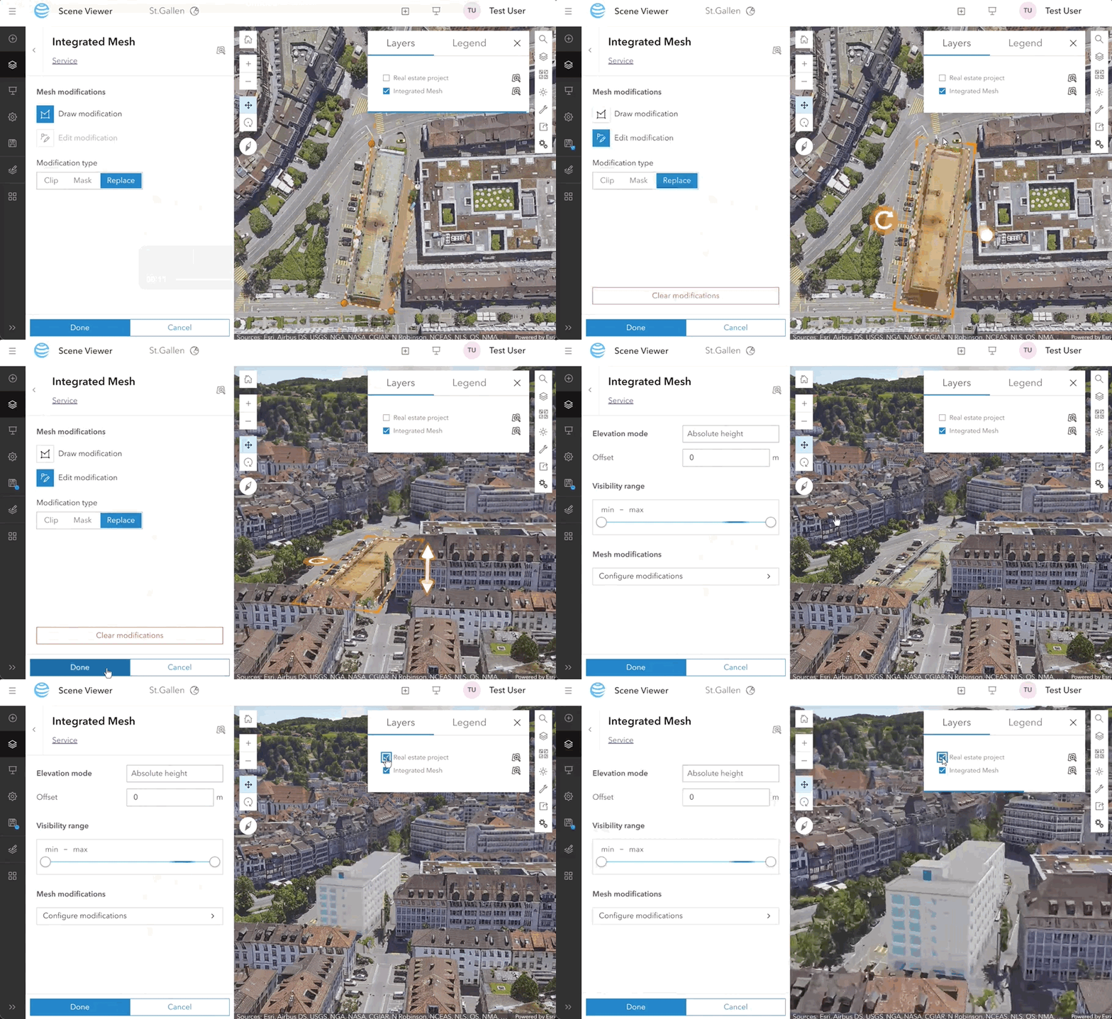
The already existing Integrated mesh scene layers can now be modified directly within Scene Viewer. This allows you to tailor your data with precision. Cut holes, flatten or clip areas in your data to better mix and match it with other layers. We plan to also support modifications of 3D Tiles integrated mesh layers in the near future.

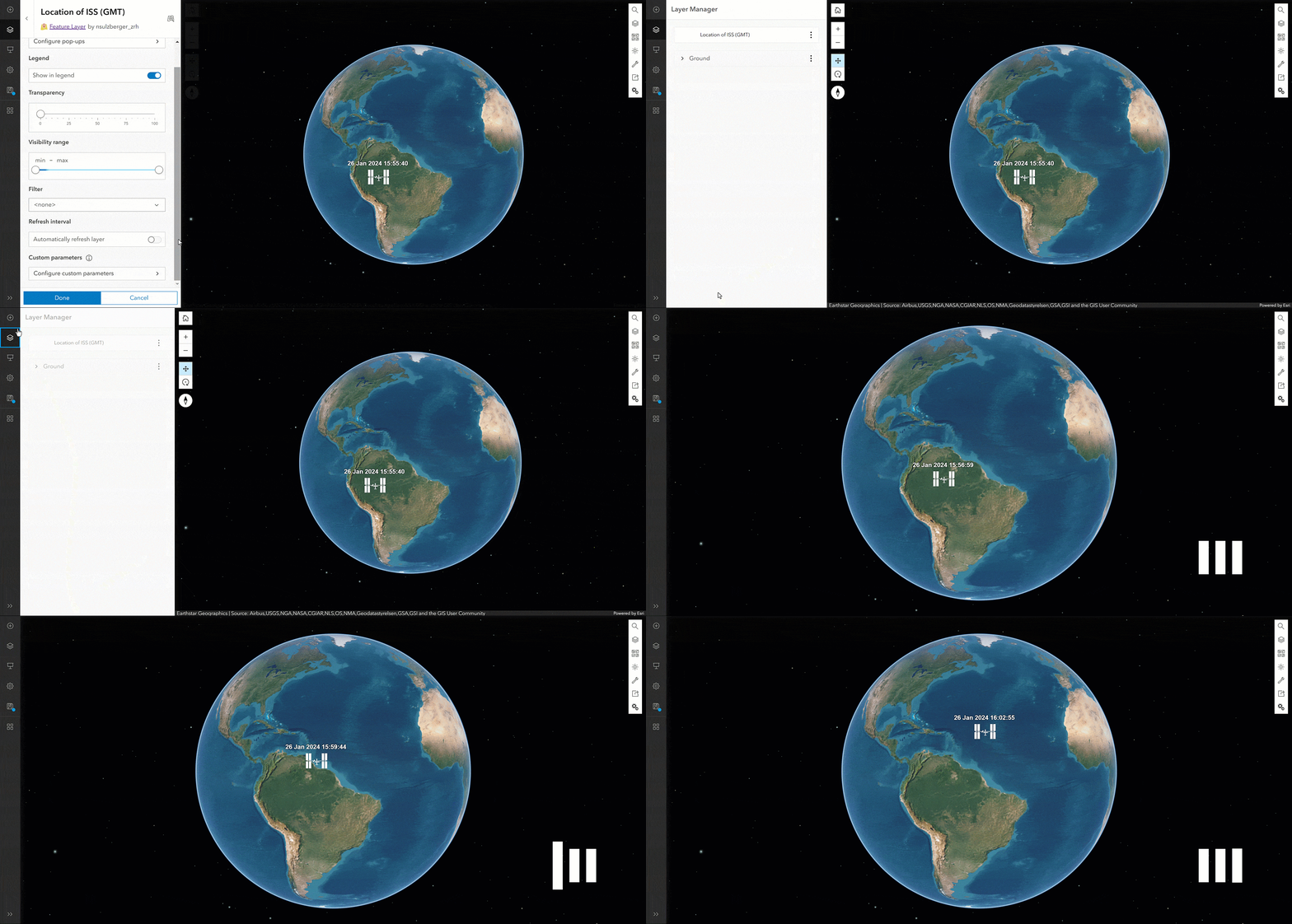
Uncover insights over time

And more
Editing capabilities in 3D
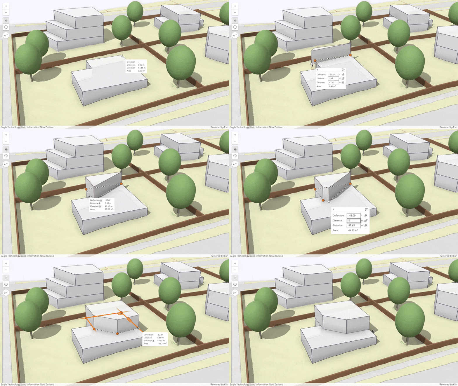
Make editing more precise and concise by using editing constraints. While creating features, you can control the lengths of segments and the angles between them, and elevations of points and vertices. To set the editing constraints, turn tooltips on and press Tab to enter the values.

3D Basemap out of beta
3D Basemap was introduced as a beta feature in previous release, you can select 3D Basemap in Basemap Gallery and now it’s formally out of beta.
Ease of Use
We’ve also made significant improvements to usability including below enhancements.
- – Apply a visibility range to voxel scene layers.
- – You can now add custom request parameters to all scene layers.
- – We increased the contrast of the user interface following WCAG criteria to improve the accessibility of Scene Viewer.
We hope you enjoy exploring these new features as much as we’ve enjoyed bringing them to life. Stay tuned for more exciting updates in the pipeline!

Article Discussion: