When ArcGIS Notebooks, Esri’s spatially optimized Jupyter notebook experience, was introduced in public beta in ArcGIS Online earlier this year, we saw over 2,000 users from across 1,800 organizations try it out. Users created more than 10,000 notebooks for the purpose of GIS administration, content management, spatial analysis, data science, and more.
But one use-case that stood out as a prime example of how ArcGIS Notebooks can be leveraged, was within the higher education community. Gregory Brunner, an adjunct professor at Saint Louis University (SLU), used ArcGIS Notebooks in his classroom to introduce the seemingly daunting concepts of programming and mapping to students.
Having been an adjunct professor at SLU for a few years, Greg had the opportunity of defining coursework for a number of GIS programming and remote sensing classes.
Reformat a class in 3…2…1
During the spring 2020 semester, Greg was teaching an ‘Intro to Programming for GIS and Remote Sensing’ course in a designated lab space on the SLU campus, leveraging technology like ArcGIS Pro and Jupyter. However, during spring break, in-person classes were suspended due to the COVID-19 pandemic and instructors were given a week to completely restructure their coursework to transition classes to online. Greg had a unique challenge trying to reformat an in-person class that was typically taught within a lab into one that could be effectively taught via Zoom meetings.

Adapting to the new normal
In order to pivot his teaching methods, Greg decided to first modify his curriculum. He shifted to teaching more non-GIS related Python packages – packages like matplotlib, pandas and NumPy – so that students were exposed to Python concepts and fundamentals outside of GIS for a more comprehensive experience. He also decided to leverage ArcGIS Online instead, given its web browser experience and its ease of use for students with PC constraints. When the ArcGIS Notebooks beta option was made available in late March in the schools’ ArcGIS Online account, he decided that it would be the perfect opportunity to introduce his students to it. Even though his initial intention was to use notebooks primarily for lecture delivery, it quickly expanded in use to show homework solutions and for use in projects as well.
Teaching with ArcGIS Notebooks
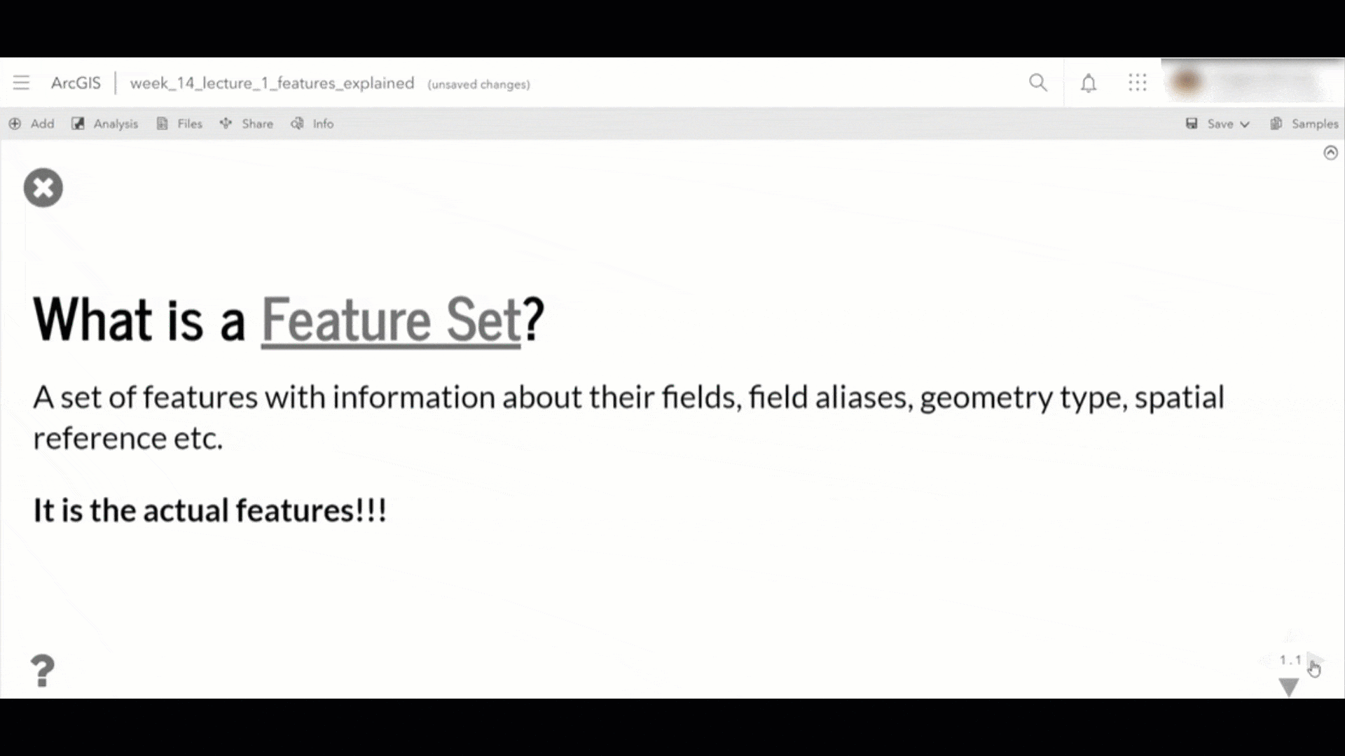
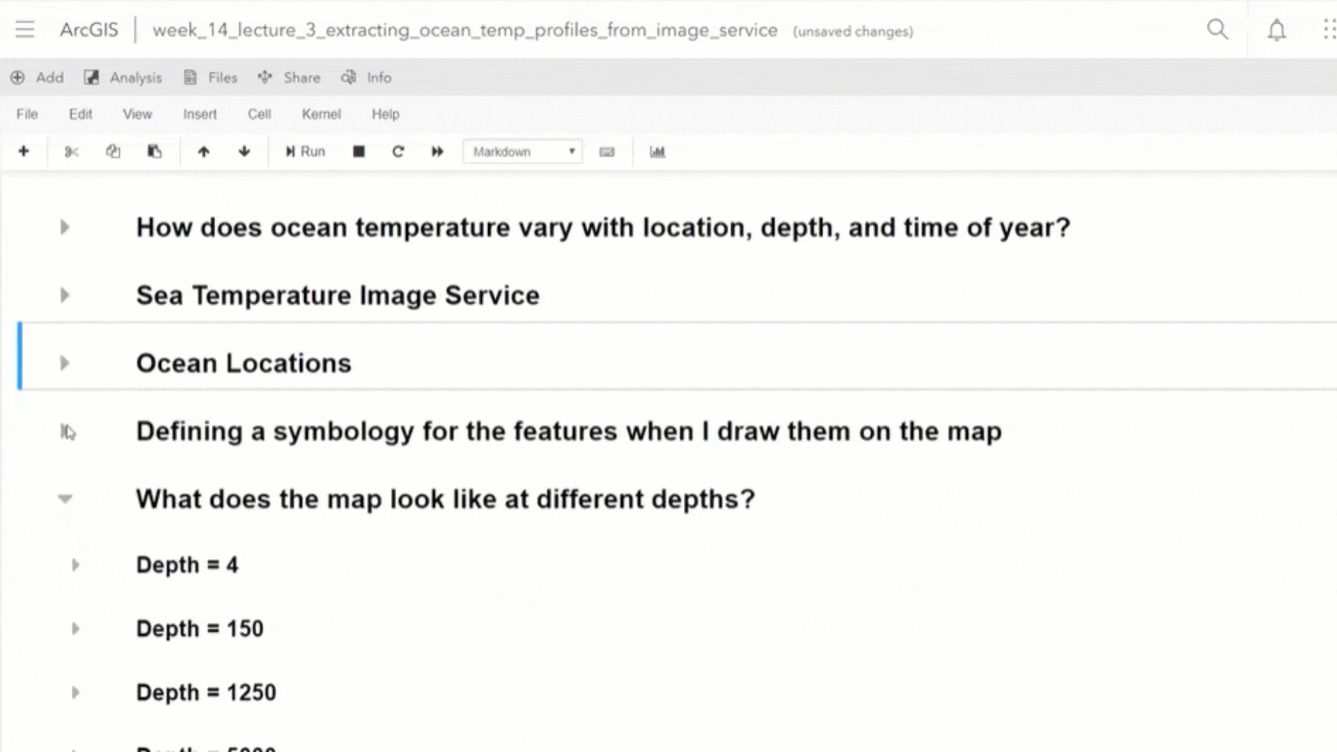
Greg started to leverage ArcGIS Notebooks as a medium to deliver his lecture content, turning the notebooks into rich slideshow experiences. This enabled him to dynamically explain concepts and provide illustrative examples to students.
He also decided to share homework and project solutions within ArcGIS Notebooks, which made it easy for students to easily run code cells in a web browser to see how a solution worked without needing to locally download, save and run a notebook. And finally, he decided to incentivize students to use the technology by awarding extra credit points for anybody that used ArcGIS Notebooks to complete their final projects. This motivated students to experiment with the technology themselves, learning to combine code, maps, charts, and graphs and showcase their understanding of the application of spatial science to solve problems.
The Success Story
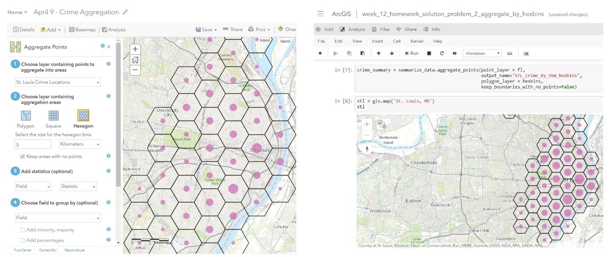
Greg summarized his experience with the technology by saying, “ArcGIS Notebooks just works!”. The integration of ArcGIS Notebooks within ArcGIS Online enabled the students’ workspaces to stay in sync and eliminated the worry around Python package dependencies. The sharing feature of ArcGIS Notebooks made it easy for Greg to post homework solutions on ArcGIS Online where the students could quickly access and review them. It also streamlined the follow-up on students’ progress. With ArcGIS Notebooks, Greg could see when the student last worked on a notebook and even open up the notebook to see their progress on a homework problem. This meant that he could iterate with the student on a problem statement and it also helped him be proactive in catching where students might find certain topics more challenging. He also found ArcGIS Notebooks to complement web GIS courses really well – it enabled him to show the comparison of a manual analytics workflow done in ArcGIS Online versus the efficiency gained when the same was automated with code within ArcGIS Notebooks. The juxtaposition of the two helped to drive home the value proposition of Python as an analysis and automation lingua franca.
Overall, Greg found the use of ArcGIS Notebooks to be very beneficial in his classroom as it helped to improve and re-imagine the learning experience for students while also making programming more approachable and interesting.

“ArcGIS Notebooks is the perfect solution to involve, engage and immerse my students in programming and mapping.”

ArcGIS Notebooks, now generally available in ArcGIS Online

In the June 2020 release of ArcGIS Online, ArcGIS Notebooks will be generally available. It will be offered in 3 versions –
- Standard – includes the ArcGIS API for Python and hundreds of open source libraries; appropriate for administrative tasks, data engineering, and light analytics. While standard notebooks themselves are free to create and run, anything that would ordinarily consume credits in ArcGIS Online still does when performed in a notebook (running analysis or accessing premium content).
- Advanced – includes everything offered in Standard plus ArcPy; offers a larger instance size (more compute and memory resources); appropriate for most workflows including large scale data engineering, advanced analytics and some machine learning workflows; credit rates apply.
- Advanced with GPU – includes everything in Standard and Advanced along with a GPU powered instance that offers the highest amount of compute and memory resources; appropriate for computationally intensive workflows such as big data analytics, model training and model inferencing; credit rates apply.
For more details on the general availability of ArcGIS Notebooks and what to expect from the end of the beta, read the blog.
To learn more about ArcGIS Notebooks in ArcGIS Online, visit our page.
To learn about licensing of ArcGIS software for higher education institutions, click here.


Article Discussion: