Often a map focuses on a smaller portion of the globe and the relatively small area of interest gets lost in the surrounding detail of the base map.
To solve this problem you can use Blend Modes and Effects in the new Map Viewer to highlight a specific area and focus your map on what is important.
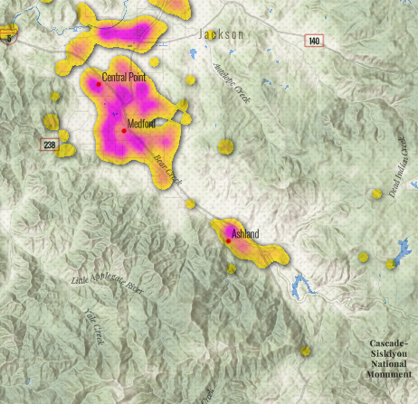
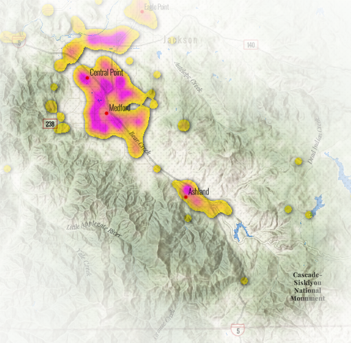
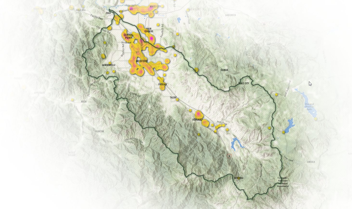
Check out this map of pollutant discharge permits for the Bear Creek Watershed in southern Oregon:
National Pollutant Discharge Elimination System permits in the Bear Creek Watershed of southern Oregon. The map was created using ArcGIS Living Atlas layers and the ArcGIS Online Map Viewer.
To create this map I started with a map of pollutant discharge permits created from a layer contributed to Living Atlas by the US EPA. See this blog for more information about the map.
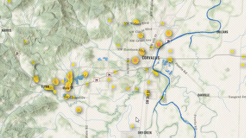
Here is a screen shot of the permit map zoomed into the watershed that I am interested in:
To focus my map on the Bear Creek Watershed I added the US Watershed Boundary Layer from ArcGIS Living Atlas and set a filter on the layer for Hydrologic Unit ID = 1710030801. The symbology fill is set to white (#ffffff) with no outline:
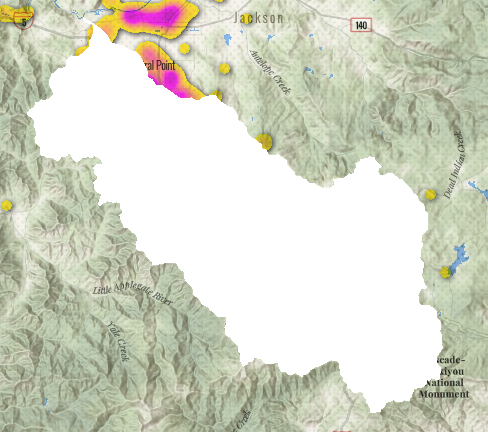
Set the Blend Mode to Destination In on the watershed layer and the map looks like this:
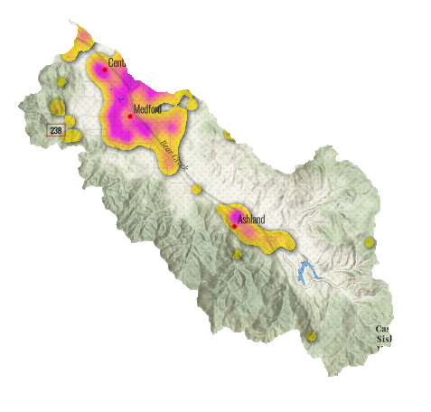
To fade the area around the watershed use the Bloom Effect (strength = 2, radius = 0.6, threshold = 10):
To create the outline add another copy of the US Watershed Boundary Layer from Living Atlas and set a filter to Hydrologic Unit ID = 1710030801. I set the symbology to no fill and the outline to dark gray (#2b2b2b) and a width of 3. I added a Drop Shadow Effect and set the shadow’s color to dark green (#2e8037). I left the Blend Mode set to Normal.
This technique will work for any feature. You can use a country, county, state, city or any other area of interest you may have.
If these methods are new to you follow the links below for help:
Resources used in this blog:


Article Discussion: