ArcGIS Solutions align with your business needs, transform your use of ArcGIS, and help you maximize the investment you are making in location-based data and technology.

Hot off the press
Our June 2023 release has twelve new ArcGIS Solutions ready for state and local governments, utilities, defense, and public safety agencies to deploy. There are also many enhancements to the existing solution portfolio that can be leveraged by organizations of all types.
Here’s what’s new in the June release:
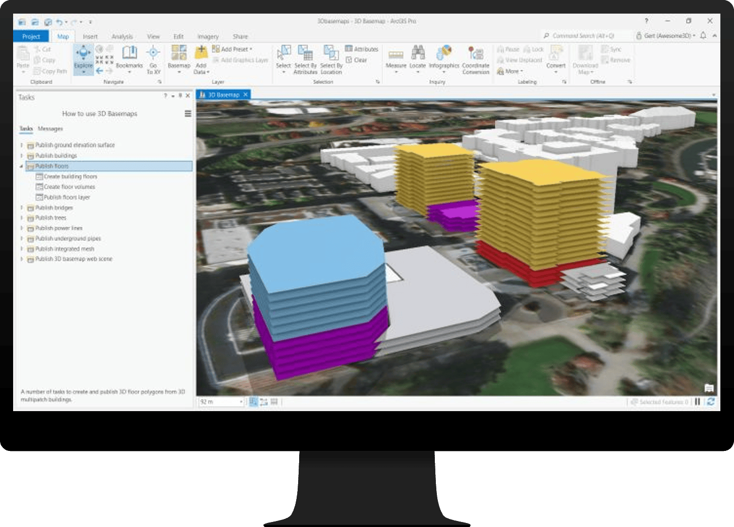
3D Buildings
3D Buildings can be used to author and maintain 3D content for an organization.
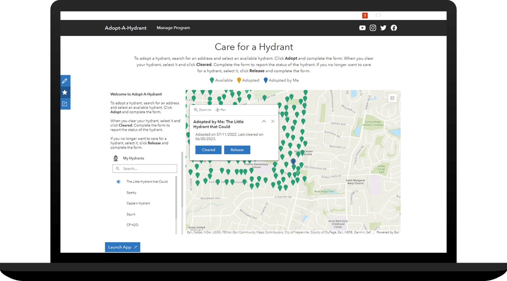
Adopt-A-Hydrant
Adopt-A-Hydrant can be used to operate hydrant adoption programs that allow volunteers to adopt hydrants and keep them free from obstructions like snow or vegetation.
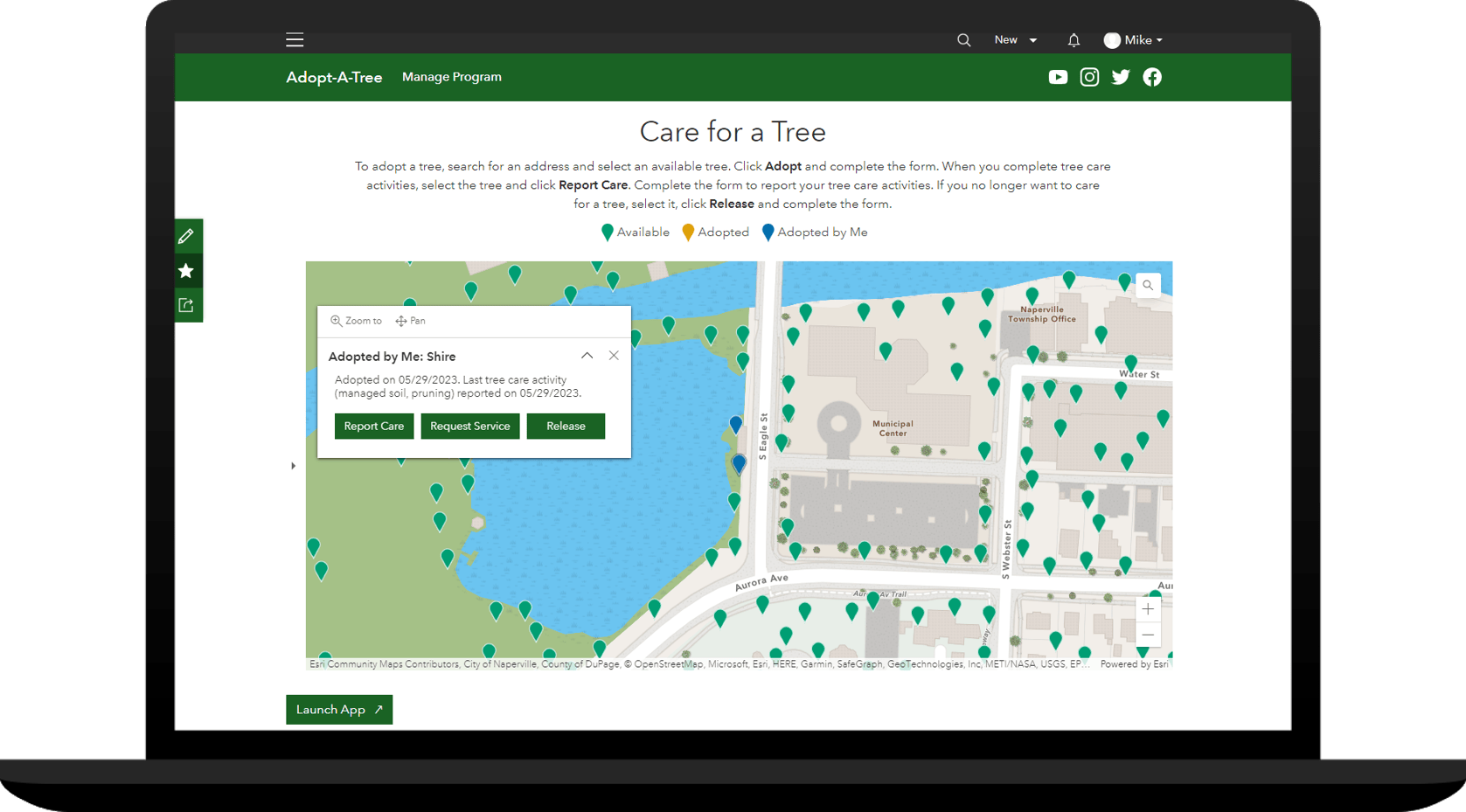
Adopt-A-Tree
Adopt-A-Tree can be used to operate tree adoption programs that allow volunteers to adopt and care for the community’s trees.
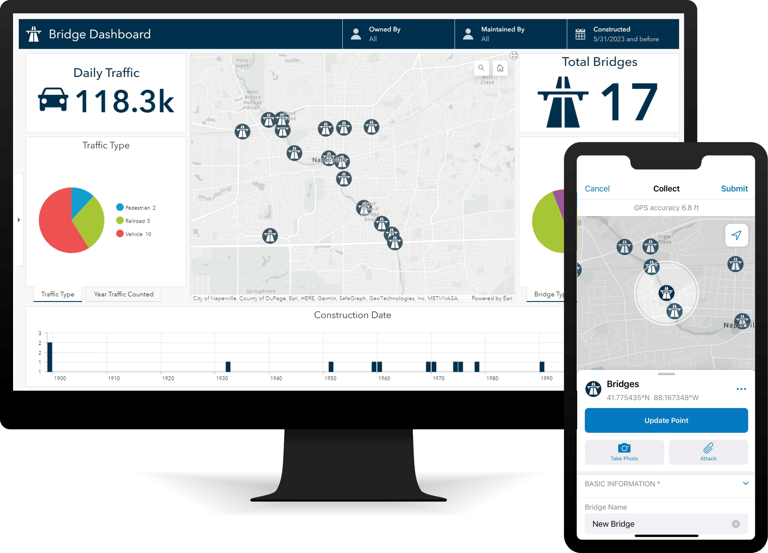
Bridge Inventory
Bridge Inventory can be used to inventory bridges and inform stakeholders.
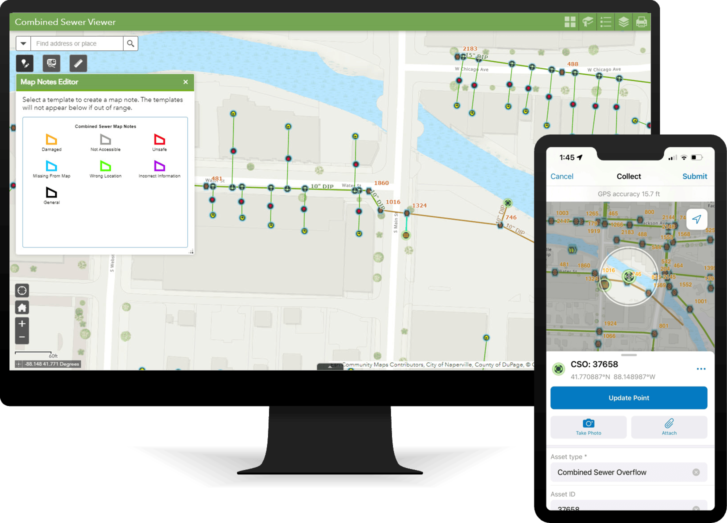
Combined Sewer Data Management
Combined Sewer Data Management can be used to map combined sewer assets, edit data, view system maps in the field and office, view asset reports, and collaborate with map notes.
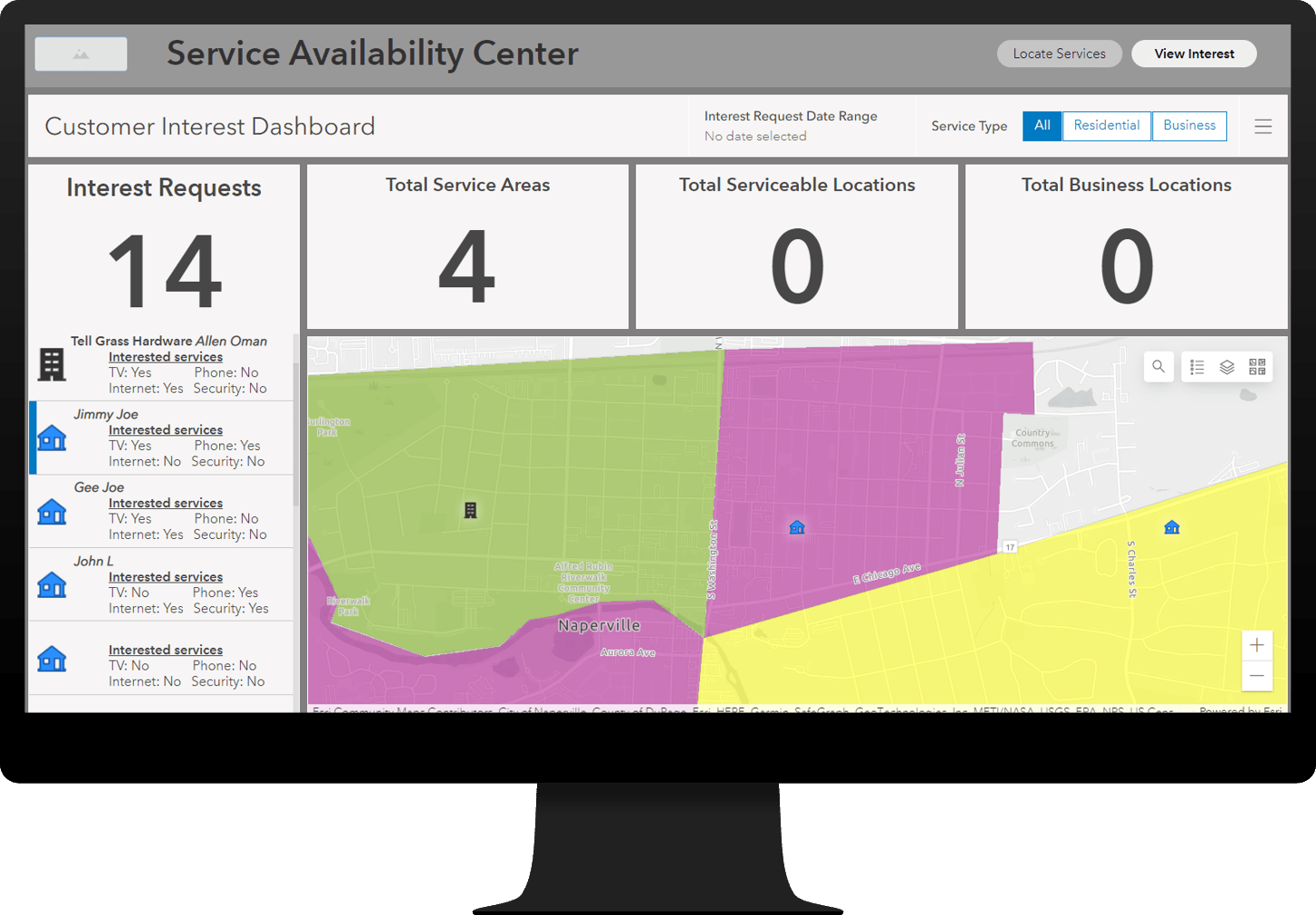
Communications Service Availability
Communications Service Availability can be used to share service availability with prospective customers and help staff understand customer interest.
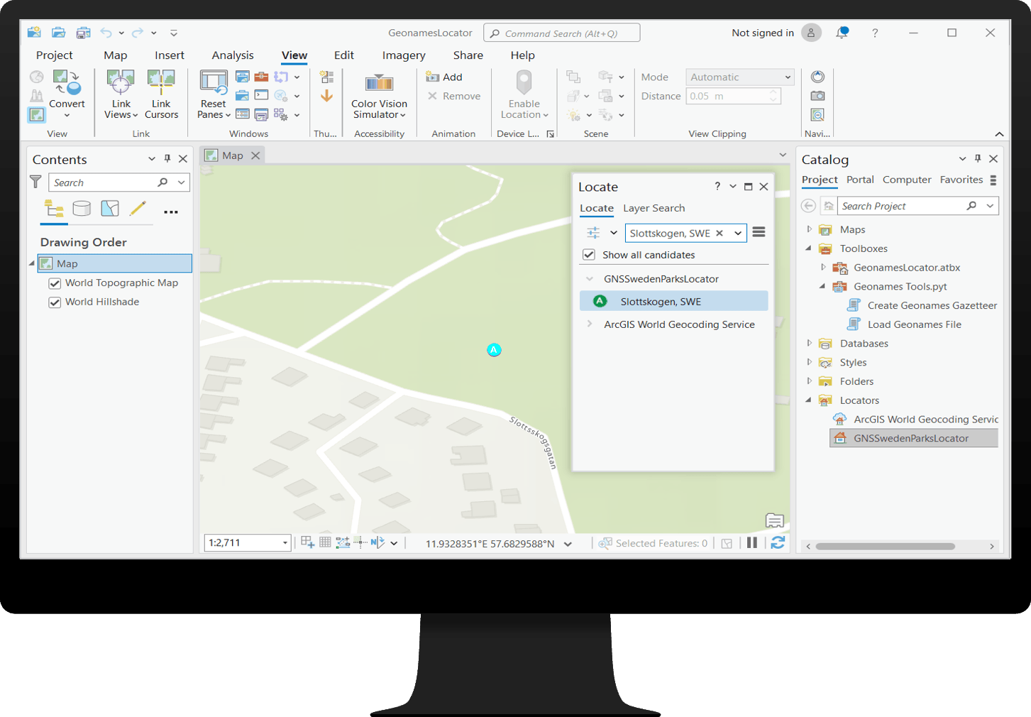
Geonames Locator
Geonames Locator can be used by intelligence groups within military and service organizations to define a glossary of local nomenclature for named places.
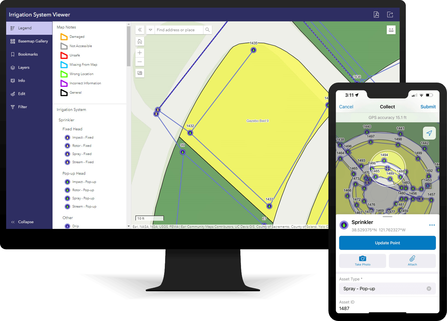
Irrigation System Data Management
Irrigation System Data Management can be used to map irrigation system assets, edit data, view system maps in the field and office, view asset reports, and collaborate with map notes.
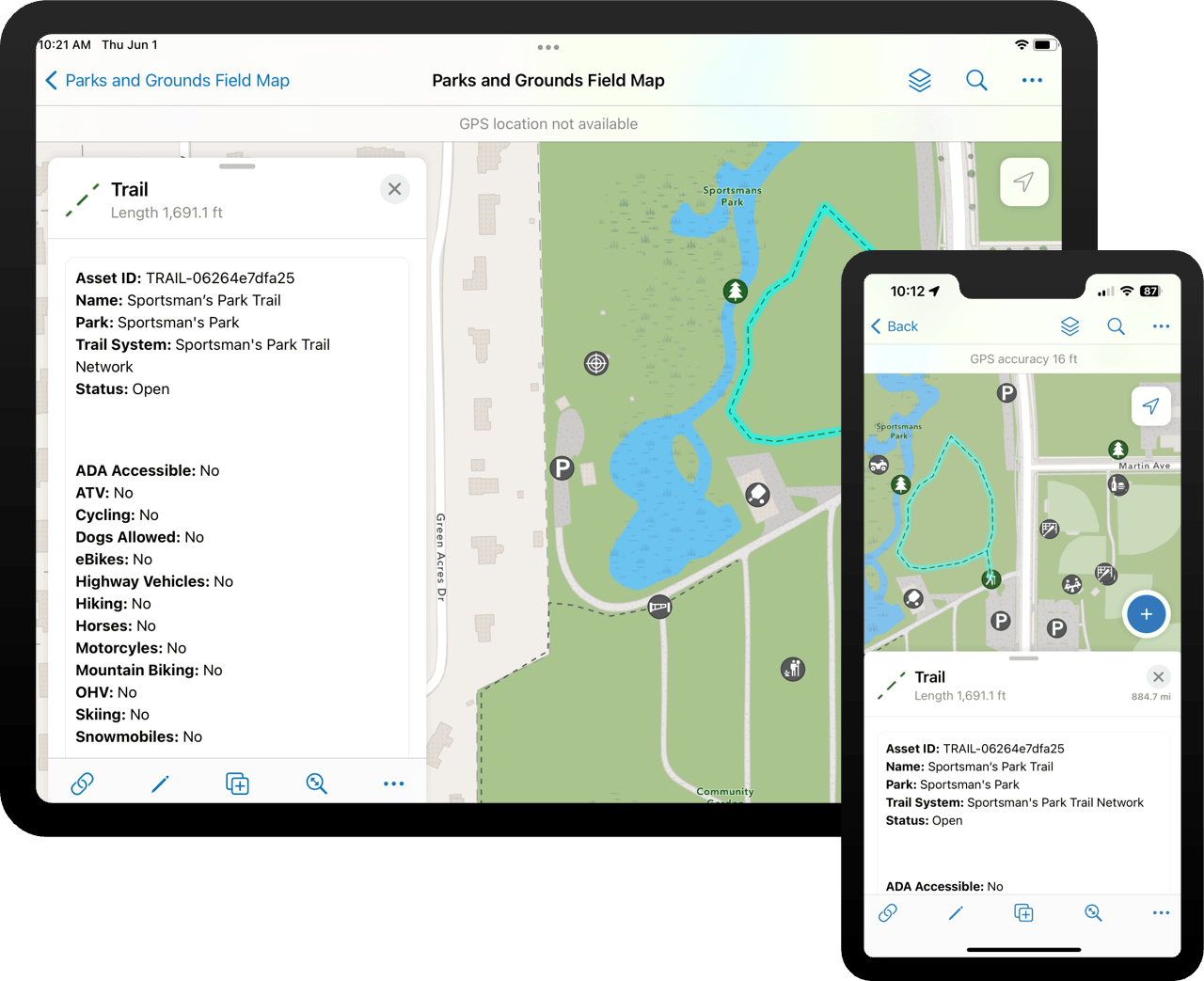
Parks and Grounds Management
Parks and Grounds Management can be used to inventory assets, understand asset condition, and communicate changing asset conditions that impact services.
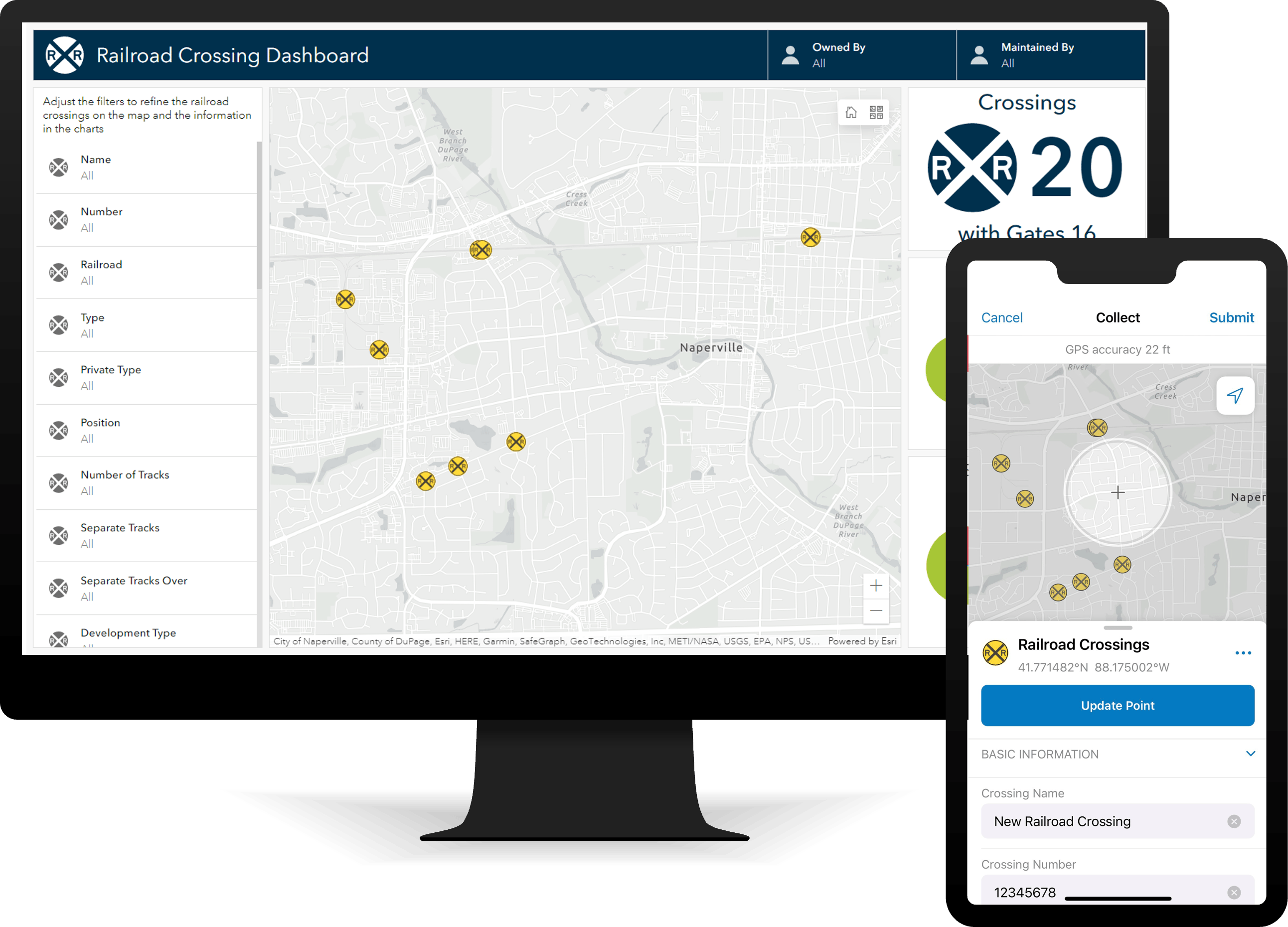
Railroad Crossing Inventory
Railroad Crossing Inventory can be used to inventory railroad crossings and inform stakeholders.
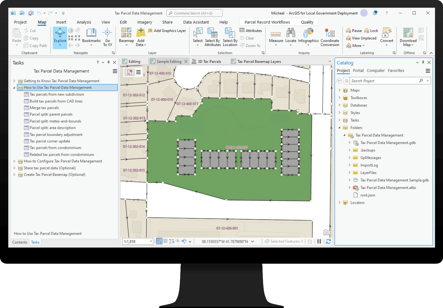
Tax Parcel Data Management
Tax Parcel Data Management can be used to develop an inventory tax parcels from record information and share this information with internal and external stakeholders.
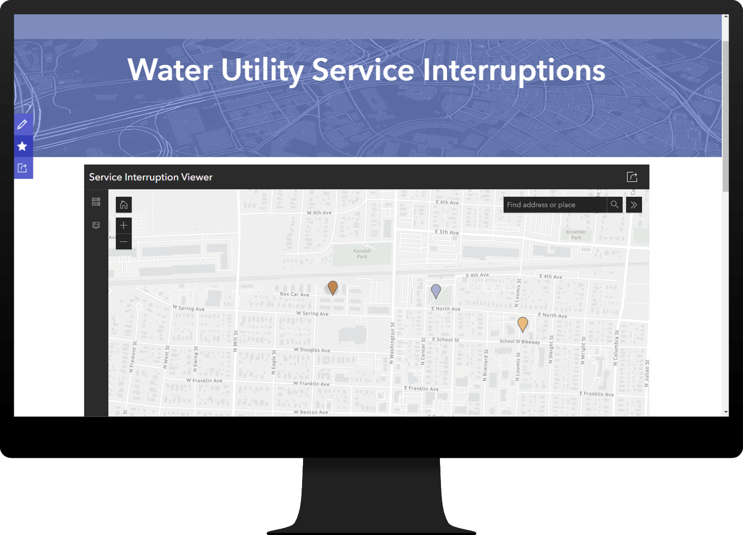
Water Utility Service Interruptions
Water Utility Service Interruptions can be used to inform customers and stakeholders about water service interruptions.
And that’s not all.
Several other solutions were also updated in this release:
• Adopt-A-Stop
• Fire Hydrant Inspections
• Public Notification
• Recreation Outreach
• Tree Management
Finally, learn more about other lifecycle changes and issues that have also been addressed in this release.
But wait, there’s more!
ArcGIS Solutions has a full range of solution videos available to the community. Check these videos out to learn more about dozens of our solutions and the key capabilities they offer.


Article Discussion: