Introduction
The latest release of the ArcGIS Maps SDKs for Native Apps, version 200.6, is here! This update brings exciting new capabilities for 3D visualization workflows. As a result, it helps you better showcase and explore your data. Among the highlights are two powerful features: integrating 3D coordinate grids into SceneViews and leveraging immersive 3D basemaps. These enhancements offer new ways to interact with and present your 3D data, making your applications more dynamic and impactful than ever.

Coordinate Grids in 3D
Version 200.6 builds on the existing 2D grid support by extending this functionality to 3D SceneViews.
Grids provide essential geographic context, enabling users to display four different grid types:
- Latitude Longitude Grids
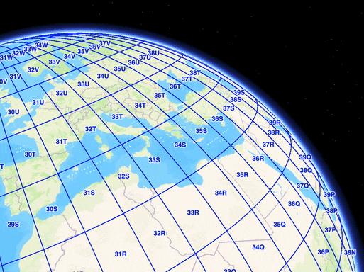
- UTM Grids
- MGRS Grids
- USNG Grids
Whether you’re analyzing data in a local scene or navigating a global view, grids help ground your work in its precise geographic framework.
Adding Grids to Your App
Prior to this release, grids were only a property on MapView. With this release, grids are now a property of the GeoView class, making them accessible for both MapView and SceneView. If you’ve previously worked with grids in 2D, you’ll find the process for 3D SceneViews to be nearly identical.
Throughout this blog post, I’ll be sharing code snippets from the Qt Maps SDK to demonstrate how to use the new features, which are also available for the .NET, Swift and Kotlin Maps SDKs.
Add a grid to your SceneView by creating a grid object like LatitudeLongitudeGrid or MGRSGrid and assigning it to your SceneView.
m_sceneView->setGrid(new MGRSGrid(this));

Customizing Coordinate Grids
You can customize your grids by stylizing their lines and labels to better fit your application’s specific needs. For MGRS and USNG grids, which feature multiple levels of detail, you can even customize each level individually.
// Set colors of different grid levels
m_grid = new MGRSGrid(this);

// Set level 0 to blue
auto lineSymbol = static_cast<SimpleLineSymbol*>(m_grid->lineSymbol(0));
auto textSymbol = static_cast<TextSymbol*>(m_grid->textSymbol(0));
lineSymbol->setColor("blue");
textSymbol->setColor("blue");
textSymbol->setSize(20.0);
m_grid->setLineSymbol(0,lineSymbol);
m_grid->setTextSymbol(0,textSymbol);

// set level 1 to burnt orange
lineSymbol = static_cast<SimpleLineSymbol*>(m_grid->lineSymbol(1));
textSymbol = static_cast<TextSymbol*>(m_grid->textSymbol(1));
lineSymbol->setColor("#cc5500");
textSymbol->setColor("#cc5500");
textSymbol->setHaloColor("#cc5500");
textSymbol->setSize(20.0);
m_grid->setLineSymbol(1,lineSymbol);
m_grid->setTextSymbol(1,textSymbol);
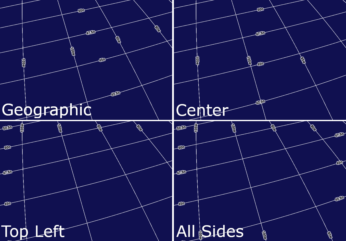
By default, labels use a Geographic placement strategy, positioning them in static locations on the globe. Additionally, for Latitude-Longitude grids, you can also choose alternate Grid Label Positions such as screen-anchored placement strategies. These keep labels fixed at specific positions on the screen—such as aligned to the edges, centered along the middle, or in predefined corners. While these label placement strategies are supported for all grid types in 2D MapViews, they are currently available only for Latitude-Longitude grids in 3D SceneViews. This focused support ensures a streamlined experience for this release, with plans to expand these capabilities to additional grid types in the future.
3D Basemaps
Basemaps are the foundation of every map or scene, offering crucial context for a variety of applications. They help bring your data to life, with examples like:
- Highlighting city projects with street maps,
- Showcasing dense vegetation with satellite imagery, or
- Adding creative touches with stylized designs like colored pencil basemaps.
With version 200.6 of the ArcGIS Maps SDK for Native Apps, we’re introducing tools that make enriching your basemaps with immersive 3D features easier than ever.
These 3D basemaps include multiple base layers designed to add depth and context to your visualizations. In the ArcGIS Maps SDK for Native Apps, support currently includes the 3D buildings layer, and the vector tile basemap.
These features empower you to create immersive scenes by providing essential context for tasks such as assessing how new developments may affect urban skylines, evaluating wildfire risks, or analyzing patterns of urban density. By enhancing both the realism and clarity of your data, 3D basemaps improve decision-making and bring your scenes to life.

Adding 3D Basemaps to Your App
In the 200.2 release of the Native Maps SDKs, we introduced support for the global OpenStreetMap (OSM) 3D Buildings layer. This layer provides 3D geometry for nearly every building worldwide. With the release of version 200.6, integrating a 3D OSM basemap into your scene has become more straightforward than ever. Previously, users needed to create Portal Item objects for both the buildings layer and the vector tile layer basemap separately, then add them to a predefined basemap as base layers. Now, users can simply construct a Basemap or create a new Scene with just a single Portal Item, streamlining the workflow and making it significantly more straightforward.
To demonstrate this, below is an example code snippet that shows how to incorporate a topographic 3D basemap into your application using the ArcGIS Maps SDK for Qt:
// Topographic 3D basemap portal item
PortalItem* item = new PortalItem("0560e29930dc4d5ebeb58c635c0909c9", this);
Basemap* basemap = new Basemap(item, this);
myScene->setBasemap(basemap);
To get started with 3D basemaps, explore the ArcGIS Living Atlas of the World and search for “3D Basemaps” to find one that fits your 3D applications. You can preview these basemaps in the online Scene Viewer or add one of the Portal Items directly into your Maps SDK for Native Apps application today!
Note: While the 3D basemaps available through ArcGIS Online include vegetation and label layers, these layers are not yet supported in the ArcGIS Maps SDK for Native Apps. Support for these layers is planned for a future release.
Spotlight on 200.5: Realistic Sun and Sky
While we’re excited about 200.6, we wanted to take a moment to spotlight an exciting new feature from 200.5. We introduced realistic sun and sky effects for sunlight-enabled SceneViews, allowing for a more naturalistic rendering across supported platforms, and enabling greater realism to create visually stunning 3D scenes. You can explore these new effects with the “Realistic lighting and shadows” sample for your preferred platform, or check them out alongside the new realistic night sky for ArcGIS Earth.

Conclusion
In this article, we explored the exciting new 3D features introduced in the 200.6 release of the ArcGIS Maps SDK for Native Apps. From 3D grids that provide vital geographic context to immersive 3D basemaps that bring your scenes to life, these tools enhance your applications and workflows.
We can’t wait to see how you use these features to create innovative solutions and stunning visualizations. We’re also eager to hear your feedback—join the discussion on the Esri Community forums to share your thoughts, ideas, and questions. Your input helps us improve and shape future releases!
Finally, stay tuned for even more exciting updates in version 200.7, and don’t forget to follow me, Tanner Yould, and Koushik Hajra for the latest news and in-depth looks at new 3D features.
Next Steps
Ready to explore these new features for yourself? To get started with grids, check out the “Show Grids” sample available on your preferred platform for the ArcGIS Maps SDK for Native Apps and see how this feature can enhance your 3D applications today! Additionally, to experiment with the 3D buildings layer and learn how to modify the buildings layer to selectively show specific buildings, check out the “Filter Features in Scene” sample.


Commenting is not enabled for this article.