Released in November 2020, ArcGIS Field Maps is a powerful mobile app solution that streamlines mobile workflows for exploring maps, collecting and updating authoritative data, and sharing where mobile workers have gone, all within a single location-aware mobile app.
Our 2 year anniversary is coming soon and in August we launched our November 2022 early access program. Today we’re updating the mobile and web apps with new capabilities for you to explore.
Sign into the Early Access Program and start using our beta apps today! Here is a preview of what’s available now.
Layer filters
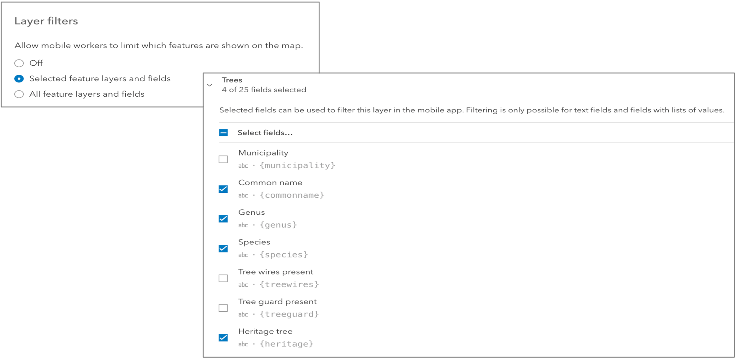
The top-most requested enhancement from Esri Community, layer filters, allow mobile users to control and limit the visibility of features within feature layers on the map. Rather than defining a static filter at the map or feature layer/view, layer filters in Field Maps provide a way for each individual mobile user to filter based on their current task.
With the November release, fields with coded value domains (text, numeric, date) and text fields without an associated domain support filtering.
Layer filters can be defined and controlled in the map author in the Field Maps web app, and used in Field Maps mobile app on Android and iOS. They are configured from the App Settings tab in the web app:

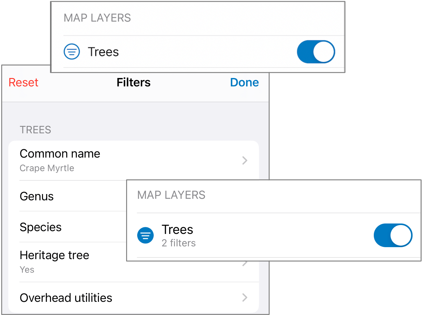
Once layer filters are enabled for a map, Field Maps will honor this setting and allow filtering, which is accessed via the Layers tool.
Tap on the Filter icon to view the available fields to filter on, then select a field and value you want to filter against. Filters can be defined on multiple fields for a single layer.
Filters apply an AND query when multiple fields are chosen, meaning that features must meet all filtered values to be displayed on the map. The Layers tool will indicate filters applied to a layer, and you can manually reset filters.

Filtering geofences
Field Maps supports adding geofences to your maps so that mobile users can be warned when entering dangerous or restricted areas, provided critical information when approaching a building, tracked only when on company property, and more.
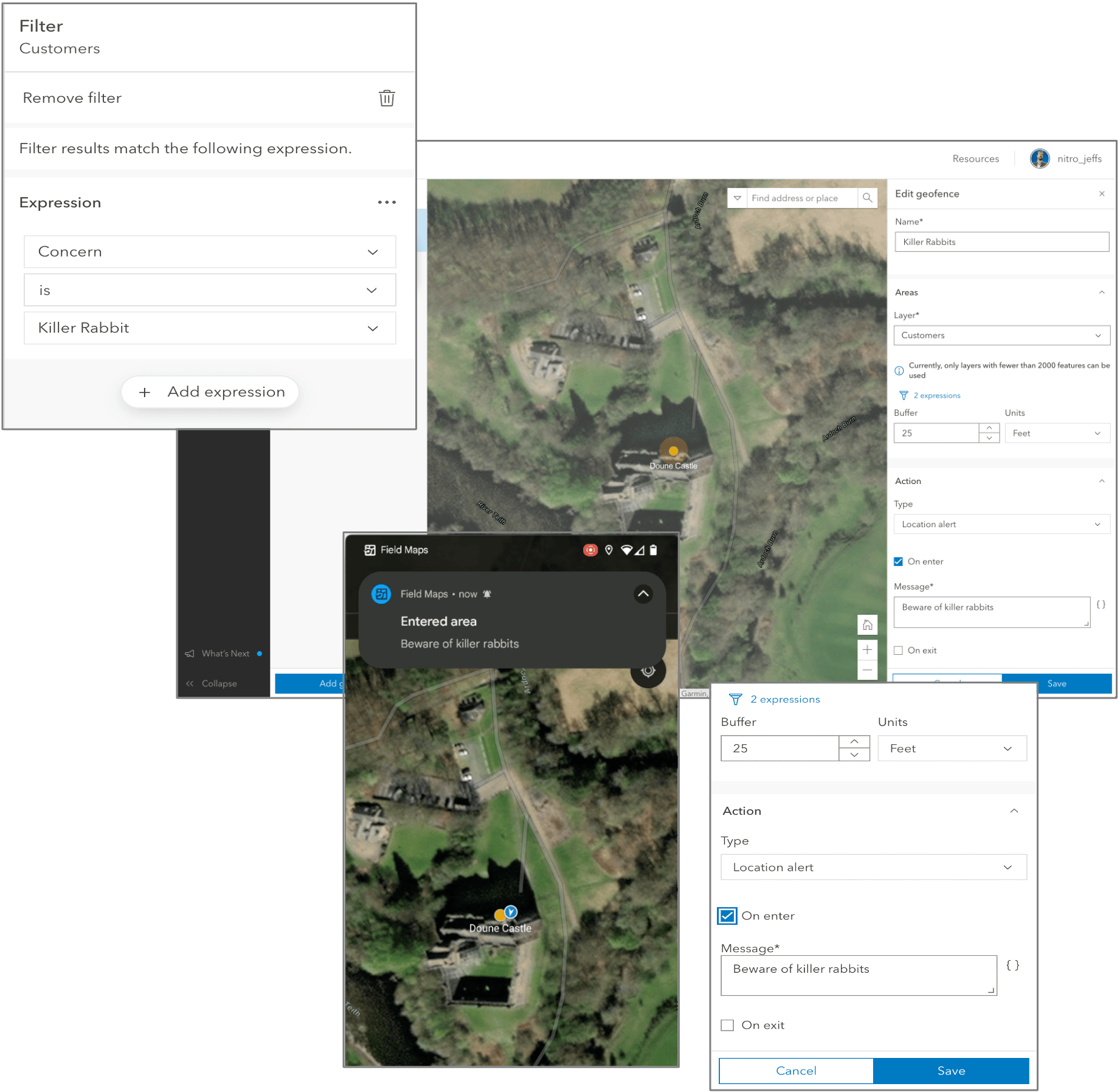
The latest EA update includes the ability to filter feature layers when creating a geofence within the Field Maps web app. Using filters, you can provide more focused location alerts when notifying mobile workers or leverage more specific criteria stored within features when controlling the behavior of location sharing.
Using familiar filtering components from the Map Viewer, you can construct advanced filters for each geofence you create.

Additional updates
We are working toward providing additional updates in Field Maps that we are classifying as QoL (quality of life) updates. Improvements that have been asked for via Esri Community, in customer conversations, and by Esri partners that improve integrations with our apps.
Offline Maps
Now the Field Maps mobile app can support opening the Online version of a map that contains offline areas. This is critical to providing seamless operational awareness where a single map can be used in both a disconnected and connected environment.
App links
In this update, you’ll find a new addition to the use of app links. When using referenceContext=center, you’ll find an additional ¢er parameter that will drop a pin at the specified location.
Example:
https://fieldmaps.arcgis.app?referenceContext=center&itemID=9821a0d91f2c4b3f9708e6b4ab5e076e¢er=34.05909223258048,-117.19610294403928&scale=15000
Group layers
The Layers pane in the Map Viewer supports the creation and management of group layers. You can organize themed, related layers into a hierarchy within a grouped layer. These are now supported in the Field Maps web app.
What’s next?
Geofences, layer filters, pop-up elements, IPS and Indoor Editing are all new capabilities available for testing in the current beta offering, but there are still more new features coming for the November release!
Here is what we are actively working on:
- Indoor location sharing – Auto-population of a new LevelID field for both the Last Known Locations (LKL) and Tracks layers.
- Indoor geofencing – Floor-aware location alerts
- Online maps – Open a map online even when offline areas are available and/or downloaded on your device.
- Form updates – Improvements to conditional logic when working with hidden fields.
- iOS CAC card reader – With Apple devices running iOS 16, we’ll support authentication using a CAC card reader.
- Improved search results – If we have time left in this release, we’d like to improve the search experience to return more than 12 results.

Is filtering available for ArcGIS Enterprise or only ArcGIS Online?
Hi Maya – filtering requires functionality inside of the Field Maps web app (to enable the ability to filter and determine what layers, fields are available to be filtered. This web app capability will be available in the 11.1 release of ArcGIS Enterprise.
Do you know when 11.1 release is currently scheduled to be released?
We have ArcGIS Enterprise 10.9, is it possible to upgrade only Field Maps Designer separately?
Unfortunately no. The changes made in each release go beyond the Designer and include changes to the web map specification, the JS API, and the Map Viewer. You need to update your Portal. Some organizations have started to use distributed collaboration with 10.9.1 and ArcGIS Online where maps are authored and configured in ArcGIS Online, pointing to enterprise services, and then sync to ArcGIS Enterprise 10.9.1+. Mobile users then sign into ArcGIS Enterprise.