By: Brad Johnson and Dinorah Sanchez, Cityworks subject matter experts
So, you’ve successfully implemented your new work management system. The software is live, organizational workflows have been added, and office and field staff are fully on board. Then, that time of month rolls around when management asks for key performance indicators.
Your division is trying to be more effective in operations, and the new work management system helps collect great data. But how do you transform that data into meaningful information? Just contemplating the work required to run reports and calculate the data seems like a daunting task.
That’s why Cityworks recently developed a series of analysis models that allow users to render Cityworks asset data in Insights for ArcGIS, Esri’s data analytics software made for advanced location intelligence.
Cityworks is a web GIS-centric public asset management system that leverages an organization’s investment in GIS. Insights for ArcGIS allows organizations to visualize asset data on maps, charts and tables to improve operational performance.
The analysis models available in Cityworks Analytics 3.0 now make it possible for Cityworks and ArcGIS users to quickly leverage tools they already have to start querying and analyzing the wealth of data they collect with Cityworks. By connecting Cityworks Analytics to Insights for ArcGIS, users can better understand large quantities of data—all at the touch of a button. Together, these tools can help answer important questions, such as:
- Where are the majority of resources concentrated?
- How is maintenance being handled?
- What are the outliers?
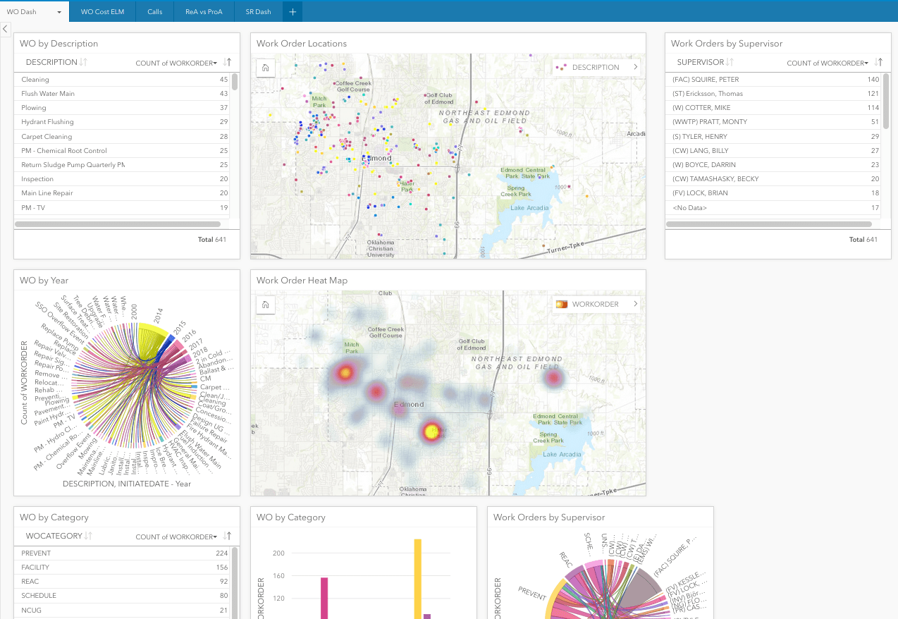
If an organization is performing a risk analysis on owned assets, they can couple these calculations with financial data, as well as maintenance and work history, all within Insights for ArcGIS. Answers to important questions can be found not only in graphs and charts, but spatially too.
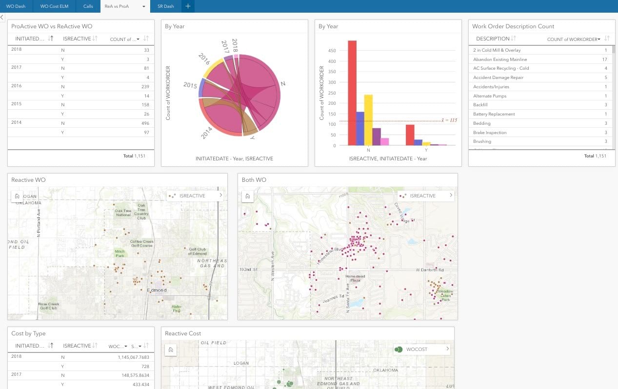
Cityworks’ analysis models for Insights for ArcGIS accommodate several important categories of public asset management data.
Data collected through Cityworks service requests and work orders can be processed into maps, graphs and charts that analyze activity by location (on a map), status (open or closed), description (hydrant flushing or water main flushing, for example), personnel (supervisor or assigned), time period (month or year) and more.
Inspection activity data can be analyzed in a similar manner, and the model developed for Cityworks PLL—permits, licensing and land—provides powerful analyses of code enforcement, permitting and licensing activities.
Cityworks also developed a model for its Storeroom material management application. This allows warehouse and parts managers to produce easy-to-read material audit and cycle count reports with just a few simple clicks.
Together, Cityworks Analytics 3.0 and Insights for ArcGIS bring data to life. These tools allow users to leverage their existing investment in Cityworks and ArcGIS to quickly and easily analyze data—providing greater insight into asset management strategies, tactics, and operations.
Learn how St. Johns County Utilities put these analysis models to work.
Insights for ArcGIS and [Cityworks] Analytics quickly identified the greatest area of need for manhole funding in the utility's service area. This early success has encouraged the use of Insights as a successful planning tool for our Administration and Purchasing Division.
To learn more about Insights for ArcGIS, please visit www.esri.com/insights. To learn more about Cityworks Analytics and the Cityworks GIS-centric platform, please visit www.cityworks.com or email info@cityworks.com.

Commenting is not enabled for this article.