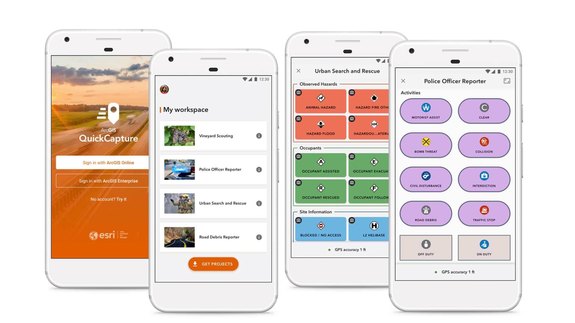
We are happy to announce the release of ArcGIS QuickCapture! This new mobile app is specifically designed to effectively support at-speed and rapid data collection workflows, where users demand an extremely simple and streamlined data collection user experience while on the go. At-speed asset inventories, aerial surveys, pipeline patrols, quick on-the-go inspections or crop scouting are some of the workflows where ArcGIS QuickCapture excels. With ArcGIS QuickCapture, you can collect field observations with the touch of a button. Fast!
The ArcGIS QuickCapture mobile app is available for iOS, Android, and Windows. It is supported with ArcGIS Online and ArcGIS Enterprise 10.7.1, and it is included at no additional cost with Field Worker, Creator, and GIS Professional user types. You can also purchase the mobile app from the Esri Store as an add-on to Editor user types.
What makes ArcGIS QuickCapture unique is its big-button experience. Each button represents a type of field observation. You push the button, and QuickCapture does the rest: it gets the location of your device and creates a GIS feature with predefined attributes. Simple!

There are many scenarios where this new data capture experience will streamline your workflows. Think of situations where users need an extremely simple and quick way to capture field observations; with the simple tap of a button. Here are some examples:
- At-speed road asset inventories: Use ArcGIS QuickCapture while travelling in a vehicle such as a truck or a car. One person drives, and a colleague in the passenger seat captures observations. Report the location of assets along the road or simply document pavement conditions, all without stopping.
- Aerial surveys and patrols: Configure ArcGIS QuickCapture to collect georeferenced observations from a helicopter or by on-foot patrol crews. Document right of way infractions, overgrown vegetation over electricity poles or malfunctioning streetlights.
- Crop scouting and noxious weed abatement: Carry ArcGIS QuickCapture with you to quickly mark locations where pests are affecting growth or invasive species are found or treated. Minimum training for field users.
- Quick damage assessments: Equip first responders and even volunteers with an extremely simple mobile app to perform quick (aka “windshield”) damage assessments. Snap a photo and quickly categorize damage while driving through town.
While we are just making ArcGIS QuickCapture available now, we have a couple use case studies that illustrate how you can make a difference with it:
- Using ArcGIS QuickCapture in King County to control invasive plants
- Rapid data collection with ArcGIS QuickCapture to boost road safety across New Zealand.
We also put together a brief teaser video so you can see the mobile app more closely.
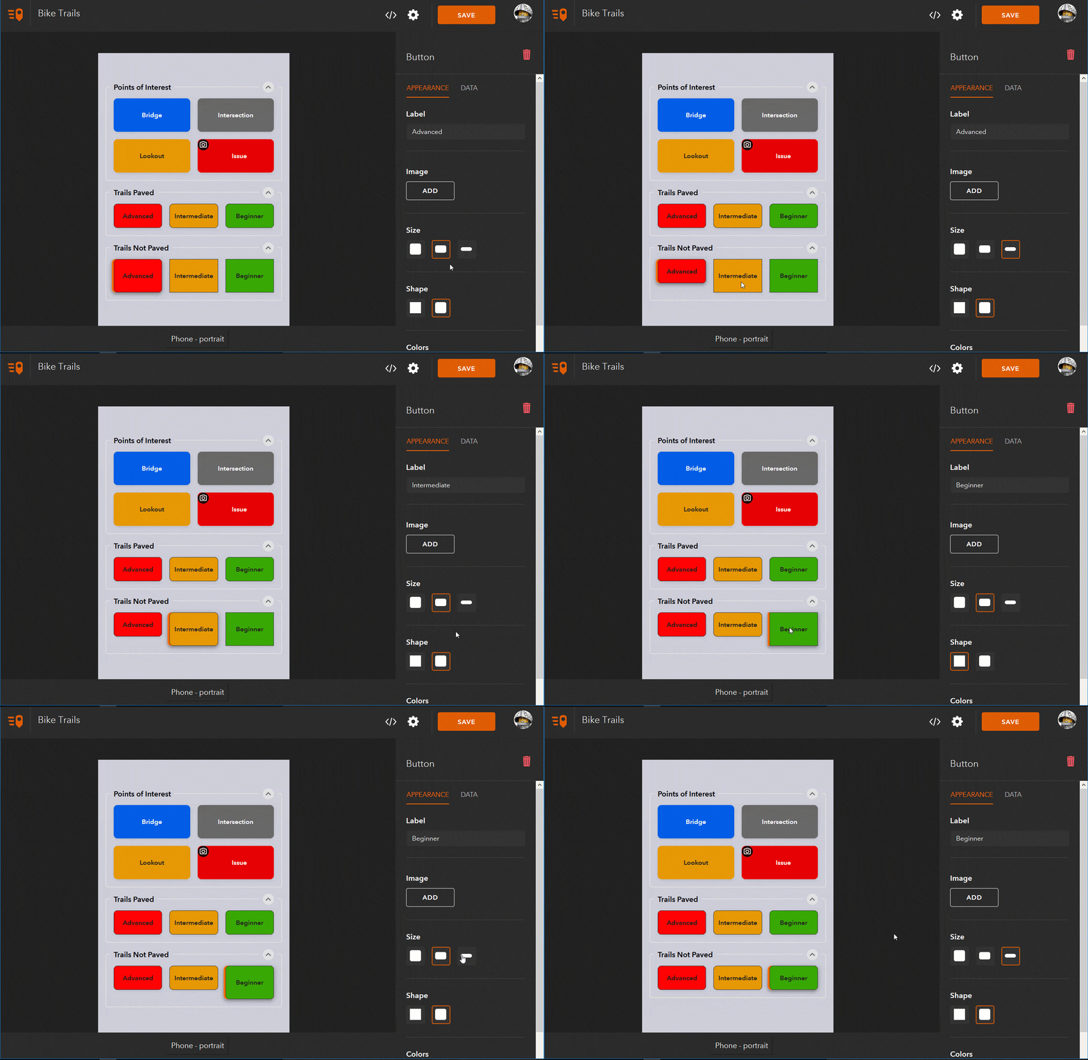
Using a Creator or GIS Professional user type, you can configure your own ArcGIS QuickCapture projects and share them with people within your organization. We have made available ArcGIS QuickCapture designer, a web tool you can use to define the shape, size, look and feel and layout of buttons to be exposed to end users. You can also define what exact GIS attributes will be captured when a button is pushed. QuickCapture designer is available now in Beta at quickcapture.arcgis.com.

We have published a couple of step by step tutorials to get you started with QuickCapture designer. They are available in our ArcGIS QuickCapture GeoNet Place, where you can also participate in the forum and find other helpful information.
We hope you try ArcGIS QuickCapture soon. It all starts with the touch of a (BIG) button!
Commenting is not enabled for this article.