There is no denying that today’s broadband economy and socio-geographic circumstances, as result of the COVID-19 pandemic, make us more dependent on communications networks than ever before. With new network technologies relying on location and mapping, GIS has been thrust into the forefront. The powerful location and mapping solutions enabled by GIS make them strong tools for planning, engineering, operations, and maintenance of communication networks.
Two NextGen Options for Network Management
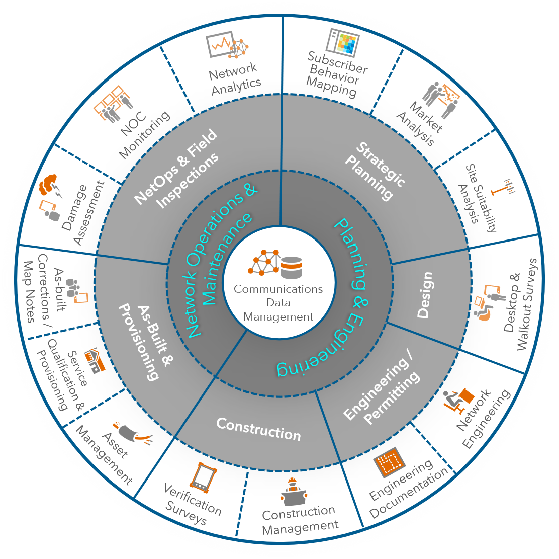
Esri is thrilled to announce the release of two new solutions aimed at helping telecommunications providers of all sizes manage their network infrastructure. The Communications Data Management for ArcGIS Enterprise solution is built for enterprise network management, while the Communications Data Management for ArcGIS Online is ideal for basic asset management and network planning. These two solutions provide flexible deployment options for managing communications networks in Esri’s ArcGIS. Both foundational solutions include an information model and preconfigured maps to support common communication network management workflows that will vary based on which solution is deployed.
Communications Data Management for ArcGIS Online
The first solution, Communications Data Management for ArcGIS Online, is a completely SaaS offering. All you need to set it up is an ArcGIS Online organization subscription with at least one Creator named user within it. Once deployed, the telecommunications service provider will have everything they need to begin loading or collecting physical telecom network assets onto a web map.
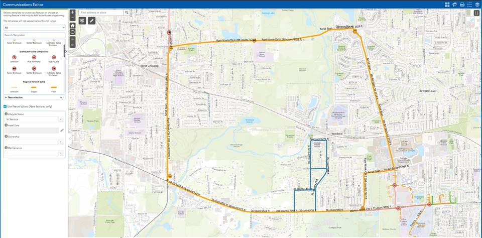
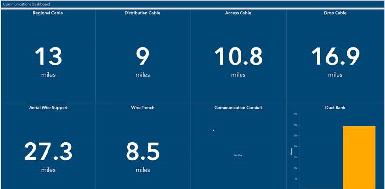
Deployed with the services based information model for managing telecom assets, are a set of maps and apps, including a dashboard configured to display counts and mileage of different network assets.
Learn more about this solution:
· Solution Overview
· Solution Documentation
· Deploy the Solution
Communications Data Management for ArcGIS Enterprise
Communications Data Management for ArcGIS Enterprise is the second solution released. This technology is intended to help telecommunications providers with more advanced network needs model their assets, build a network, perform traces, and implement business rules. You may have downloaded and tested early preview versions of Communications Network Foundation in the past; this new solution is the fully released with a re-naming to Communications Data Management.
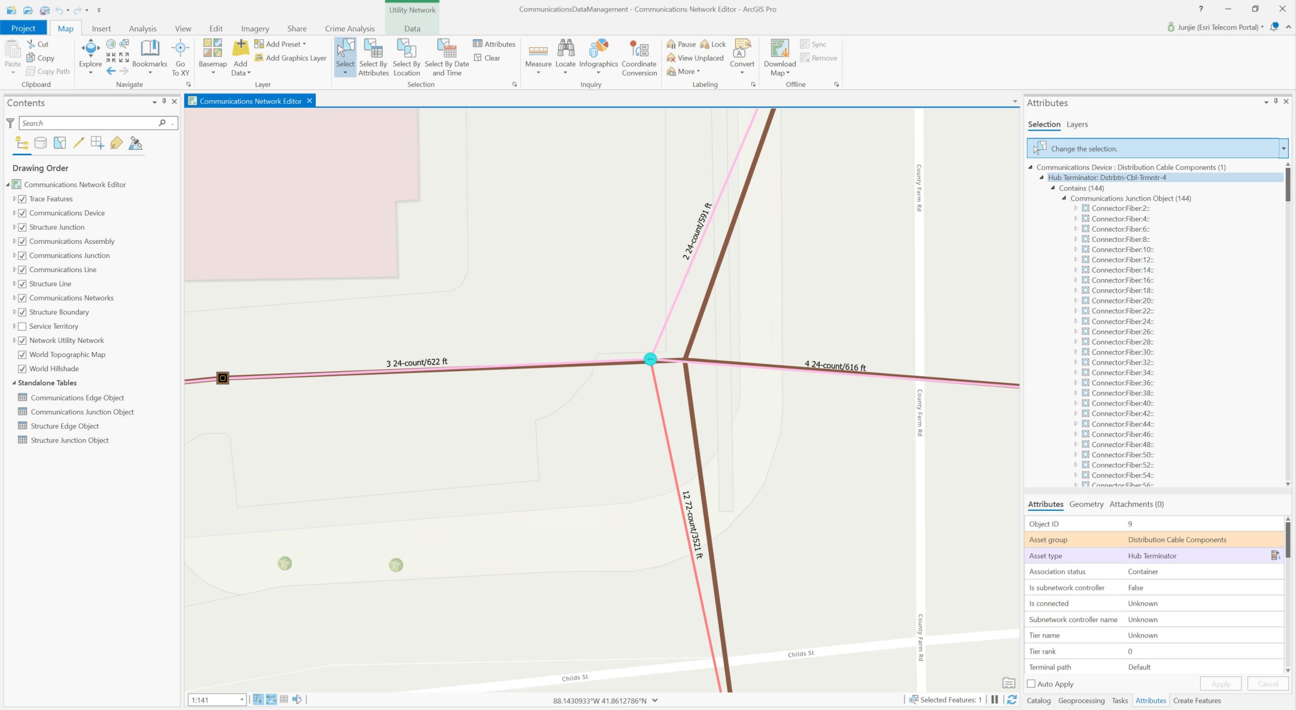
It includes an asset package, sample data, and a set of preconfigured maps with suggested symbology relevant for telecommunication networks. This solution fully supports modeling telecom networks from the structures down to the fiber strands and equipment ports, as you can see below.
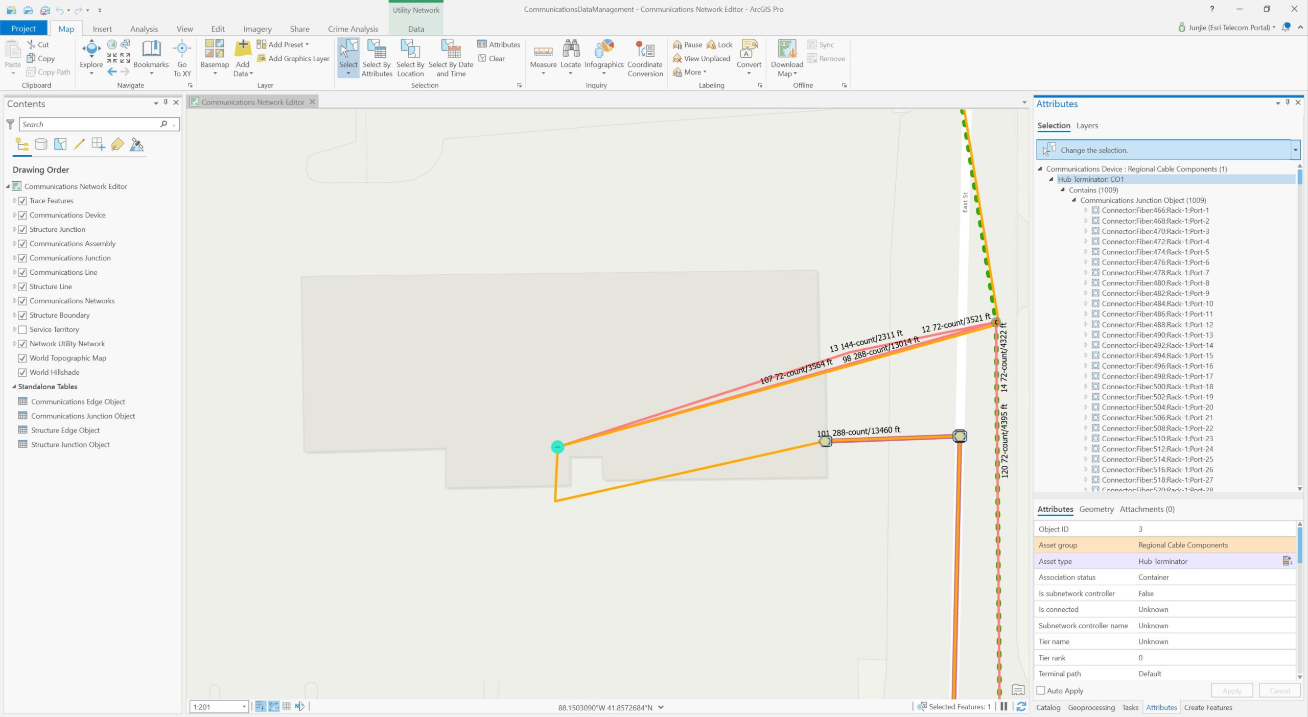
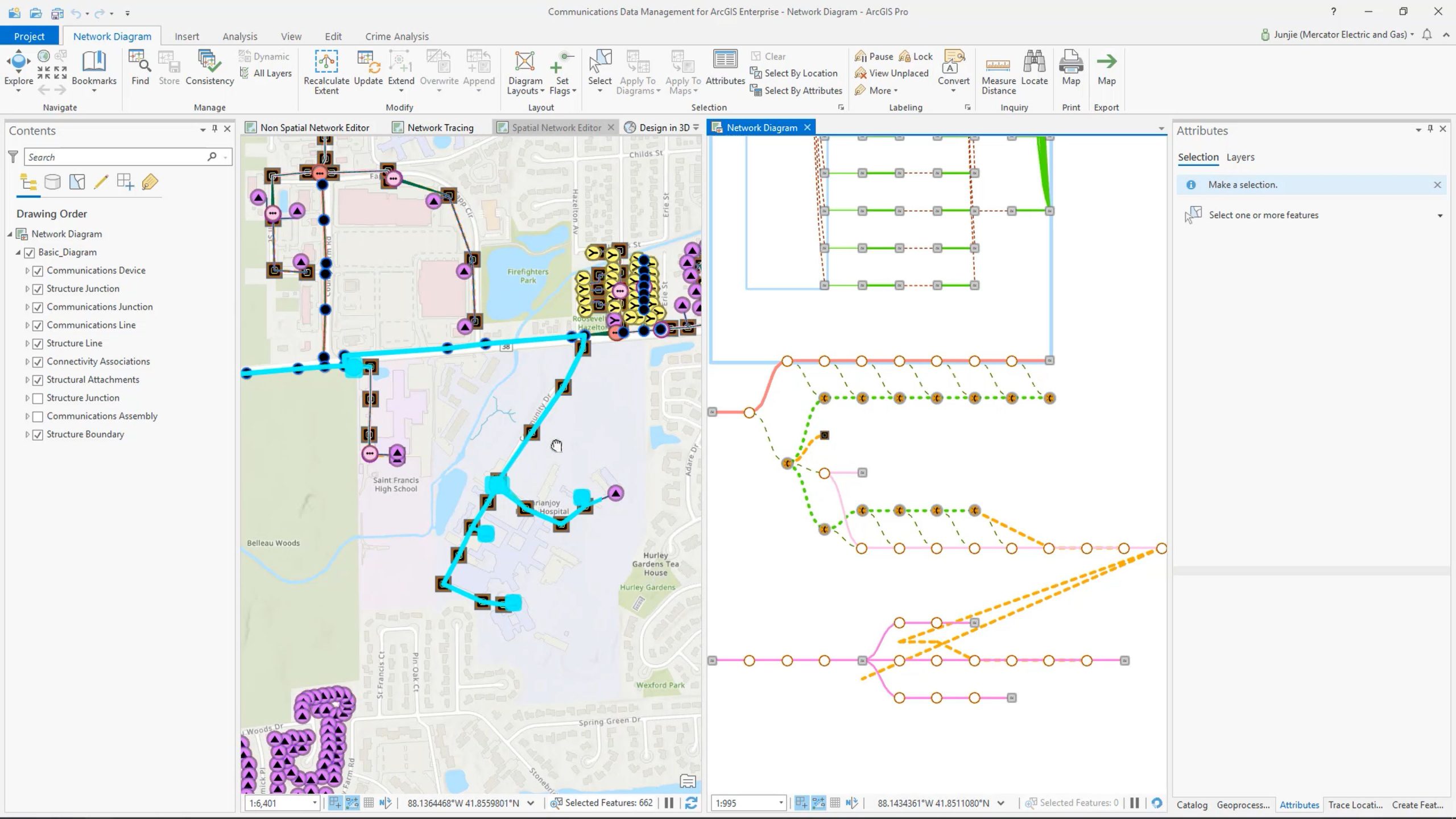
Tracing is supported on nonspatial objects. You can see below the trace is running through a strand in the lower right that is modeled as a nonspatial object. This feature was the result of feedback from telecommunications customers for the need document separate strands without necessarily drawing them on the map.
Another feature you’ll see is the ability to visualize network assets both on a map but also as a diagram. The two views are completely integrated, such that traces can be performed in one view and propagated to the other view.
Learn more about this solution:
· Solution Overview
· Solution Documentation
· Deploy the Solution
These new solutions are the direct result of feedback and requirements gathered from telecommunications service providers of all sizes and Esri is anxious for you to begin deploying and using them in your business work processes.
Have questions? Please get in touch with us at telecominfo@esri.com, or check out these additional resources.
· Network Management in ArcGIS Resources
· Communication Networks and ArcGIS Utility Network Management FAQ
About the author