Real-time GIS has become mission critical throughout everything we do at the Municipal Authority of Westmoreland County. We are able to reduce our labor costs across various departments by having live data on a single GIS platform.
user story
ANTHONY POLOGRUTO, GIS ANALYST, MUNICIPAL AUTHORITY OF WESTMORELAND COUNTY
Critical infrastructure deserves real-time monitoring. With a service territory of 2,000 square miles in the center of southwestern Pennsylvania, the Municipal Authority of Westmoreland County (MAWC) directly serves 130,000 customers with water and wastewater services. MAWC also serves other water utilities, heavy industry companies, and a power production plant. With a fleet of over 300 vehicles and 2,500 miles of underground assets, MAWC keeps track of its real-time data using Esri's ArcGIS GeoEvent Server.
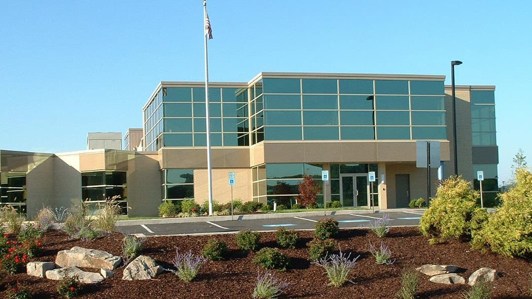
 MAWC Headquarters, New Stanton, Pennsylvania
MAWC was using two separate external solutions to monitor both its fleet and the locations of excavations taking place within its territory. However, these external solutions were isolated from one another as well as from MAWC's geographic information system (GIS) data. Users needed to cycle back and forth between two external websites and the GIS portal to come up with the bigger picture. When it became clear that GeoEvent Server could enable MAWC to incorporate the data from each of these external solutions into the GIS, the decision was made to do so.
MAWC implemented GeoEvent Server with two goals in mind: to incorporate real-time excavation notices from the Pennsylvania One Call System and to integrate real-time vehicle speed, odometer reading, ignition status, and locations into the GIS. Since implementation, MAWC has expanded the role of GeoEvent Server. Staff using ArcGIS Collector for field inspections now generate real-time email notifications based on inspection information. We also collect and display readings from automated reading compatible meters, helping to achieve a common operating picture that was not possible before.
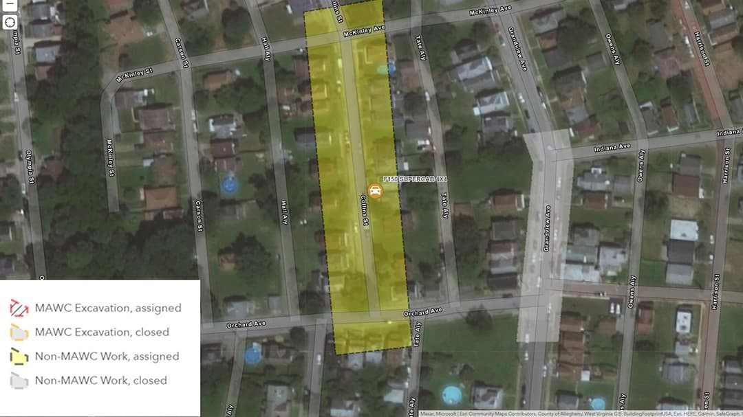
 A locator is seen responding to a One Call System notification.
Before incorporating the real-time excavation notices and their associated dig boxes into the GIS, the location of excavations was only known to staff responsible for visiting those sites and marking MAWC's assets. These six employees, who are referred to as locators, would then manually compare the locations of these excavations with our GIS to determine if any assets needed to be marked. With GeoEvent Server, those dig boxes now appear directly on our web map along with our GIS features, allowing a locator—or their fill-in—to quickly understand where excavations would take place and what assets would need to be marked.
In addition to meeting our goal, having dig boxes on the map resulted in an unintended benefit—now other staff are aware of where excavations are taking place. Whether it is a customer communication representative on the phone with a customer who is wondering why someone just spray-painted a blue mark in their front yard or management now being able to see where our crews are digging, this real-time data is being used to answer questions from staff not directly related to locating.
"Big improvement on my end as far as sending out mapping for my designs. So easy to locate the dig areas on the map with the dig boxes, making me much more efficient!" - April Tilson, Engineering Clerk—Municipal Authority of Westmoreland County
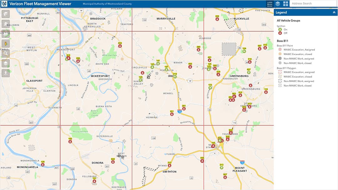
 MAWC visualizes real-time vehicle locations onto maps for staff to consume.
The value of our GIS was further enhanced with real-time vehicle location. Incorporating vehicle locations into GeoEvent Server was done via an API with Verizon Network Fleet. Several times a minute, monitored vehicles check in with Verizon, information MAWC sends directly to GeoEvent Server and then onto maps for staff to consume. Quickly, we were able to find that a few of the units in vehicles needed to be replaced, as they were not returning data.
With locations of work and the work vehicles now on the map, we can see in real time as staff complete their tasks. The data has led to geoenabling, as we have empowered management to also find answers using robust maps and dashboards. One example of this is a foreman on nightshift using the Fleet Management Viewer application to view real-time vehicle locations and find where the closest excavator has been parked. Empowerment like this saves time and money while also replacing the late-night phone calls that would have taken place to find the same equipment.
"The addition of the GIS mapping system has enhanced our ability to have one-stop shopping. Accessing the RVI [document server] and service history, along with the maps of our main lines, has significantly reduced time spent at customer homes to complete orders. Knowing vehicle locations is important during an emergency call; we now have the ability to find the locations of our techs and dispatch accordingly." - Rod Rusch, Customer Service Supervisor—Municipal Authority of Westmoreland County
Monitoring real-time data is made simpler with the ability of GeoEvent Server to send notifications based on the criteria that we've chosen. As more events are processed through GeoEvent Server, there is less need for staff to constantly monitor the stream of incoming data. Notifications help to make this overwhelming stream of data more easily managed. One example of a notification that MAWC has instituted relates to data captured in ArcGIS Collector. The valve inspection and exercising program sends a notification to the supervisor when a valve is not in its expected state. Because the status of a valve is critical, an email is automatically sent to the supervisor notifying him of the potential issue. Notifications like these not only help to ensure our distribution system is healthy but also ascertains that the attribute data in the GIS is accurate.
"The real-time valve notifications have become a valuable tool in our valve exercise program. I get notified by email when a valve is left in a position other than originally found. This helps us locate closed valves that should be open and open valves that should be closed. This is extremely important to make sure we have an adequate flow for fire suppression as well as supplying our customers with sufficient water pressure and flow." - Mark Yackovich, Distribution Facilities Hydrant and Valve Supervisor—Municipal Authority of Westmoreland County
Esri technology has become an essential tool for our staff to manage critical infrastructure. Our data has been democratized, and our users have been geoenabled. Access to mapping and real-time information provides quick answers and supports better decision-making. Our assets are safer now that we can see where excavation is taking place. Our staff are safer should we lose communication while they are in the field. Work is being done more efficiently as users can now locate the closest agent or piece of equipment when moments count.
The projects discussed in this article are only the beginning of the endless possibilities. MAWC will continue to explore where changes can be made to better support our staff and our customers.

Real-time GIS has become mission critical throughout everything we do at the Municipal Authority of Westmoreland County. We are able to reduce our labor costs across various departments by having live data on a single GIS platform.