ArcGIS Blog

Decision Support

ArcGIS Mission

The TAK Plugin to ArcGIS is here!

By Darron Pustam and Jamon Johnson and Tiffany Glenn

Have you ever experienced challenges when accessing rich content from ArcGIS when using your Android Tactical or Team Awareness Kit (ATAK) mobile device?  The ATAK Plugin to ArcGIS extends these capabilities and can be accessed via the TAK.gov website.
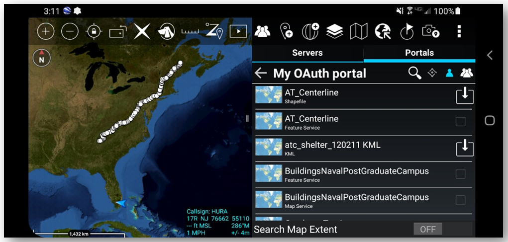
Viewing of supported content from ArcGIS Enterprise

ATAK’s mobile client users can now receive, process, and handle foundational raster and vector content provided by ArcGIS.  When connected, users can browse supported services or access protected content using built-in security authentication.  This content can also be cached for offline use.
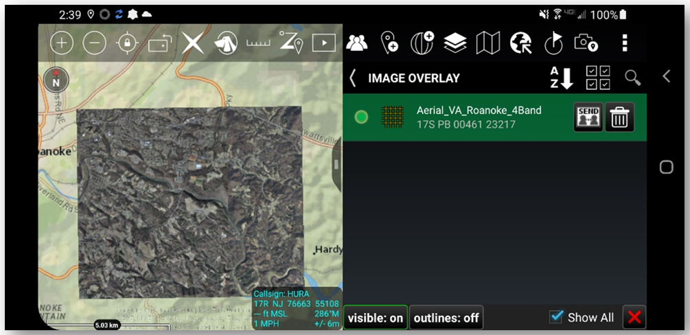
Viewing of an ArcGIS image service

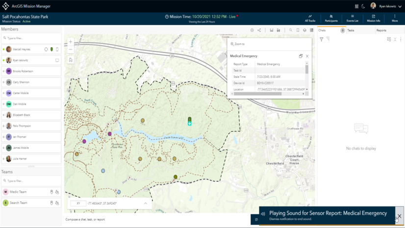
Additionally, the ATAK Plugin to ArcGIS enables users to stream their location from an ATAK device back to ArcGIS.  This feature enables an ATAK user’s location to be visualized in applications like ArcGIS Dashboard, or when actively participating in team activities in ArcGIS Mission.
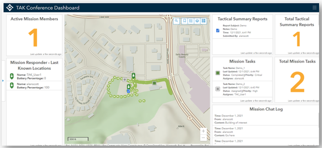
Example of an ArcGIS Dashboard configured with Mission + ATAK Plugin to ArcGIS

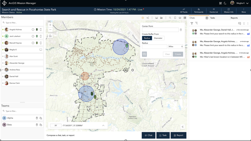
ArcGIS Mission is a relatively new product that enables analysts, mobile teams, and executives to quickly establish command and control by organizing and managing teams and resources, whether working on planned events or dealing with unplanned circumstances.
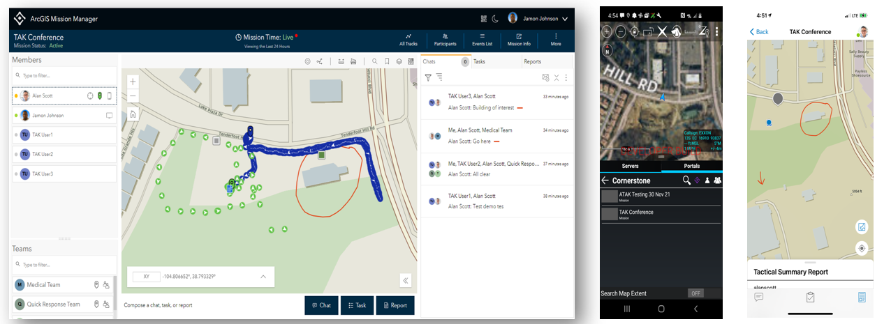
Example of ArcGIS Mission with ArcGIS Mission Responder Mobile App + ATAK w/ArcGIS Plugin

To gain access to the ATAK Plugin, please visit Tak.gov and for information on ArcGIS Mission please click here.


Share this article

Subscribe
Notify of
3 Comments
Oldest
Newest
Inline Feedbacks
View all comments
Hans-Jørg Schneidt(@hjschneidt)
July 11, 2022 2:51 am

Hi,I´m astonished that you removed the ability to automatically convert CAD drawings to geodatabase in Pro 3.0. Please reinstall this feature at the next update.

anna garrett(@agarrett528)
July 14, 2022 9:01 am

please post a write up of all the changes in 3.0. not everyone has time to sit through a video and wait patiently for features that are relevant to them to show up, if they do. this is really disrespectful of our time as users.

Kate Hess(@khess)
January 13, 2023 8:22 am
Reply to  anna garrett

Hi Anna – the written version is located here.

Nick Jones(@njones_dewberry)
September 8, 2022 8:50 am

I’ve noticed a number of tools have added parameters, and it has been a bit challenging with python scripts. Is there a list of all the tools with changed parameters? I know Delete Field, Join Field, and Zonal Statistics as Table, for example, have changed. If you develop a script in 3.0 and then somebody with an earlier version uses it, you have to be aware of these things.