More than fifty years ago I discovered the wonder of birds, thanks to a high school biology teacher who required her students to do field observations during spring migration. “Discovering” birds opened my teenage eyes to the world. I was enchanted by the beauty of these seemingly fragile creatures, and the fact that so many of them migrated thousands of miles between their winter ranges and summer breeding grounds.
As I’ve aged, my sense of wonder has only increased, in part because tracking technology has revealed in vivid detail the heroic feats of endurance that even small birds achieve. Take the tiny Blackpoll Warbler, thousands of which fly non-stop every fall from the coast of Nova Scotia across the open ocean to the tropical shores of the Caribbean.
When I learned that our friends at the National Audubon Society were soon to publish a data-rich Bird Migration Explorer, I jumped at the chance to collaborate with them on a companion story, using ArcGIS StoryMaps to provide a multimedia overview of the natural wonder of bird migration.
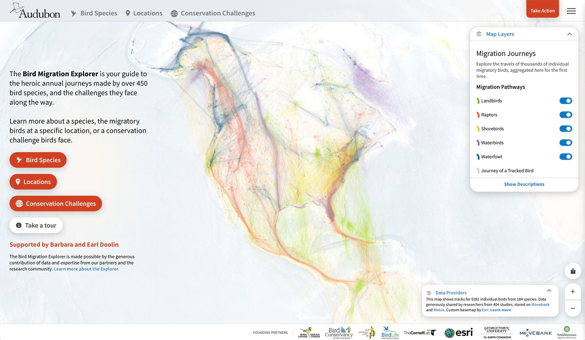
The heart of the story is a series of animated maps focusing on the tracked migration routes of a few example individuals. Creating these animations involved using both ArcGIS tools and desktop graphics software (Adobe Illustrator and After Effects). In a nutshell, here’s the process our team employed to create the animations:
- Datasets, including basemap layers, bird GPS tracks, and Bird Migration Explorer conservation challenge layers, were combined in ArcGIS Pro, where projections, basic symbology, and labeling was performed.
- The map layout was then exported to the Adobe Illustrator Exchange (AIX) format. This format allowed us to export maps and layouts from ArcGIS Pro and open them with ArcGIS Maps for Adobe Creative Cloud.
- The map was further refined in Adobe Illustrator and saved as an .ai file; then it was imported into After Effects.
- Map movements, the GPS route, and other details were animated using After Effects.
- The animation was exported as separate sequences and embedded into the StoryMaps sidecar immersive block, where each sequence animates sequentially as the reader scrolls through the story.
Want to try creating your own animations? This blog provides step-by-step instructions.
I urge you to read our story, to peruse the riches of the Bird Migration Explorer—and to get out into nature to appreciate first-hand the wonder and beauty of migratory birds!

Article Discussion: