In this post, I’m going to discuss the new territory design and management tools that are a part of the second release of Business Analyst for ArcGIS Pro.
A New Territory Design Toolbox
The Business Analyst Team has a long history of supporting a powerful set of territory design and management tools with our ArcMap extension.
At the 2.2 release, we are proud to introduce territory design and management to Business Analyst users of ArcGIS Pro.
These tools have been completely redesigned to take advantage of ArcGIS Pro’s high-performance architecture and modern & intuitive UI.
In this initial release, you will have access to two new territory design and management workflows supported by 7 geoprocessing tools in a new Toolbox. There’s also a supporting set of ribbon tools.
Auto-Balanced Territories
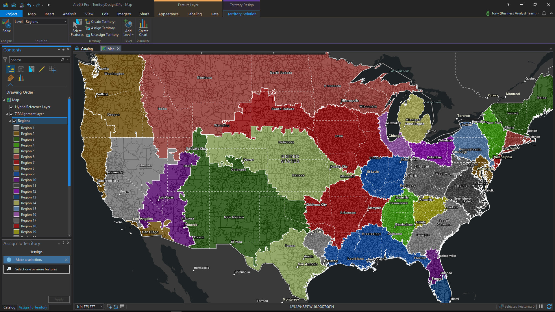
The first of the two basic workflows supported with the new Territory Design Toolbox will enable you to create “auto-balanced” territories.
It’s a surprisingly fast and simple workflow consisting of three key inputs:
1. Submit almost any polygon layer describing the individual area features which will be grouped to form your territories, regions, or districts
This is your territory “alignment layer”. This layer can consist of any administrative geography features for any country and can contain hundreds or even thousands of individual area features.
You can use the Business Analyst Color Coded Layer tool (released at ArcGIS Pro 2.1) or the Generate Standard Geography Trade Areas tool (new at ArcGIS Pro 2.2) to dynamically generate layers consisting of the administrative geographies of your choosing. For example, they might be U.S. ZIP codes or counties, German districts, Canadian dissemination areas, Japanese prefectures, or French postal codes. Whatever your requirements may be, you have multiple options and flexible access to this valuable supporting content through Business Analyst.
You can also leverage your own in-house or proprietary boundaries that describe the individual area features used to form your territories, regions, or districts. In this case, your organization may be building and maintaining map layers with your own custom area features using other tools in ArcGIS Pro. You may also be importing an existing territory alignment layer from the legacy territory management tools in our ArcMap extension. You may even be bringing in a layer from another business system or software solution.
2. Specify the number of territories, regions, or districts you want to create
This could be any number from 2 to 20 (and even more). Business Analyst for ArcGIS Pro will generate the number of territories you need by intelligently grouping the individual area features from your alignment layer based on your balancing criteria.
3. Specify your “balance” variables/criteria
This is how you tell Business Analyst how you want those individual areas grouped and divided. You will have the option to use individual site or area-based characteristics as part of the automatic balancing workflow. Whether these characteristics are based on historical or anticipated sales; counts of customers, patients, employees, students, households, or businesses; area sizes; maximum drive times or distances; or something completely different, Business Analyst can efficiently distribute and align your territories, regions, or districts to meet your organization’s needs.
And since this is Business Analyst for ArcGIS Pro, you can leverage other tools such as Enrich Layer to append additional business, consumer, and demographic data to the individual area features of your alignment layer. You can then use the additional contextual information alongside your organization’s own data as supplemental balancing criteria for creating your territories.
Interactive Territory Creation and Management
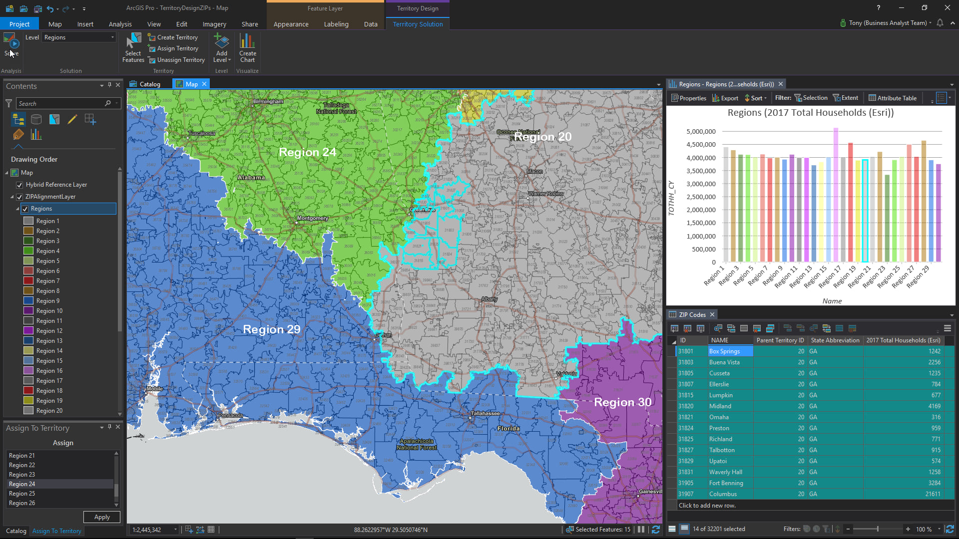
The second basic workflow supported with the Territory Design Toolbox will help you interactively create and update your territories.
In this workflow, you can “fine tune”, modify, or update an existing territory alignment or solution, or you may want to manually build new territories from scratch. The individual areas forming your territories can be selected, moved, and removed using a number of options including simple panel, ribbon, and map-based tools; and attribute tables and charts associated with the alignment layer. And since the territory design and management tools work with standard map layers, you can use all of the capabilities of ArcGIS Pro, including advanced selection tools, to work with the individual area features that are the basis for your territories.
After your territories have been created or updated, they can be shared with your organization as paper maps, PDFs, web maps, tables, and more.
Taken as a whole, Business Analyst for ArcGIS Pro provides you with powerful, flexible, and intuitive options to create, visualize, maintain, and share your territories with your organization and other stakeholders.

Commenting is not enabled for this article.