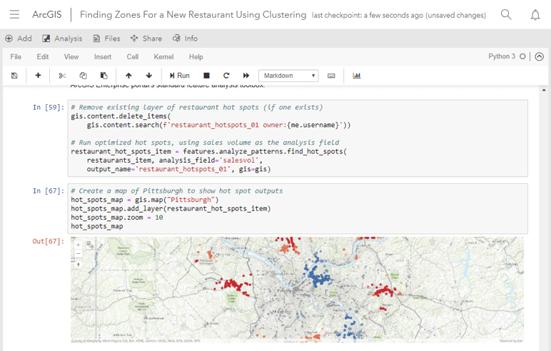
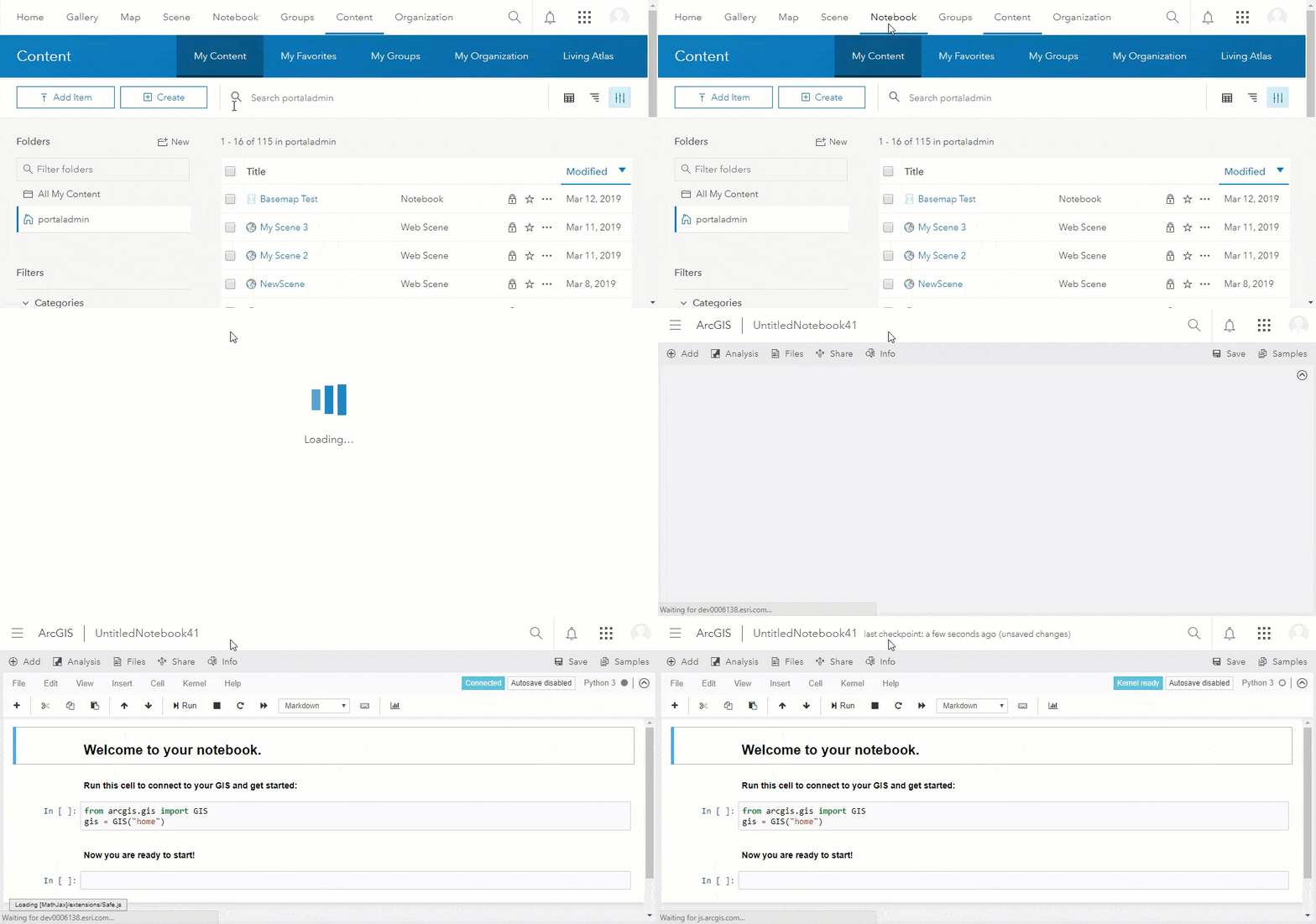
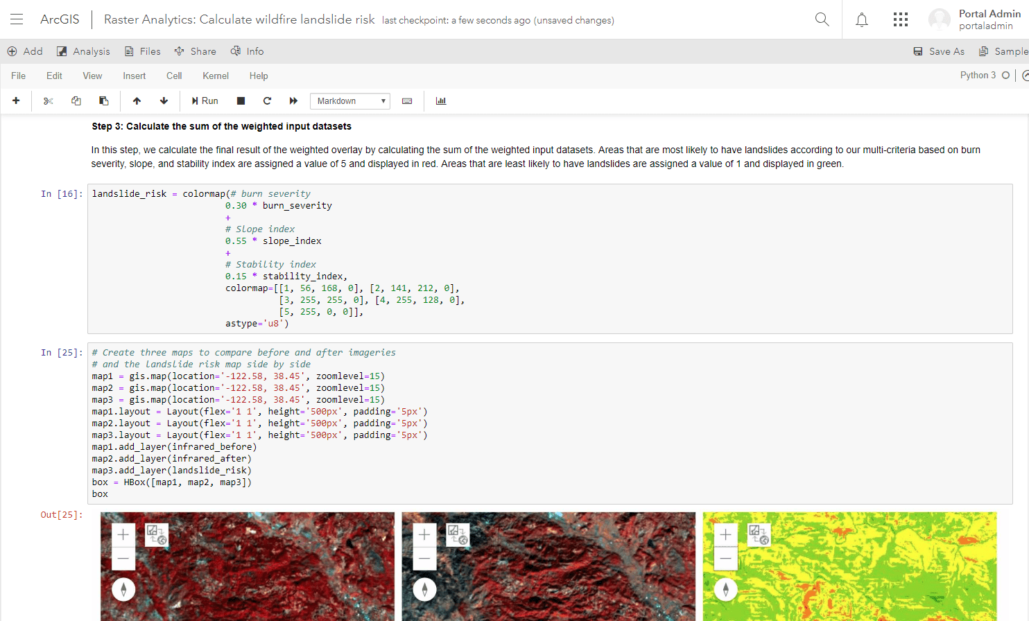
As part of ArcGIS Enterprise 10.7, we are thrilled to release a new capability that unlocks versatile data science tools and the limitless potential of Python in your Web GIS deployment. ArcGIS Notebooks provide users with a Jupyter notebook environment, hosted in your ArcGIS Enterprise portal and powered by the new ArcGIS Notebook Server.
ArcGIS Notebooks are built to run big data analysis, deep learning models, and dynamic visualization tools. Notebooks are implemented using Docker containers – a virtualized operating system that provides an isolated “sandbox” style environment for each notebook author. The computational resources for each container can be configured by the organization – allowing the flexibility for notebook authors to get the computing resources they need, when they need it.

Seamless integration with the portal
ArcGIS Notebook Server is a new licensing role for ArcGIS Server. Because it works with the Docker container allocation technology to deliver a separate container for each notebook author, it requires specific installation steps to get up and running. Take a look at the ArcGIS Notebook Server install guide to see how it works.
Once you’ve installed ArcGIS Notebook Server and configured it with your portal, you can create custom roles to grant notebook privileges to the members of your organization so that they can create and edit notebooks.

Authors don’t need any additional software installed on their machines – all they need is to be granted notebook privileges via their portal member role. They work in an ArcGIS-managed notebook environment, with hundreds of Python libraries already provided for them, and can add other libraries into their notebooks as their workflows require.
Notebooks are fully integrated into your ArcGIS Enterprise deployment. That means you can reference portal items in your notebooks from a browser pane. You can select a portal analysis tool as you do in the Map Viewer and add it as a code snippet into your notebook cell. And you can share notebooks as portal items, with the security and ease you have when sharing a web map or a hosted feature layer.
Put Python to work for you
At the core of the ArcGIS Notebook experience are Esri’s powerful Python resources: ArcPy and the ArcGIS API for Python. Alongside these are hundreds of popular Python libraries, such as TensorFlow, scikit-learn, and fast.ai. It all comes together to give you a complete Python workstation for spatial analysis, data science, deep learning, and content management.
The Standard license of ArcGIS Notebook Server, which comes at no additional cost for ArcGIS Enterprise customers, bundles the Python API and nearly 300 other third-party Python libraries built-in. The Jupyter notebook environment has long been an essential medium for Python API users; with ArcGIS Notebooks, that environment is now available directly in the ArcGIS Enterprise portal.
The Advanced license, which is purchased in addition to your existing agreement, includes everything in Standard and also includes ArcPy. This is the first time ArcPy has been made available in a notebook environment outside of an ArcGIS Desktop implementation. You can work with the full range of tools provided in the Mapping (arcpy.mp), Data Access (arcpy.da), Sharing (arcpy.sharing), and Spatial Analyst (arcpy.sa) modules.
Turn analysis into action
Location is the common thread that runs through almost any problem. What you buy, who your customers are, the impact that your business has on the natural world, and that the natural world has on your business are all problems of location. Traditional data science has many powerful tools and algorithms for solving problems. Spatial data science – GeoAI – also brings in spatial data, methods, and tools. GeoAI can help you create more effective models that more closely resemble problems you want to solve. Because of this, spatial data science models are better suited to model the impact of the solution you create. .
ArcGIS Notebooks give you the ability to run analysis and build models in the same location as your GIS system of record. Because of this, you can reduce the amount of time spent wrangling data, giving you more time to explore your results. Integration with the ArcGIS Enterprise portal lets you build complete models, taking advantage of all the data you may need from within your organization.
Esri’s popular Living Atlas of the World is also available in the ArcGIS Notebook editor. This gives you access to the thousands of spatial datasets available within the Living Atlas. You can search, discover, and bring in layers to provide additional context to your analysis and workflows. You can also use data from the Living Atlas to enrich your existing data, adding additional attributes to create a more comprehensive analysis and build a better model.

It’s not just for data science
ArcGIS Notebooks bring the content management and GIS administration tools of the ArcGIS API for Python, which many users have harnessed to automate their routine workflows, directly into the portal.
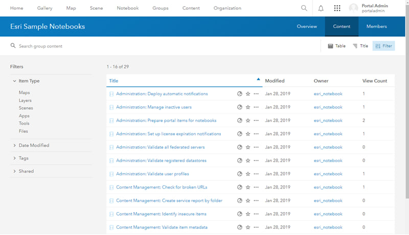
As a portal administrator, for example, you can run notebooks to clean up portal items, to notify web map authors of broken links or insecure URLs, and to delete inactive users. The sample notebook gallery at 10.7 comes with these and with other administrative workflows.

Promote transparency and reproducibility
One of the most powerful things you can do with a notebook is share it with others. That’s because notebooks don’t just display your finished map – they integrate the code that powers your output, and the documentation and comments that explain how you’re getting there. When you share your complete notebook with colleagues, stakeholders, or the public, you’re giving them a full insight into your workflow.
You allow them to reproduce it, to tinker with it, or to adapt it for their own purposes. You can receive feedback quickly and make improvements to your notebook in an interactive workspace. The Python community is incredibly vibrant in large part because it is full of collaboration and transparency; with ArcGIS Notebooks, we’re glad to be making a big contribution to that spirit.
To share your notebook with other members of your ArcGIS Enterprise portal, you can use the Share button from the notebook editor. Notebooks are treated like any other portal item – you can share it with individual groups, or with the whole portal organization. Each portal member who opens a shared notebook will open a copy of it; this new copy of the notebook will run in that member’s own container.
Let’s get to work!
ArcGIS Enterprise 10.7 will be released to the public next week, but all of its documentation, including the user guide and install guide, is online now:
Administrators and system architects will want to pay close attention to the system requirements pages (Windows | Linux), which discuss everything you need to provide and which edition of Docker you should obtain.
The development of ArcGIS Notebook Server was codenamed “Turing,” after the legendary British computer scientist Alan Turing. He looked far into the future to consider the concepts of artificial intelligence and machine learning, while delivering concrete advances to the contemporary field of cryptology. It was fitting for us to honor him with a project combining data science, machine learning, and collaborative programming.
We’re eager to hear from you as you get started with ArcGIS Notebooks. Please share the good and the “needs improvement” with us on GeoNet, on Twitter, or with your account managers.
Article Discussion: