ArcGIS Mission is an all-inclusive geospatial communications and situational awareness tool that allows you to create, share, and monitor maps, teams, and other materials for use in operations to interact with mission teams in real time. In this blog, we will walk through how a mission analyst uses the Proximity Tools to help Responders in the field locate a missing hiker in Pocahontas State Park.
Use the proximity tools
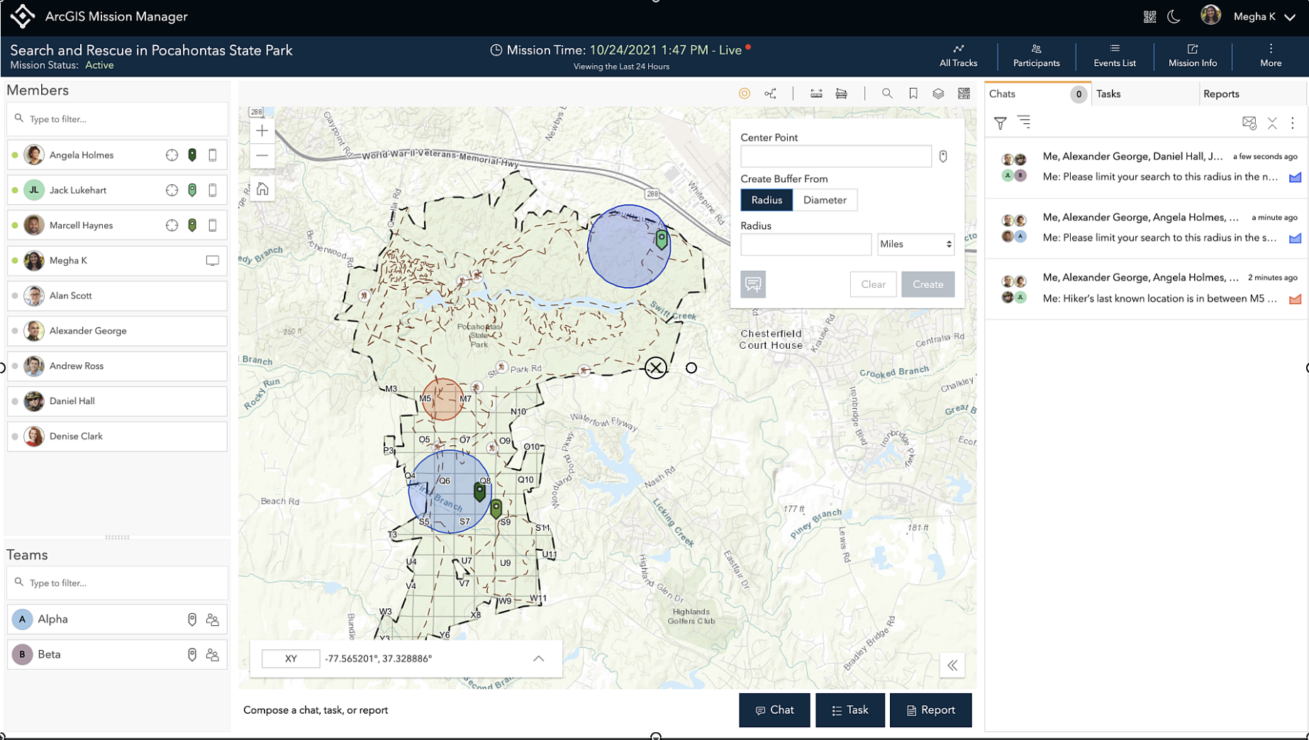
Local authorities determined that an immediate search of the area is necessary to assure the hiker’s safety. My supervisor has tasked me with creating search radius buffers from the location where the hiker was last seen and to determine where teams will start their search.
I can do this by using the Create Buffer tool. Since reporting providing me information on the last known location of the hiker at a specific intersection, I can choose a center point where my buffer will start at this intersection, make the distance a quarter of a mile, and create my buffer.

Now that the initial search area for the hiker’s location is created, I can send this buffer out to my mission members so they can see this on their mission map for awareness. I can send this buffer as a sketch in a chat to all teams in my mission, so they immediately have this information.
Now that I created the buffer for the search area of the hiker, I want to create a few more for other search areas teams to cover a specific area. We will assign Team Alpha and Team Beta with a quarter of a mile search buffers.
I just received a message, and it looks like there is a backpack that may lead to the location of the missing hiker and realize they want to concentrate more help to search that area by 1 or 2 searchers. I have a few Responders in the mission that can assist in this search.
I’m going to use the Find Nearest tool to locate the closest Responders to the backpack. I will choose a starting point of where the clues were location from Team Beta’s message, limit my number of Responders to two to get the closest Responders to the location, and limit my search range to 1 mile.
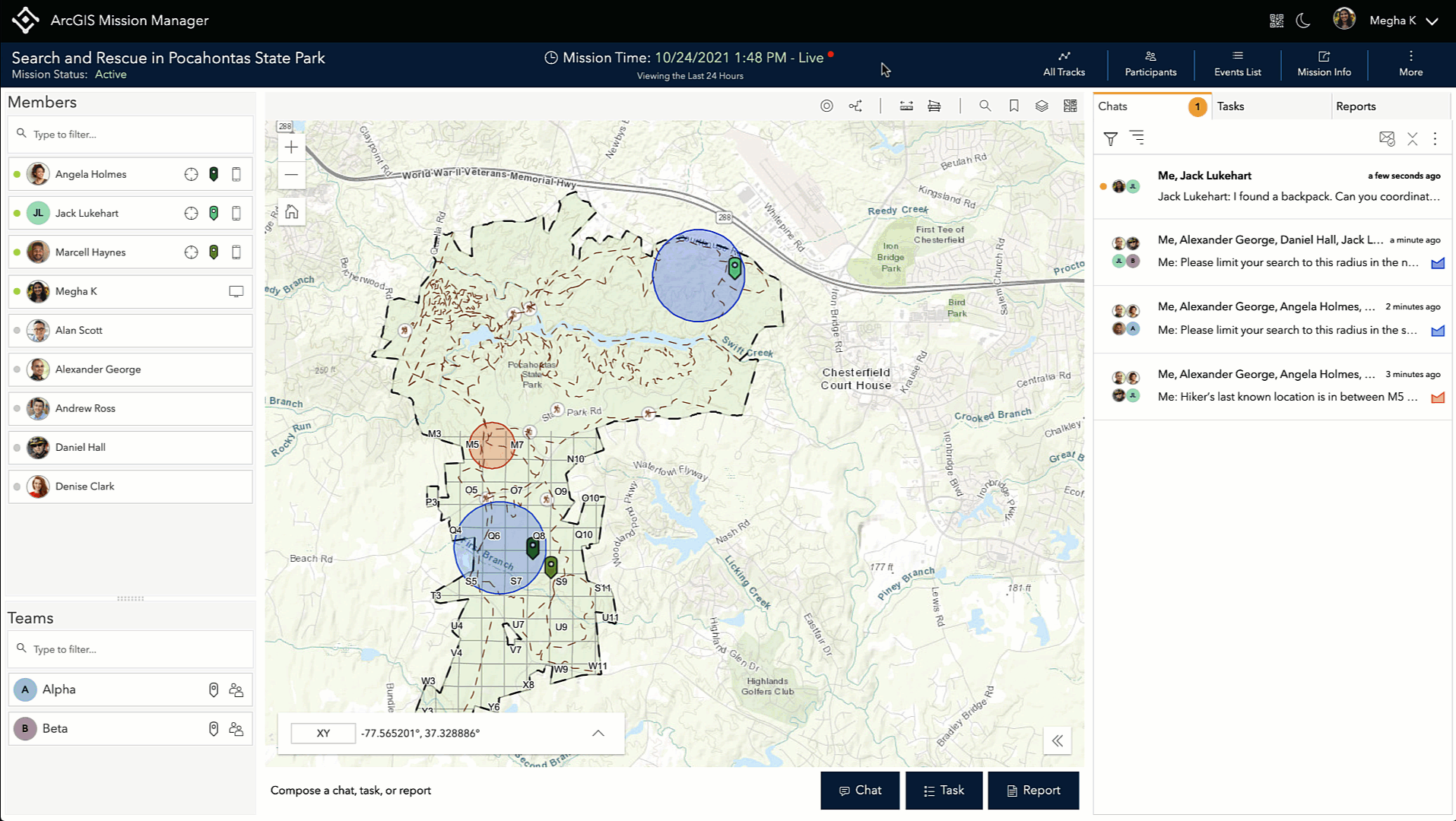
Once I run the search, and I can see the closest Responder to the location of the backpack. I can send the location point I originally used as a sketch in a chat to the Responder and tell them that they are needed to go and assist their search.
This is just one example of how you can leverage the Proximity Analysis tools to help you with your mission. To learn more about Mission, visit our product page or read our documentation.

Article Discussion: