Try ArcGIS Mission
Go through the uses, components, and capabilities of ArcGIS Mission.

Experience what’s possible with ArcGIS Mission through curated series of tutorials
Go through the uses, components, and capabilities of ArcGIS Mission.
Read articles from the ArcGIS Mission team. Connect to ask questions and learn more.
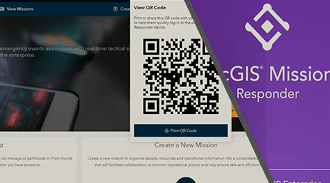
A quick guide to accessing the ArcGIS Mission Responder app.
Discover recently added capabilities to ArcGIS Mission.

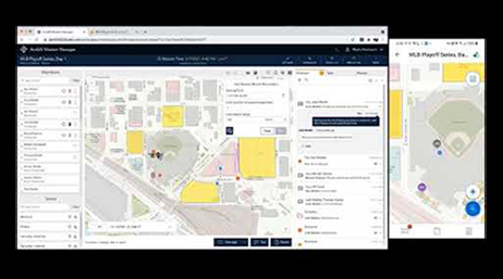
Using ArcGIS Mission dashboard
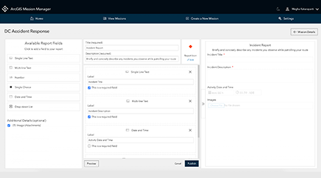
Create and leverage custom reports
What’s new in ArcGIS Mission 11.1
Find answers and information so you can complete your projects.

What is ArcGIS Mission?
ArcGIS Mission Demo
Conduct an After-Action Report in ArcGIS Mission
Exchange ideas, solve problems, and build relationships with the Esri Community for ArcGIS Mission.
Do you have an idea to improve ArcGIS Mission? Many of our capabilities started as suggestions from our users.
Get inspired by user projects, keep up on product news, and be among the first to learn about updates.
Start a conversation online.
Get an email response.
Speak with a representative.