The October 2023 Map Viewer update includes some significant enhancements to the Sketch experience, including the ability to duplicate sketch features, view dimensions while drawing, and share out sketch layers as part of group layers. This blog will outline how you can take advantage of these new features.
Tooltips
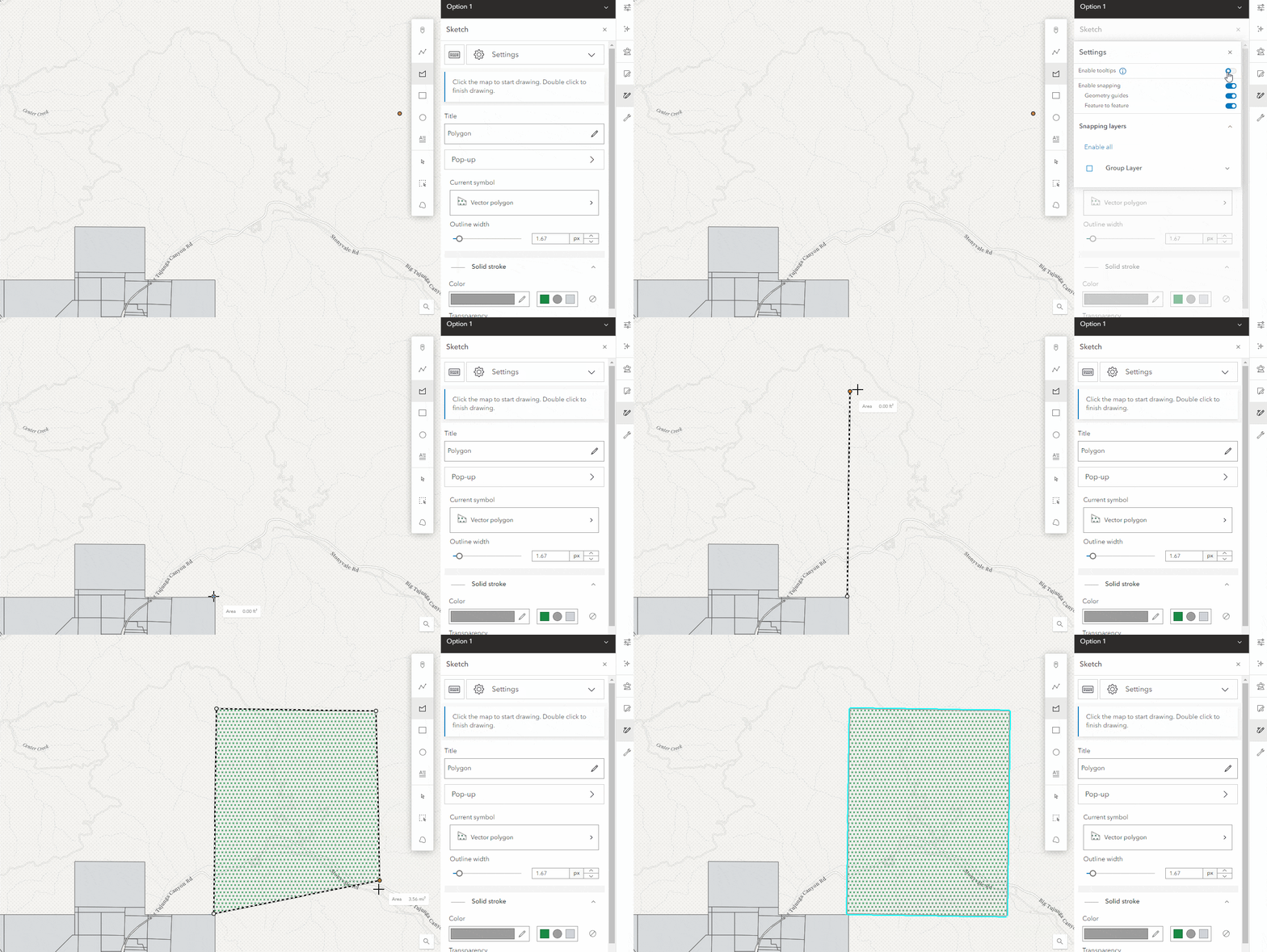
With the October 2023 update, you now have the option to enable tooltips to show feature dimensions while drawing sketch polygon or line features. When editing an existing point, polygon, or line, the tooltips will also display the distance from your original feature.
In this example, I am using Sketch to illustrate potential sites for a new Wild Burro sanctuary. The sites should be large enough to comfortably accommodate the burros, so it is useful to see the dimensions while drawing.
Tooltips are turned off by default, but can be enabled by going to the settings at the top of the Sketch pane and turning on the Enable Tooltips toggle.

Duplicate Features
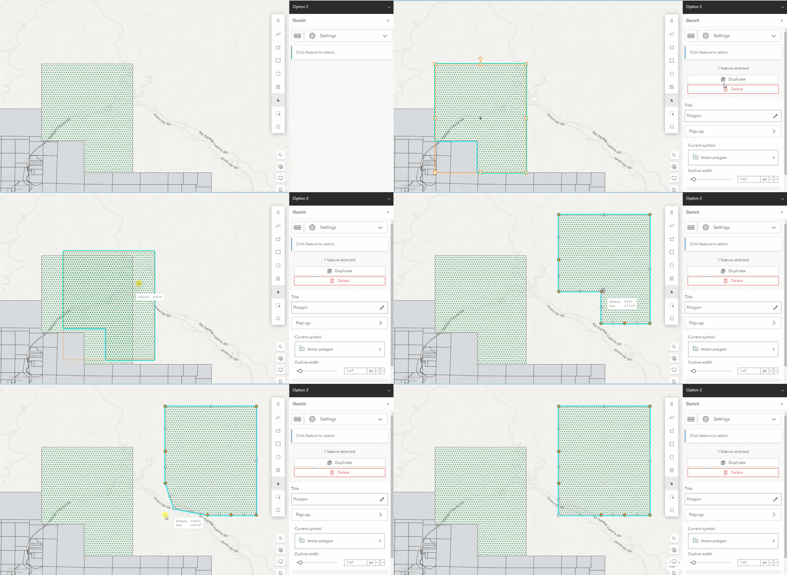
You can also now duplicate sketch features in Map Viewer, preserving things like symbology and pop-ups. In this example, I want to show multiple options for the sanctuary locations using the same hatch fill symbology settings for each. With this enhancement, I can now create multiple features with the same settings without having to draw them all in the same session.
With tooltips enabled, I can also see the dimensions when editing existing features, useful after duplicating my sites and modifying them. Duplicate supports duplicating multiple features at once, including those with different geometries, allowing you to quickly add new features.

Group Layer Items
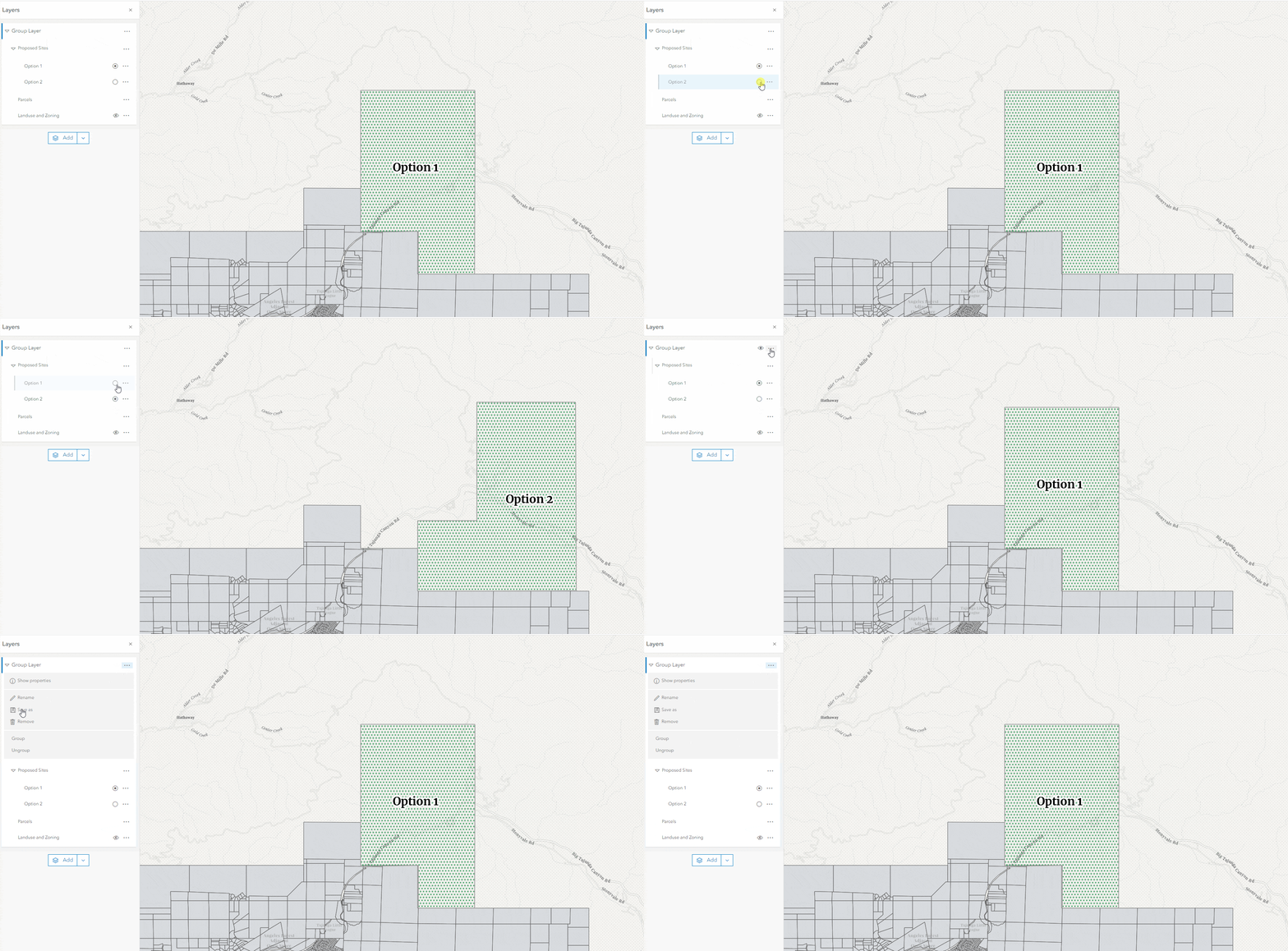
With the latest Map Viewer update, you can also take advantage of the new Group Layer items to save and share your Sketch layers with others. This new group layer item can be shared with others and will retain any styling, or other, settings applied to the layers within it. This is a great option for organizing multiple layers that are frequently used together.

In this example, I have grouped my sketch layers illustrating the proposed sanctuary options together with feature layers of existing parcel and landuse data into a nested group layer. I am also taking advantage of the exclusive visibility option available in group, which allows users to view only one sketch layer at a time. This Group Layer can now be saved as a layer item and easily shared and reused across multiple webmaps. Check out this blog post for more information on the new group layer items and a great example of how to take advantage of them when using sketch layers.
The option to save sketch layers as their own layer items, as well as duplicating entire sketch layers, will be available in a future update. We continue to improve the Sketch experience in Map Viewer with each release, so keep an eye out for new enhancements as they are announced.

Is there a way to keep the users view consistent between the maps. In my example I am showing a coastal area and each map has a different layer corresponding to a flooding level prediction model based on X storm event and sea-level rise. The idea is that a user can zoom to their location and see how/if these prediction models intersect their how business. I like the Portfolio template, but the extent reverts back to “home” every time a new map is loaded.
Hi Nick,
Thanks for reaching out about Portfolio. Have you tried using the Define location tool (under Map location/Interactivity)? That tool will provide you as the app author to determine a location for all web maps and web scenes in an app to open to.
Thanks!
Sarah